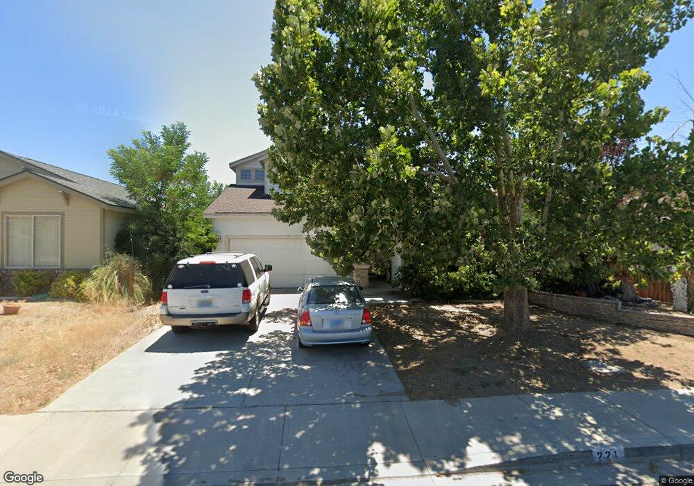
221 Corral Dr Dayton, NV 89403
Estimated Value: $416,691 - $426,000
4
Beds
3
Baths
1,738
Sq Ft
$243/Sq Ft
Est. Value
About This Home
This home is located at 221 Corral Dr, Dayton, NV 89403 and is currently estimated at $422,173, approximately $242 per square foot. 221 Corral Dr is a home located in Lyon County with nearby schools including Sutro Elementary School, Dayton Intermediate School, and Dayton High School.
Ownership History
Date
Name
Owned For
Owner Type
Purchase Details
Closed on
Aug 22, 2017
Sold by
Leach Michael E
Bought by
Leach Huong N
Current Estimated Value
Purchase Details
Closed on
Dec 8, 2011
Sold by
Alonso Maria C
Bought by
Erven Craig and Erven Heather
Purchase Details
Closed on
May 26, 2005
Sold by
White Cheryl Lynn and White Michael R
Bought by
Alonso Maria C
Home Financials for this Owner
Home Financials are based on the most recent Mortgage that was taken out on this home.
Original Mortgage
$216,800
Interest Rate
5.62%
Mortgage Type
Adjustable Rate Mortgage/ARM
Create a Home Valuation Report for This Property
The Home Valuation Report is an in-depth analysis detailing your home's value as well as a comparison with similar homes in the area
Home Values in the Area
Average Home Value in this Area
Purchase History
| Date | Buyer | Sale Price | Title Company |
|---|---|---|---|
| Leach Huong N | -- | None Available | |
| Erven Craig | $105,000 | Ticor Title Of Nevada Inc | |
| Alonso Maria C | $271,000 | First Centennial Title Co Nv |
Source: Public Records
Mortgage History
| Date | Status | Borrower | Loan Amount |
|---|---|---|---|
| Previous Owner | Alonso Maria C | $216,800 |
Source: Public Records
Tax History Compared to Growth
Tax History
| Year | Tax Paid | Tax Assessment Tax Assessment Total Assessment is a certain percentage of the fair market value that is determined by local assessors to be the total taxable value of land and additions on the property. | Land | Improvement |
|---|---|---|---|---|
| 2025 | $2,354 | $114,022 | $56,000 | $58,022 |
| 2024 | $2,180 | $114,544 | $56,000 | $58,544 |
| 2023 | $2,180 | $111,070 | $56,000 | $55,070 |
| 2022 | $1,633 | $94,795 | $43,785 | $51,010 |
| 2021 | $1,512 | $93,685 | $43,785 | $49,900 |
| 2020 | $1,399 | $91,646 | $43,790 | $47,856 |
| 2019 | $1,311 | $75,404 | $29,190 | $46,214 |
| 2018 | $1,249 | $66,201 | $21,000 | $45,201 |
| 2017 | $1,199 | $59,285 | $14,000 | $45,285 |
| 2016 | $1,168 | $49,782 | $7,880 | $41,902 |
| 2015 | $1,166 | $38,809 | $7,880 | $30,929 |
| 2014 | $1,130 | $34,973 | $7,880 | $27,093 |
Source: Public Records
Map
Nearby Homes
- 7017 Highway 50 Unit 61
- 298 Monte Cristo Dr
- 608 Westwinds Dr
- 539 Rawe Peak Dr
- 720 Butte Creek Rd
- 628 Rock Island Dr
- 7013 Highway 50
- 707 Butte Creek Rd
- 856 Schell Creek Dr
- 300 Golden Pick Dr
- 7044 Highway 50 Unit 80
- The Gem Plan at Gold Sky
- The Haven Plan at Gold Sky
- The Cottonwood Plan at Oro Hills at Traditions
- The Highland Plan at Oro Hills at Traditions
- The La Mesa Plan at Oro Hills at Traditions
- The Eden Plan at Gold Sky
- 201 Crown Point Dr
- 214 Green Ln
- 832 Camp Station Dr Unit Homesite 312
- 219 Corral Dr
- 223 Corral Dr
- 225 Corral Dr
- 217 Corral Dr
- 220 Corral Dr
- 222 Corral Dr
- 218 Corral Dr
- 215 Corral Dr
- 227 Corral Dr
- 216 Corral Dr
- 226 Corral Dr
- 403 Crosswinds Dr
- 213 Corral Dr
- 228 Corral Dr
- 317 Monte Cristo Dr
- 315 Monte Cristo Dr
- 405 Crosswinds Dr
- 211 Corral Dr
- 406 Crosswinds Dr
- 313 Monte Cristo Dr