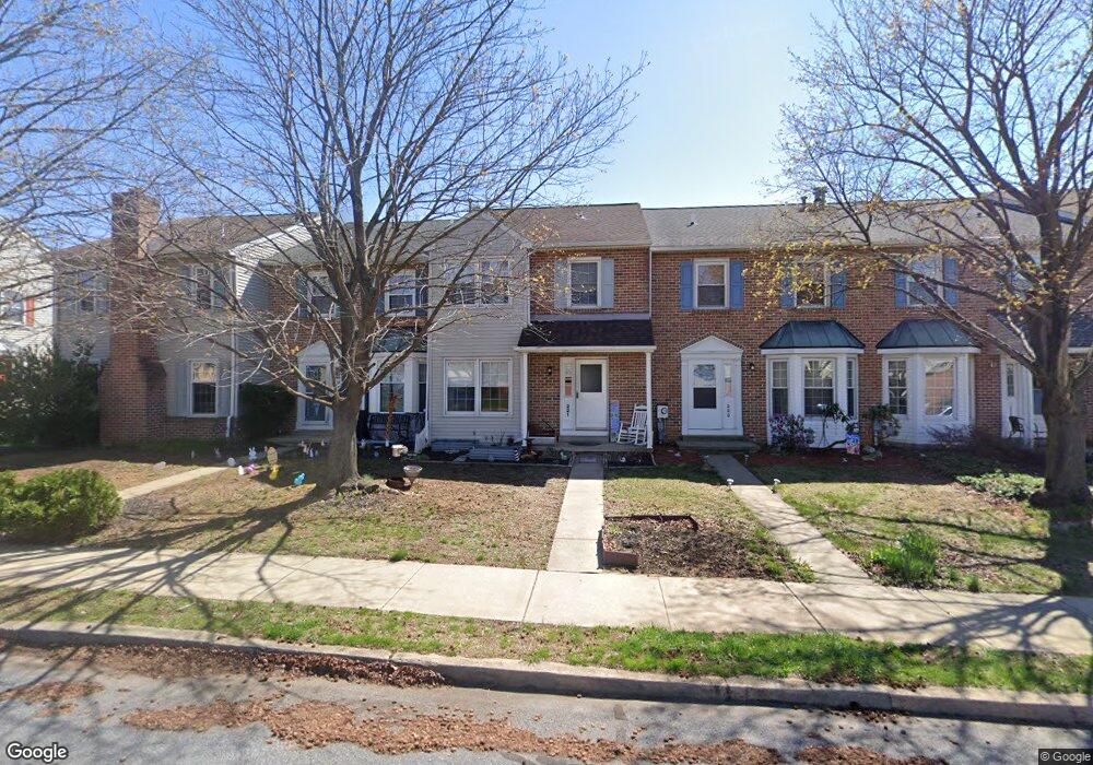
221 Elm St Reading, PA 19606
Saint Lawrence NeighborhoodEstimated Value: $234,931 - $269,000
3
Beds
3
Baths
1,396
Sq Ft
$186/Sq Ft
Est. Value
About This Home
This home is located at 221 Elm St, Reading, PA 19606 and is currently estimated at $259,733, approximately $186 per square foot. 221 Elm St is a home located in Berks County with nearby schools including Jacksonwald Elementary School, Exeter Township Junior High School, and Exeter Township Senior High School.
Ownership History
Date
Name
Owned For
Owner Type
Purchase Details
Closed on
Oct 25, 2002
Sold by
Henry Deidre S
Bought by
Quaintance Darren S and Quaintance Gloria J
Current Estimated Value
Home Financials for this Owner
Home Financials are based on the most recent Mortgage that was taken out on this home.
Original Mortgage
$78,750
Outstanding Balance
$33,155
Interest Rate
6.09%
Estimated Equity
$226,578
Create a Home Valuation Report for This Property
The Home Valuation Report is an in-depth analysis detailing your home's value as well as a comparison with similar homes in the area
Home Values in the Area
Average Home Value in this Area
Purchase History
| Date | Buyer | Sale Price | Title Company |
|---|---|---|---|
| Quaintance Darren S | $87,500 | -- |
Source: Public Records
Mortgage History
| Date | Status | Borrower | Loan Amount |
|---|---|---|---|
| Open | Quaintance Darren S | $78,750 |
Source: Public Records
Tax History Compared to Growth
Tax History
| Year | Tax Paid | Tax Assessment Tax Assessment Total Assessment is a certain percentage of the fair market value that is determined by local assessors to be the total taxable value of land and additions on the property. | Land | Improvement |
|---|---|---|---|---|
| 2025 | $1,429 | $83,000 | $10,400 | $72,600 |
| 2024 | $4,252 | $83,000 | $10,400 | $72,600 |
| 2023 | $4,154 | $83,000 | $10,400 | $72,600 |
| 2022 | $4,097 | $83,000 | $10,400 | $72,600 |
| 2021 | $4,048 | $83,000 | $10,400 | $72,600 |
| 2020 | $4,007 | $83,000 | $10,400 | $72,600 |
| 2019 | $2,424 | $83,000 | $10,400 | $72,600 |
| 2018 | $3,894 | $83,000 | $10,400 | $72,600 |
| 2017 | $3,837 | $83,000 | $10,400 | $72,600 |
| 2016 | $1,140 | $83,000 | $10,400 | $72,600 |
| 2015 | $1,140 | $83,000 | $10,400 | $72,600 |
| 2014 | $1,088 | $83,000 | $10,400 | $72,600 |
Source: Public Records
Map
Nearby Homes
- 222 Poplar Dr
- 40 Gunpowder Ln
- 3609 Grant St
- 120 & 110 Kerr Rd
- 3024 Oley Turnpike Rd
- 6 Taylor Dr
- 30 Estates Dr
- 3406 Perkiomen Ave
- 0 Perkiomen Ave Unit PABK2061892
- 16 Mulligan Dr
- 4861 Dunham Dr
- 202 W 39th St
- 3505 Circle Ave
- 111 W 33rd St
- 222 Opal Ave
- 5 Craig Dr
- 4851 Perkiomen Ave
- 16 Ironstone Dr
- 1034 Butter Ln
- 21 Sawgrass Dr