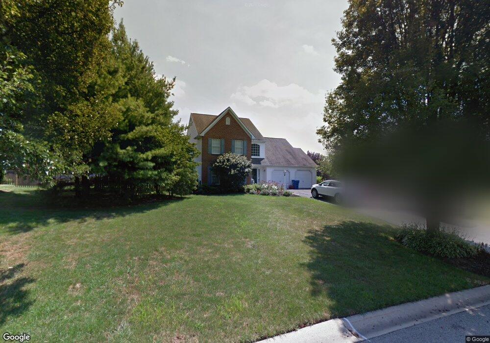
221 Glenfield Ln Kennett Square, PA 19348
Estimated Value: $543,469 - $631,000
3
Beds
3
Baths
2,144
Sq Ft
$273/Sq Ft
Est. Value
About This Home
This home is located at 221 Glenfield Ln, Kennett Square, PA 19348 and is currently estimated at $584,617, approximately $272 per square foot. 221 Glenfield Ln is a home located in Chester County with nearby schools including Kennett Middle School, Kennett High School, and Avon Grove Charter School.
Ownership History
Date
Name
Owned For
Owner Type
Purchase Details
Closed on
Mar 31, 1994
Sold by
The Bancroft Woods Company
Bought by
Morson Edward M and Morson Elizabeth F
Current Estimated Value
Home Financials for this Owner
Home Financials are based on the most recent Mortgage that was taken out on this home.
Original Mortgage
$120,700
Interest Rate
7.07%
Create a Home Valuation Report for This Property
The Home Valuation Report is an in-depth analysis detailing your home's value as well as a comparison with similar homes in the area
Home Values in the Area
Average Home Value in this Area
Purchase History
| Date | Buyer | Sale Price | Title Company |
|---|---|---|---|
| Morson Edward M | $163,233 | -- |
Source: Public Records
Mortgage History
| Date | Status | Borrower | Loan Amount |
|---|---|---|---|
| Closed | Morson Edward M | $120,700 |
Source: Public Records
Tax History Compared to Growth
Tax History
| Year | Tax Paid | Tax Assessment Tax Assessment Total Assessment is a certain percentage of the fair market value that is determined by local assessors to be the total taxable value of land and additions on the property. | Land | Improvement |
|---|---|---|---|---|
| 2025 | $6,595 | $164,680 | $40,590 | $124,090 |
| 2024 | $6,595 | $164,680 | $40,590 | $124,090 |
| 2023 | $6,374 | $164,680 | $40,590 | $124,090 |
| 2022 | $6,281 | $164,680 | $40,590 | $124,090 |
| 2021 | $6,218 | $164,680 | $40,590 | $124,090 |
| 2020 | $6,100 | $164,680 | $40,590 | $124,090 |
| 2019 | $6,017 | $164,680 | $40,590 | $124,090 |
| 2018 | $5,923 | $164,680 | $40,590 | $124,090 |
| 2017 | $5,802 | $164,680 | $40,590 | $124,090 |
| 2016 | $653 | $164,680 | $40,590 | $124,090 |
| 2015 | $653 | $164,680 | $40,590 | $124,090 |
| 2014 | $653 | $164,680 | $40,590 | $124,090 |
Source: Public Records
Map
Nearby Homes
- Sutton Grand Plan at Copperleaf Ridge
- Carlton Plan at Copperleaf Ridge
- Sutton Plan at Copperleaf Ridge
- Carlton Grand Plan at Copperleaf Ridge
- 103 Foragers Ln
- 156 Bancroft Rd Unit CARLTON
- 156 Bancroft Rd Unit SUTTON
- 156 Bancroft Rd Unit SGR
- 156 Bancroft Rd Unit CARLTON GRND
- 107 Foragers Ln
- 13 Tullow Hill Dr
- 15 Tullow Hill Dr
- 9 Tullow Hill Dr
- 5 Tullow Hill Dr
- 1265 W Baltimore Pike
- 201 Kestrel Ct
- Augusta Plan at Stonebridge at Longwood
- Woodford Plan at Holly Drive
- 700 Shagbark Dr Unit HAWTHORNE
- Hawthorne Plan at Stonebridge at Longwood
- 225 Glenfield Ln
- 217 Glenfield Ln
- 728 Brighton Cir
- 732 Brighton Cir
- 724 Brighton Cir
- 220 Glenfield Ln
- 224 Glenfield Ln
- 229 Glenfield Ln
- 213 Glenfield Ln
- 216 Glenfield Ln
- 720 Brighton Cir
- 228 Glenfield Ln
- 155 Crestview Dr
- 209 Glenfield Ln
- 212 Glenfield Ln
- 731 Brighton Cir
- 727 Brighton Cir
- 716 Brighton Cir
- 165 Crestview Dr