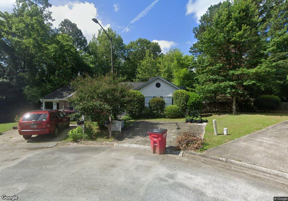
221 Johns Ct Macon, GA 31210
Estimated Value: $139,000 - $157,000
2
Beds
2
Baths
1,083
Sq Ft
$139/Sq Ft
Est. Value
About This Home
This home is located at 221 Johns Ct, Macon, GA 31210 and is currently estimated at $150,019, approximately $138 per square foot. 221 Johns Ct is a home located in Bibb County with nearby schools including Carter Elementary School, Howard Middle School, and Howard High School.
Ownership History
Date
Name
Owned For
Owner Type
Purchase Details
Closed on
May 12, 2020
Sold by
Bacon Syble and Bacon Syble J
Bought by
Fowler Christi M and Bacon Charles B
Current Estimated Value
Purchase Details
Closed on
Aug 13, 2008
Sold by
Ussery Todd A
Bought by
Bacon Syble
Purchase Details
Closed on
Jun 8, 2005
Sold by
Carter Beverly J
Bought by
Ussery Todd A
Home Financials for this Owner
Home Financials are based on the most recent Mortgage that was taken out on this home.
Original Mortgage
$81,425
Interest Rate
5.69%
Mortgage Type
New Conventional
Purchase Details
Closed on
Jul 30, 2002
Create a Home Valuation Report for This Property
The Home Valuation Report is an in-depth analysis detailing your home's value as well as a comparison with similar homes in the area
Home Values in the Area
Average Home Value in this Area
Purchase History
| Date | Buyer | Sale Price | Title Company |
|---|---|---|---|
| Fowler Christi M | -- | None Available | |
| Bacon Syble | $92,900 | None Available | |
| Ussery Todd A | $81,425 | Na | |
| -- | $73,000 | -- |
Source: Public Records
Mortgage History
| Date | Status | Borrower | Loan Amount |
|---|---|---|---|
| Previous Owner | Ussery Todd A | $81,425 |
Source: Public Records
Tax History Compared to Growth
Tax History
| Year | Tax Paid | Tax Assessment Tax Assessment Total Assessment is a certain percentage of the fair market value that is determined by local assessors to be the total taxable value of land and additions on the property. | Land | Improvement |
|---|---|---|---|---|
| 2025 | $1,252 | $50,934 | $6,900 | $44,034 |
| 2024 | $1,255 | $49,428 | $6,900 | $42,528 |
| 2023 | $1,293 | $43,636 | $6,000 | $37,636 |
| 2022 | $1,133 | $32,725 | $4,800 | $27,925 |
| 2021 | $954 | $25,116 | $3,840 | $21,276 |
| 2020 | $975 | $25,116 | $3,840 | $21,276 |
| 2019 | $983 | $25,116 | $3,840 | $21,276 |
| 2018 | $1,686 | $25,116 | $3,840 | $21,276 |
| 2017 | $1,027 | $27,406 | $4,800 | $22,606 |
| 2016 | $948 | $27,406 | $4,800 | $22,606 |
| 2015 | $1,573 | $32,115 | $5,520 | $26,595 |
| 2014 | $1,575 | $32,115 | $5,520 | $26,595 |
Source: Public Records
Map
Nearby Homes
- 222 Johns Ct
- 219 Johns Ct
- 112 the Vinings
- 143 Wesleyan Way
- 114 the Vinings
- 217 Johns Ct
- 220 Johns Ct
- 110 the Vinings
- 145 Wesleyan Way
- 141 Wesleyan Way
- 215 Johns Ct
- 116 the Vinings
- 0 the Vinings Dr Unit 7453206
- 0 the Vinings Dr Unit 7005498
- 137 Wesleyan Way
- 218 Johns Ct
- 108 the Vinings
- 213 Johns Ct
- 216 Johns Ct
- 135 Wesleyan Way