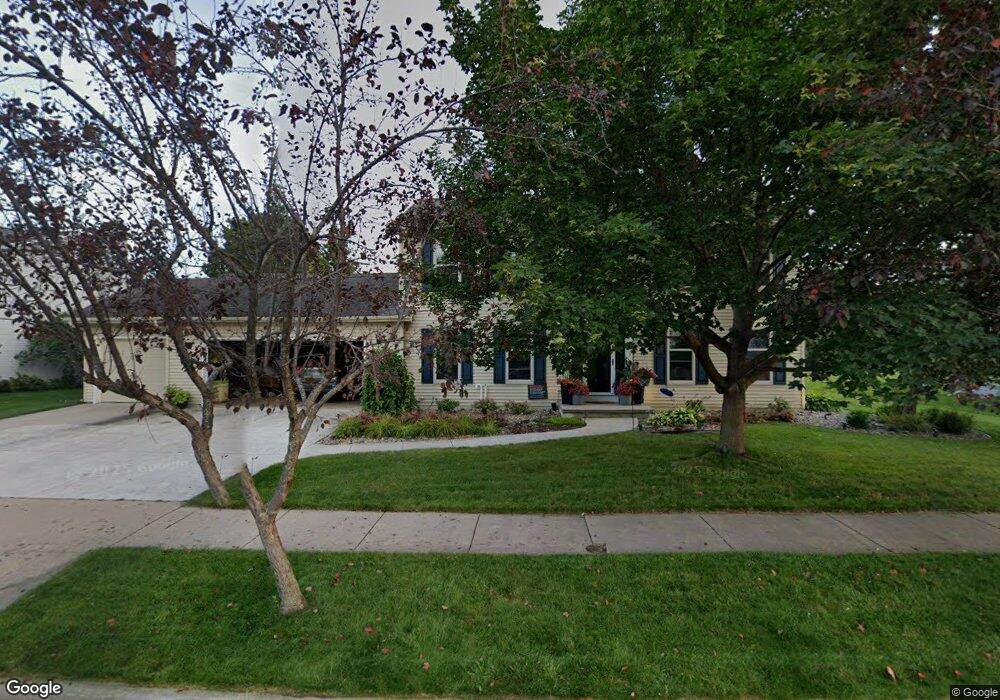
221 Kraft St Neenah, WI 54956
Estimated Value: $483,374 - $561,000
4
Beds
3
Baths
1,324
Sq Ft
$385/Sq Ft
Est. Value
About This Home
This home is located at 221 Kraft St, Neenah, WI 54956 and is currently estimated at $510,344, approximately $385 per square foot. 221 Kraft St is a home located in Winnebago County with nearby schools including Coolidge Elementary School, Horace Mann Middle School, and Neenah Middle School.
Ownership History
Date
Name
Owned For
Owner Type
Purchase Details
Closed on
Apr 8, 2019
Sold by
Meyers Signa A
Bought by
Signa A Meyers Trust
Current Estimated Value
Purchase Details
Closed on
Jun 14, 2018
Sold by
Lamb Jacob M and Lamb Tracy A
Bought by
Meyers Signa A
Home Financials for this Owner
Home Financials are based on the most recent Mortgage that was taken out on this home.
Original Mortgage
$209,930
Interest Rate
5%
Mortgage Type
Adjustable Rate Mortgage/ARM
Create a Home Valuation Report for This Property
The Home Valuation Report is an in-depth analysis detailing your home's value as well as a comparison with similar homes in the area
Home Values in the Area
Average Home Value in this Area
Purchase History
| Date | Buyer | Sale Price | Title Company |
|---|---|---|---|
| Signa A Meyers Trust | -- | None Listed On Document | |
| Meyers Signa A | $299,900 | None Available |
Source: Public Records
Mortgage History
| Date | Status | Borrower | Loan Amount |
|---|---|---|---|
| Previous Owner | Meyers Signa A | $209,930 |
Source: Public Records
Tax History Compared to Growth
Tax History
| Year | Tax Paid | Tax Assessment Tax Assessment Total Assessment is a certain percentage of the fair market value that is determined by local assessors to be the total taxable value of land and additions on the property. | Land | Improvement |
|---|---|---|---|---|
| 2024 | $6,478 | $419,000 | $59,000 | $360,000 |
| 2023 | $6,478 | $419,000 | $59,000 | $360,000 |
| 2022 | $6,348 | $312,500 | $57,000 | $255,500 |
| 2021 | $6,443 | $312,500 | $57,000 | $255,500 |
| 2020 | $6,522 | $312,500 | $57,000 | $255,500 |
| 2019 | $6,107 | $312,500 | $57,000 | $255,500 |
| 2018 | $5,345 | $235,200 | $59,400 | $175,800 |
| 2017 | $5,314 | $235,200 | $59,400 | $175,800 |
| 2016 | $5,287 | $235,200 | $59,400 | $175,800 |
| 2015 | $5,322 | $235,200 | $59,400 | $175,800 |
| 2014 | $5,377 | $235,200 | $59,400 | $175,800 |
| 2013 | $5,638 | $235,200 | $59,400 | $175,800 |
Source: Public Records
Map
Nearby Homes
- 223 Bosworth Ln
- 1404 Mahler Blvd
- 231 Bosworth Ln
- 214 W Peckham St
- 2419 Maple Grove Dr
- 127 Southfield Ct
- 0 S Park Ave
- 123 Southfield Ct
- 2375 Fiesta Ct Unit 2377
- 130 Southfield Ct
- 136 Langley Blvd Unit 138
- 145 Langley Blvd
- 0 S Commercial St Unit 50063338
- 926 Congress St
- 2513 Bishops Ln
- 444 Maple Ln
- 525 Pembrook Ct
- 870 Maple St
- 2530 Grassy Ln
- 949 Higgins Ave
- 213 Kraft St
- 209 Kraft St
- 205 Kraft St
- 212 Kraft St
- 204 Kraft St
- 216 Kraft St
- 209 Edgewood Dr
- 220 Kraft St
- 201 Edgewood Dr
- 218 Whitenack Ct
- 213 Edgewood Dr
- 210 Whitenack Ct
- 206 Whitenack Ct
- 214 Whitenack Ct
- 1347 Maple St
- 217 Edgewood Dr
- 207 Whitenack Ct
- 203 Whitenack Ct
- 223 Edgewood Dr
- 1343 Maple St