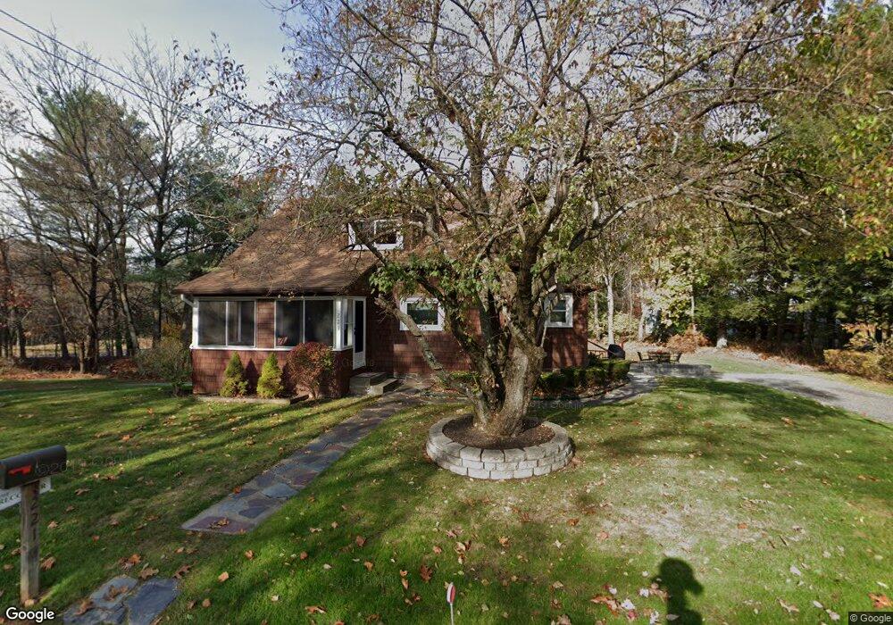
221 Log Plain Rd Greenfield, MA 01301
Estimated Value: $307,000 - $465,000
3
Beds
1
Bath
1,284
Sq Ft
$281/Sq Ft
Est. Value
About This Home
This home is located at 221 Log Plain Rd, Greenfield, MA 01301 and is currently estimated at $360,884, approximately $281 per square foot. 221 Log Plain Rd is a home located in Franklin County with nearby schools including Greenfield Center School, Cornerstone Christian School, and Stoneleigh-Burnham School.
Ownership History
Date
Name
Owned For
Owner Type
Purchase Details
Closed on
Feb 9, 2023
Sold by
Grybko Mark E and Grybko Elizabeth M
Bought by
Grybko Ft and Grybko
Current Estimated Value
Purchase Details
Closed on
Nov 13, 2008
Sold by
Grybko Mark E
Bought by
Grybko Elizabeth M and Grybko Mark E
Purchase Details
Closed on
Aug 18, 1987
Sold by
Weeks George E
Bought by
Grybko Mark E
Home Financials for this Owner
Home Financials are based on the most recent Mortgage that was taken out on this home.
Original Mortgage
$72,000
Interest Rate
10.4%
Mortgage Type
Purchase Money Mortgage
Create a Home Valuation Report for This Property
The Home Valuation Report is an in-depth analysis detailing your home's value as well as a comparison with similar homes in the area
Home Values in the Area
Average Home Value in this Area
Purchase History
| Date | Buyer | Sale Price | Title Company |
|---|---|---|---|
| Grybko Ft | -- | None Available | |
| Grybko Ft | -- | None Available | |
| Grybko Elizabeth M | -- | -- | |
| Grybko Elizabeth M | -- | -- | |
| Grybko Mark E | $80,000 | -- |
Source: Public Records
Mortgage History
| Date | Status | Borrower | Loan Amount |
|---|---|---|---|
| Previous Owner | Grybko Mark E | $20,000 | |
| Previous Owner | Grybko Mark E | $77,900 | |
| Previous Owner | Grybko Mark E | $72,000 |
Source: Public Records
Tax History
| Year | Tax Paid | Tax Assessment Tax Assessment Total Assessment is a certain percentage of the fair market value that is determined by local assessors to be the total taxable value of land and additions on the property. | Land | Improvement |
|---|---|---|---|---|
| 2025 | $4,937 | $252,400 | $76,500 | $175,900 |
| 2024 | $4,890 | $239,800 | $65,200 | $174,600 |
| 2023 | $4,270 | $217,300 | $65,200 | $152,100 |
| 2022 | $4,395 | $196,900 | $65,200 | $131,700 |
| 2021 | $4,324 | $186,200 | $69,000 | $117,200 |
| 2020 | $4,160 | $181,400 | $69,000 | $112,400 |
| 2019 | $3,866 | $172,900 | $60,000 | $112,900 |
| 2018 | $3,788 | $168,900 | $58,900 | $110,000 |
| 2017 | $3,670 | $168,900 | $58,900 | $110,000 |
| 2016 | $3,671 | $168,300 | $58,900 | $109,400 |
| 2015 | $3,611 | $160,400 | $60,400 | $100,000 |
| 2014 | $3,293 | $160,400 | $60,400 | $100,000 |
Source: Public Records
Map
Nearby Homes
- 001 Adams Rd
- 85 Verde Dr
- 42 Adams Rd Unit 53
- 75 South St Unit 3
- 23 Industrial Dr
- 1 Northfield Rd
- 0 Fox Hill Rd Unit 73477185
- 539 Fox Hill Rd
- 402 Country Side Rd
- 306 Country Side Rd
- 182 Main Rd
- 187 Leyden Rd
- 96 Bald Mountain Rd
- 116 Bald Mountain Rd
- 37 Cleveland St
- 171 Cleveland St
- 19 Arnold Ln
- 63 Davis St
- 151 Smead Hill Rd
- 0 French King Hwy
- 1148 Bernardston Rd
- 225 Log Plain Rd
- 218 Log Plain Rd
- 1164 Bernardston Rd
- 1144 Bernardston Rd
- 1138 Bernardston Rd
- 1134 Bernardston Rd
- 1182 Bernardston Rd
- 1130 Bernardston Rd
- 1173 Bernardston Rd
- 252 Log Plain Rd
- 189 Log Plain Rd
- 1124 Bernardston Rd
- 0 Fargo St
- 188 Log Plain Rd
- 185 Log Plain Rd
- 260 Log Plain Rd
- 1118 Bernardston Rd
- 8 Fargo St
- 1175 Bernardston Rd
Your Personal Tour Guide
Ask me questions while you tour the home.