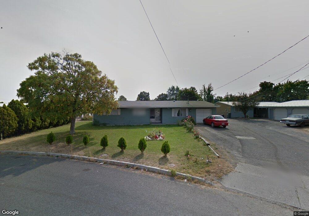
221 Loring Dr Moses Lake, WA 98837
Estimated Value: $218,000 - $257,000
4
Beds
2
Baths
1,452
Sq Ft
$166/Sq Ft
Est. Value
About This Home
This home is located at 221 Loring Dr, Moses Lake, WA 98837 and is currently estimated at $241,453, approximately $166 per square foot. 221 Loring Dr is a home located in Grant County with nearby schools including Larson Heights Elementary School, Endeavor Middle School, and Moses Lake High School.
Ownership History
Date
Name
Owned For
Owner Type
Purchase Details
Closed on
Aug 21, 2012
Sold by
Johns Jay W and Johns Nancy J
Bought by
Nieto Jorge A and Silvia Loera E
Current Estimated Value
Home Financials for this Owner
Home Financials are based on the most recent Mortgage that was taken out on this home.
Original Mortgage
$50,900
Interest Rate
5%
Mortgage Type
Seller Take Back
Purchase Details
Closed on
Feb 19, 2008
Sold by
Coronado Baldomero and Coronado Marilyn
Bought by
Nieto Gabriel and Escobar Zenaida
Home Financials for this Owner
Home Financials are based on the most recent Mortgage that was taken out on this home.
Original Mortgage
$103,000
Interest Rate
7%
Mortgage Type
Seller Take Back
Create a Home Valuation Report for This Property
The Home Valuation Report is an in-depth analysis detailing your home's value as well as a comparison with similar homes in the area
Home Values in the Area
Average Home Value in this Area
Purchase History
| Date | Buyer | Sale Price | Title Company |
|---|---|---|---|
| Nieto Jorge A | $52,500 | Chicago Title Ins Co | |
| Nieto Gabriel | $110,000 | Chicago Title |
Source: Public Records
Mortgage History
| Date | Status | Borrower | Loan Amount |
|---|---|---|---|
| Closed | Nieto Jorge A | $50,900 | |
| Closed | Nieto Gabriel | $103,000 |
Source: Public Records
Tax History Compared to Growth
Tax History
| Year | Tax Paid | Tax Assessment Tax Assessment Total Assessment is a certain percentage of the fair market value that is determined by local assessors to be the total taxable value of land and additions on the property. | Land | Improvement |
|---|---|---|---|---|
| 2024 | $1,251 | $94,917 | $25,500 | $69,417 |
| 2023 | $1,336 | $106,435 | $25,500 | $80,935 |
| 2022 | $1,352 | $106,435 | $25,500 | $80,935 |
| 2021 | $1,290 | $106,435 | $25,500 | $80,935 |
| 2020 | $1,401 | $98,735 | $25,500 | $73,235 |
| 2019 | $1,410 | $93,845 | $20,000 | $73,845 |
| 2018 | $1,478 | $90,420 | $20,000 | $70,420 |
| 2017 | $1,566 | $100,985 | $20,000 | $80,985 |
| 2016 | $1,345 | $84,985 | $20,000 | $64,985 |
| 2013 | -- | $79,075 | $20,000 | $59,075 |
Source: Public Records
Map
Nearby Homes
- 9023 Mcconnell Dr Unit A
- 205 March Dr NE
- 9021 Mcconnell Dr Unit A
- 9035 Forrestal Ln
- 410 Biggs Dr NE
- 9008 Bong Loop Unit B
- 8958 Tinker Loop Unit A & B
- 7613 Cox St NE
- 4815 Airway Dr NE Unit 72
- 4815 Airway Dr NE Unit 12
- 4926 Shorecrest Dr NE
- 4898 Shorecrest Dr NE
- 8558 Arlene Rd NE
- 8653 Harris Rd NE
- 1127 Arlington Dr
- 4886 Ray Rd NE
- 0 TBD Broad St NE
- 1214 Arnold Dr
- 1244 Adair St
- 2043 N Oak Rd
- 223 Loring Dr
- 217 Loring Dr
- 217 Loring Dr Unit 219
- 226 Carswell Dr
- 225 Loring Dr
- 228 Carswell Dr
- 215 Loring Dr
- 227 Loring Dr
- 216 Carswell Dr
- 214 Carswell Dr
- 220 Carswell Dr
- 234 Carswell Dr
- 210 212 Carswell Dr
- 212 Loring Dr
- 213 Beale Ave
- 305 Daley Dr
- 307 Daley Dr Unit 1and2
- 307 Daley Dr Unit 1
- 207 Beale Ave
- 207 Beale Ave Unit 209