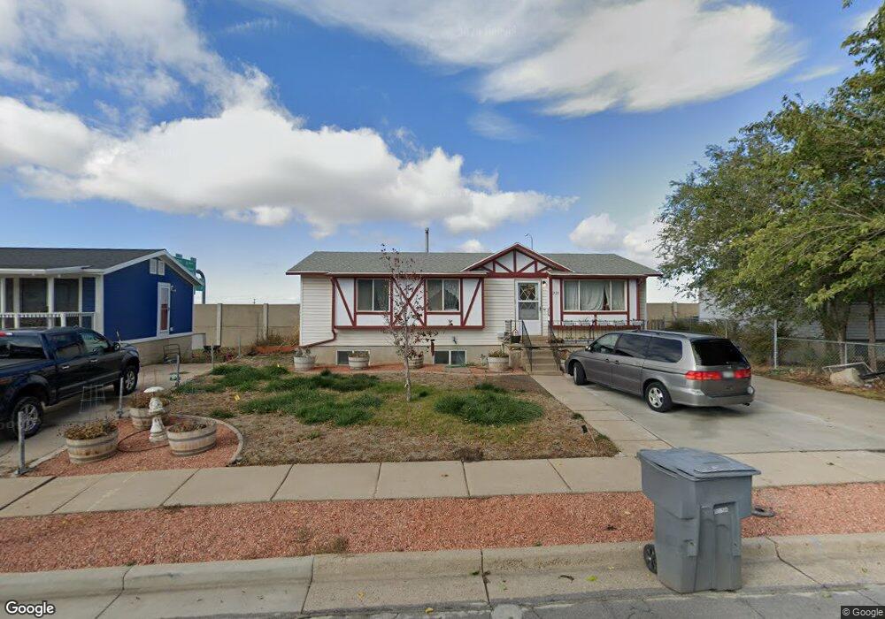
221 Maple Dr North Salt Lake, UT 84054
Estimated Value: $428,000 - $483,000
5
Beds
2
Baths
2,045
Sq Ft
$226/Sq Ft
Est. Value
About This Home
This home is located at 221 Maple Dr, North Salt Lake, UT 84054 and is currently estimated at $462,629, approximately $226 per square foot. 221 Maple Dr is a home located in Davis County with nearby schools including Adelaide School, South Davis Junior High School, and Woods Cross High School.
Ownership History
Date
Name
Owned For
Owner Type
Purchase Details
Closed on
Nov 7, 2023
Sold by
Hood James Robert
Bought by
Zaugg Jordan Shiloh and Zaugg Tiffany Marie
Current Estimated Value
Home Financials for this Owner
Home Financials are based on the most recent Mortgage that was taken out on this home.
Original Mortgage
$420,010
Outstanding Balance
$411,859
Interest Rate
7.19%
Mortgage Type
New Conventional
Estimated Equity
$50,770
Purchase Details
Closed on
Nov 6, 2023
Sold by
Collins Rashell
Bought by
Hood James R
Home Financials for this Owner
Home Financials are based on the most recent Mortgage that was taken out on this home.
Original Mortgage
$420,010
Outstanding Balance
$411,859
Interest Rate
7.19%
Mortgage Type
New Conventional
Estimated Equity
$50,770
Purchase Details
Closed on
May 25, 2023
Sold by
Collins Rashell Pearl
Bought by
Hood James Robert
Purchase Details
Closed on
Dec 28, 2018
Sold by
Hood James R
Bought by
Hood James R and Collins Rashell
Purchase Details
Closed on
Dec 14, 2018
Sold by
Hood Jennifer
Bought by
Hood James R
Purchase Details
Closed on
Jul 16, 2018
Sold by
Hood Jennifer
Bought by
Hood James R
Purchase Details
Closed on
Feb 18, 2015
Sold by
Hood Brenda R
Bought by
Hood Brenda R and Hood James Robert
Purchase Details
Closed on
Feb 7, 2008
Sold by
Hood Brenda R
Bought by
Hood Brenda R
Home Financials for this Owner
Home Financials are based on the most recent Mortgage that was taken out on this home.
Original Mortgage
$56,000
Interest Rate
6.04%
Mortgage Type
New Conventional
Purchase Details
Closed on
Nov 17, 1997
Sold by
Hood Brenda R
Bought by
Hood Brenda R and Brenda R Hood Living Trust
Home Financials for this Owner
Home Financials are based on the most recent Mortgage that was taken out on this home.
Original Mortgage
$71,000
Interest Rate
7.23%
Create a Home Valuation Report for This Property
The Home Valuation Report is an in-depth analysis detailing your home's value as well as a comparison with similar homes in the area
Home Values in the Area
Average Home Value in this Area
Purchase History
| Date | Buyer | Sale Price | Title Company |
|---|---|---|---|
| Zaugg Jordan Shiloh | -- | Meridian Title | |
| Hood James R | -- | Meridian Title | |
| Hood James Robert | -- | None Listed On Document | |
| Hood James R | -- | Backman Title Servic | |
| Hood James R | -- | Backman Title Servic | |
| Hood James R | -- | None Available | |
| Hood Brenda R | -- | Inwest Title Servic | |
| Hood Brenda R | -- | Nations Title Agency Inc | |
| Hood Brenda R | -- | First American Title Co | |
| Hood Brenda R | -- | First American Title Co |
Source: Public Records
Mortgage History
| Date | Status | Borrower | Loan Amount |
|---|---|---|---|
| Open | Zaugg Jordan Shiloh | $420,010 | |
| Previous Owner | Hood Brenda R | $56,000 | |
| Previous Owner | Hood Brenda R | $71,000 |
Source: Public Records
Tax History Compared to Growth
Tax History
| Year | Tax Paid | Tax Assessment Tax Assessment Total Assessment is a certain percentage of the fair market value that is determined by local assessors to be the total taxable value of land and additions on the property. | Land | Improvement |
|---|---|---|---|---|
| 2025 | $2,157 | $213,400 | $106,072 | $107,328 |
| 2024 | $2,072 | $208,450 | $111,989 | $96,461 |
| 2023 | $1,980 | $360,000 | $147,410 | $212,590 |
| 2022 | $2,055 | $205,150 | $133,107 | $72,043 |
| 2021 | $1,941 | $294,000 | $93,673 | $200,327 |
| 2020 | $1,729 | $259,000 | $79,987 | $179,013 |
| 2019 | $1,738 | $254,000 | $83,565 | $170,435 |
| 2018 | $1,591 | $230,000 | $82,469 | $147,531 |
| 2016 | $1,343 | $103,235 | $32,864 | $70,371 |
| 2015 | $1,229 | $90,750 | $32,864 | $57,886 |
| 2014 | $1,249 | $94,018 | $32,864 | $61,154 |
| 2013 | -- | $94,536 | $25,285 | $69,251 |
Source: Public Records
Map
Nearby Homes
- 284 N 100 E
- 70 E North Town Ln
- 189 E 210 N Unit 8
- 1443 E Cove Crest Ct Unit 1406
- 1423 E Wood Oaks Loop S Unit 1313
- 1428 E Cove Crest Ct S Unit 1404
- 410 N 175 E
- 55 W Center St Unit 206
- 55 W Center St Unit 331
- 252 E Kirsten Ln
- 72 S 130 E
- 3573 S Highway 89
- 562 Lancelot Dr Unit 60
- 167 Guenevere St Unit 128
- 2420 S Orchard Dr
- 246 N Glenwood Way
- 621 Excalibur St Unit 143
- 626 Sagramore St
- 246 Galahad St
- 259 Lionel St Unit 373