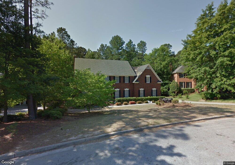
221 Matson Ct Augusta, GA 30907
Estimated Value: $451,009 - $482,000
5
Beds
3
Baths
3,140
Sq Ft
$149/Sq Ft
Est. Value
About This Home
This home is located at 221 Matson Ct, Augusta, GA 30907 and is currently estimated at $467,002, approximately $148 per square foot. 221 Matson Ct is a home located in Columbia County with nearby schools including Martinez Elementary School, Evans Middle School, and Evans High School.
Ownership History
Date
Name
Owned For
Owner Type
Purchase Details
Closed on
Jul 18, 2005
Sold by
Kallab Andre
Bought by
Paluba Michael J
Current Estimated Value
Home Financials for this Owner
Home Financials are based on the most recent Mortgage that was taken out on this home.
Original Mortgage
$212,000
Outstanding Balance
$110,166
Interest Rate
5.59%
Mortgage Type
New Conventional
Estimated Equity
$356,836
Purchase Details
Closed on
Mar 30, 2001
Sold by
Young Clinton A
Bought by
Kallab Andre
Home Financials for this Owner
Home Financials are based on the most recent Mortgage that was taken out on this home.
Original Mortgage
$221,000
Interest Rate
6.37%
Create a Home Valuation Report for This Property
The Home Valuation Report is an in-depth analysis detailing your home's value as well as a comparison with similar homes in the area
Home Values in the Area
Average Home Value in this Area
Purchase History
| Date | Buyer | Sale Price | Title Company |
|---|---|---|---|
| Paluba Michael J | $265,000 | -- | |
| Kallab Andre | $221,000 | -- |
Source: Public Records
Mortgage History
| Date | Status | Borrower | Loan Amount |
|---|---|---|---|
| Open | Paluba Michael J | $212,000 | |
| Closed | Paluba Michael J | $53,000 | |
| Previous Owner | Kallab Andre | $221,000 |
Source: Public Records
Tax History
| Year | Tax Paid | Tax Assessment Tax Assessment Total Assessment is a certain percentage of the fair market value that is determined by local assessors to be the total taxable value of land and additions on the property. | Land | Improvement |
|---|---|---|---|---|
| 2025 | $4,698 | $196,522 | $32,104 | $164,418 |
| 2024 | $4,818 | $192,498 | $25,804 | $166,694 |
| 2023 | $4,818 | $168,827 | $29,904 | $138,923 |
| 2022 | $3,767 | $144,702 | $26,404 | $118,298 |
| 2021 | $3,743 | $137,495 | $24,204 | $113,291 |
| 2020 | $3,341 | $120,172 | $22,004 | $98,168 |
| 2019 | $3,342 | $120,233 | $22,704 | $97,529 |
| 2018 | $3,185 | $114,160 | $21,304 | $92,856 |
| 2017 | $3,323 | $118,727 | $24,004 | $94,723 |
| 2016 | $3,244 | $120,204 | $21,980 | $98,224 |
| 2015 | $3,233 | $119,568 | $21,180 | $98,388 |
| 2014 | $3,374 | $123,270 | $22,780 | $100,490 |
Source: Public Records
Map
Nearby Homes
- 233 Kestwick Dr W
- 654 Clinton Way W
- 351 Pellet Ct
- 4357 Quail Creek Rd
- 4367 Quail Creek Rd
- 186 Kestwick Dr W
- 4350 Quail Creek Rd
- 4127 Meriden Dr
- 4130 Knollcrest Cir N
- 213 S Belair Rd
- 4121 Englewood Dr
- 511 Merrymont Dr
- 4507 Colonial Rd
- 4524 Oakley Pirkle Rd
- 245 Hillbrook Dr
- 302 Laurel Place
- 155 Stone Mill Dr
- 4518 Colonial Rd
- 524 Casey Ct
- 606 Todd Rd
- 225 Kestwick Dr W
- 219 Matson Ct
- 217 Matson Ct
- 227 Kestwick Dr W
- 313 Forest Ct
- 215 Matson Ct
- 210 Kestwick Dr W
- 317 Forest Ct
- 229 Kestwick Dr W
- 309 Forest Ct
- 206 Kestwick Dr W
- 319 Forest Ct
- 311 Forest Ct
- 209 Kestwick Dr W
- 212 Kestwick Dr W
- 321 Forest Ct
- 642 Clinton Way E
- 640 Clinton Way E
- 642 Clinton Way W
- 640 Clinton Way W
Your Personal Tour Guide
Ask me questions while you tour the home.