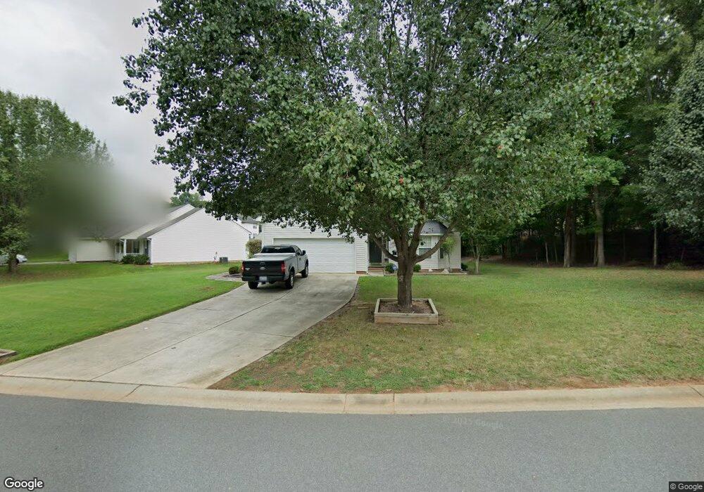
221 Maywood Path Waxhaw, NC 28173
Estimated Value: $389,000 - $443,000
3
Beds
2
Baths
1,652
Sq Ft
$248/Sq Ft
Est. Value
About This Home
This home is located at 221 Maywood Path, Waxhaw, NC 28173 and is currently estimated at $410,471, approximately $248 per square foot. 221 Maywood Path is a home located in Union County with nearby schools including Waxhaw Elementary School, Parkwood Middle School, and Parkwood High School.
Ownership History
Date
Name
Owned For
Owner Type
Purchase Details
Closed on
Jun 28, 2002
Sold by
Don Galloway Homes Llc
Bought by
Emerson Michael C and Emerson Lora Kay
Current Estimated Value
Home Financials for this Owner
Home Financials are based on the most recent Mortgage that was taken out on this home.
Original Mortgage
$146,866
Outstanding Balance
$62,921
Interest Rate
6.86%
Mortgage Type
FHA
Estimated Equity
$347,550
Create a Home Valuation Report for This Property
The Home Valuation Report is an in-depth analysis detailing your home's value as well as a comparison with similar homes in the area
Home Values in the Area
Average Home Value in this Area
Purchase History
| Date | Buyer | Sale Price | Title Company |
|---|---|---|---|
| Emerson Michael C | $149,500 | -- |
Source: Public Records
Mortgage History
| Date | Status | Borrower | Loan Amount |
|---|---|---|---|
| Open | Emerson Michael C | $146,866 |
Source: Public Records
Tax History Compared to Growth
Tax History
| Year | Tax Paid | Tax Assessment Tax Assessment Total Assessment is a certain percentage of the fair market value that is determined by local assessors to be the total taxable value of land and additions on the property. | Land | Improvement |
|---|---|---|---|---|
| 2024 | $2,490 | $242,900 | $47,800 | $195,100 |
| 2023 | $2,465 | $242,900 | $47,800 | $195,100 |
| 2022 | $2,465 | $242,900 | $47,800 | $195,100 |
| 2021 | $2,461 | $242,900 | $47,800 | $195,100 |
| 2020 | $1,164 | $148,500 | $35,000 | $113,500 |
| 2019 | $1,738 | $148,500 | $35,000 | $113,500 |
| 2018 | $1,166 | $148,500 | $35,000 | $113,500 |
| 2017 | $1,756 | $148,500 | $35,000 | $113,500 |
| 2016 | $1,726 | $148,500 | $35,000 | $113,500 |
| 2015 | $1,210 | $148,500 | $35,000 | $113,500 |
| 2014 | $1,077 | $153,370 | $32,740 | $120,630 |
Source: Public Records
Map
Nearby Homes
- 113 Dawn View Ln
- 432 Old Town Village Rd
- 416 Old Town Village Rd
- 412 Old Town Village Rd
- 451 Old Town Village Rd
- 317 Old Town Village Rd
- Duncan Plan at Old Town Village
- Wilson Plan at Old Town Village
- Price Plan at Old Town Village
- Hudson Plan at Old Town Village
- 639 Boxcar Bend
- 403 Old Town Village Rd
- 309 Old Town Village Rd
- TBD Blythe Mill Rd
- Kensington Plan at Blythe Mill Townhomes
- Ashland Plan at Blythe Mill Townhomes
- Southampton Plan at Blythe Mill Townhomes
- Norman Plan at Blythe Mill Townhomes
- Cary Plan at Blythe Mill Townhomes
- Cambridge Plan at Blythe Mill Townhomes
- 209 Maywood Path
- 124 Leafmore Ct
- 120 Leafmore Ct
- 205 Maywood Path
- 220 Maywood Path
- 216 Maywood Path
- 212 Maywood Path
- 116 Leafmore Ct
- 200 Leafmore Ct
- 228 Maywood Path
- 208 Maywood Path
- 100 Dawn View Ln
- 104 Dawn View Ln
- 204 Maywood Path
- 112 Leafmore Ct
- 204 Leafmore Ct
- 117 Leafmore Ct
- 108 Dawn View Ln
- 224 Maywood Path
- 125 Leafmore Ct