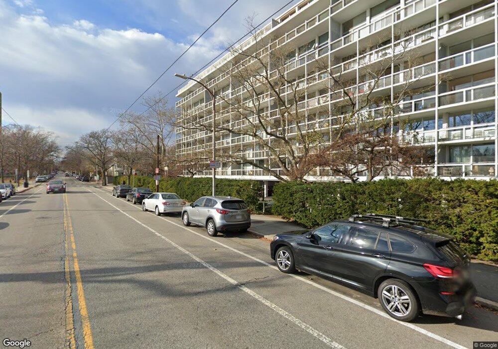
221 Mt Auburn Unit 309 Cambridge, MA 02138
West Cambridge NeighborhoodEstimated Value: $899,295 - $980,000
2
Beds
1
Bath
851
Sq Ft
$1,099/Sq Ft
Est. Value
About This Home
This home is located at 221 Mt Auburn Unit 309, Cambridge, MA 02138 and is currently estimated at $935,324, approximately $1,099 per square foot. 221 Mt Auburn Unit 309 is a home located in Middlesex County with nearby schools including St Peter School, Shady Hill School, and Cambridge Montessori School.
Ownership History
Date
Name
Owned For
Owner Type
Purchase Details
Closed on
Sep 6, 2018
Sold by
Brockunier Barbara K
Bought by
201 Barbara Brockunier
Current Estimated Value
Purchase Details
Closed on
Oct 15, 2014
Sold by
Jackson Mary E
Bought by
Brockunier Barbara K
Purchase Details
Closed on
May 1, 2008
Sold by
Kennedy Mary B
Bought by
Jackson Mary Eliot
Purchase Details
Closed on
Jul 10, 2003
Sold by
309 Riverview Rt
Bought by
Kennedy Mary B
Purchase Details
Closed on
Apr 16, 1987
Sold by
Harkness Elaine H
Bought by
Levine Harold G
Home Financials for this Owner
Home Financials are based on the most recent Mortgage that was taken out on this home.
Original Mortgage
$153,100
Interest Rate
8.97%
Mortgage Type
Purchase Money Mortgage
Create a Home Valuation Report for This Property
The Home Valuation Report is an in-depth analysis detailing your home's value as well as a comparison with similar homes in the area
Home Values in the Area
Average Home Value in this Area
Purchase History
| Date | Buyer | Sale Price | Title Company |
|---|---|---|---|
| 201 Barbara Brockunier | -- | -- | |
| Brockunier Barbara K | $775,000 | -- | |
| Jackson Mary Eliot | $605,000 | -- | |
| Kennedy Mary B | $420,000 | -- | |
| Levine Harold G | $194,500 | -- |
Source: Public Records
Mortgage History
| Date | Status | Borrower | Loan Amount |
|---|---|---|---|
| Previous Owner | Levine Harold G | $153,100 |
Source: Public Records
Tax History Compared to Growth
Tax History
| Year | Tax Paid | Tax Assessment Tax Assessment Total Assessment is a certain percentage of the fair market value that is determined by local assessors to be the total taxable value of land and additions on the property. | Land | Improvement |
|---|---|---|---|---|
| 2025 | $5,333 | $839,800 | $0 | $839,800 |
| 2024 | $5,365 | $906,200 | $0 | $906,200 |
| 2023 | $5,137 | $876,700 | $0 | $876,700 |
| 2022 | $5,448 | $920,300 | $0 | $920,300 |
| 2021 | $5,463 | $933,900 | $0 | $933,900 |
| 2020 | $5,192 | $903,000 | $0 | $903,000 |
| 2019 | $4,971 | $836,800 | $0 | $836,800 |
| 2018 | $4,775 | $759,200 | $0 | $759,200 |
| 2017 | $4,614 | $711,000 | $0 | $711,000 |
| 2016 | $4,508 | $644,900 | $0 | $644,900 |
| 2015 | $4,254 | $544,000 | $0 | $544,000 |
| 2014 | $3,983 | $475,300 | $0 | $475,300 |
Source: Public Records
Map
Nearby Homes
- 20 Maynard Place
- 1010 Memorial Dr Unit 6G
- 15 Hubbard Park Rd
- 48 Hubbard Park Rd
- 32 Hawthorn St
- 988 Memorial Dr Unit 386
- 153 Brattle St
- 158 Brattle St
- 5 Brewer St Unit 5
- 986 Memorial Dr Unit 404
- 984 Memorial Dr Unit 984-503
- 983 Memorial Dr Unit 502
- 3 Berkeley Place
- 172 Brattle St
- 12 Berkeley St
- 130 Mount Auburn St Unit 108
- 22 Concord Ave Unit 10
- 975 Memorial Dr Unit 209
- 975 Memorial Dr Unit 211
- 44 Garden St
- 221 Mt Auburn Unit 108
- 221 Mt Auburn Unit 502
- 221 Mt Auburn Unit 706
- 221 Mt Auburn Unit 508
- 221 Mt Auburn Unit 408
- 221 Mt Auburn
- 221 Mt Auburn Unit 107
- 221 Mt Auburn Unit 606
- 221 Mt Auburn Unit 302
- 221 Mt Auburn Unit 307
- 221 Mt Auburn Unit 111
- 221 Mt Auburn Unit 104
- 221 Mt Auburn Unit A
- 221 Mt Auburn Unit 505
- 221 Mount Auburn St Unit 801B
- 221 Mount Auburn St Unit 801A
- 221 Mount Auburn St Unit 510A
- 221 Mount Auburn St Unit 802
- 221 Mount Auburn St Unit 708
- 221 Mount Auburn St Unit 707