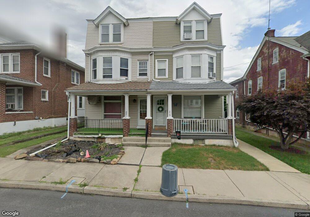
221 N 5th St Emmaus, PA 18049
Estimated Value: $209,000 - $289,000
4
Beds
2
Baths
1,954
Sq Ft
$132/Sq Ft
Est. Value
About This Home
This home is located at 221 N 5th St, Emmaus, PA 18049 and is currently estimated at $258,529, approximately $132 per square foot. 221 N 5th St is a home located in Lehigh County with nearby schools including Lincoln Elementary School, Lower Macungie Middle School, and Emmaus High School.
Ownership History
Date
Name
Owned For
Owner Type
Purchase Details
Closed on
Jan 7, 2022
Sold by
Weaknecht Mark J
Bought by
Durante Kyle
Current Estimated Value
Home Financials for this Owner
Home Financials are based on the most recent Mortgage that was taken out on this home.
Original Mortgage
$130,000
Outstanding Balance
$119,827
Interest Rate
3.12%
Mortgage Type
New Conventional
Estimated Equity
$138,702
Purchase Details
Closed on
Jun 26, 1958
Bought by
Weaknecht Jay & Kathryn E
Create a Home Valuation Report for This Property
The Home Valuation Report is an in-depth analysis detailing your home's value as well as a comparison with similar homes in the area
Home Values in the Area
Average Home Value in this Area
Purchase History
| Date | Buyer | Sale Price | Title Company |
|---|---|---|---|
| Durante Kyle | $150,000 | Penn Abstract & Land Svcs Ll | |
| Weaknecht Jay & Kathryn E | $10,000 | -- |
Source: Public Records
Mortgage History
| Date | Status | Borrower | Loan Amount |
|---|---|---|---|
| Open | Durante Kyle | $130,000 |
Source: Public Records
Tax History Compared to Growth
Tax History
| Year | Tax Paid | Tax Assessment Tax Assessment Total Assessment is a certain percentage of the fair market value that is determined by local assessors to be the total taxable value of land and additions on the property. | Land | Improvement |
|---|---|---|---|---|
| 2025 | $4,932 | $140,000 | $15,400 | $124,600 |
| 2024 | $4,517 | $140,000 | $15,400 | $124,600 |
| 2023 | $4,429 | $140,000 | $15,400 | $124,600 |
| 2022 | $4,283 | $140,000 | $124,600 | $15,400 |
| 2021 | $4,176 | $140,000 | $15,400 | $124,600 |
| 2020 | $4,140 | $140,000 | $15,400 | $124,600 |
| 2019 | $4,030 | $140,000 | $15,400 | $124,600 |
| 2018 | $3,878 | $140,000 | $15,400 | $124,600 |
| 2017 | $3,758 | $140,000 | $15,400 | $124,600 |
| 2016 | -- | $140,000 | $15,400 | $124,600 |
| 2015 | -- | $140,000 | $15,400 | $124,600 |
| 2014 | -- | $140,000 | $15,400 | $124,600 |
Source: Public Records
Map
Nearby Homes
- 543 Long St
- 120 N 2nd St
- 118 N 2nd St
- 569 Chestnut St Unit 571
- 657 Walnut St
- 331 Minor St
- 106 Garden Ct
- 41 S 2nd St
- 104 Garden Ct
- 659 Broad St
- 101 E George St
- 521 Wood St
- 943 N 6th St
- 507 Iroquois St
- 137 E Harrison St
- 1 E Pine St
- 610 Wood St
- 141 E Berger St
- 3601 Country Club Rd
- 3430 Gentlewind Way Unit IC 109