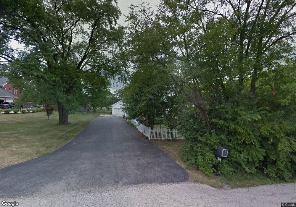
221 N Anderson Rd New Lenox, IL 60451
Estimated Value: $592,002
--
Bed
--
Bath
--
Sq Ft
6.05
Acres
About This Home
This home is located at 221 N Anderson Rd, New Lenox, IL 60451 and is currently estimated at $592,002. 221 N Anderson Rd is a home located in Will County with nearby schools including Bentley Elementary School, Arnold J Tyler School, and Alex M Martino Jr High School.
Ownership History
Date
Name
Owned For
Owner Type
Purchase Details
Closed on
Jan 1, 2018
Sold by
Brown Miles and Brown Rosemary
Bought by
Julie S Rentals Llc
Current Estimated Value
Purchase Details
Closed on
Oct 11, 2011
Sold by
Brown Rosemary and Rosemary Brown Trust
Bought by
Rose Rentals Lllp
Purchase Details
Closed on
Jun 11, 2007
Sold by
Brown Miles and Brown Rosemary
Bought by
Brown Rosemary and Rosemary Brown Declaration Of
Purchase Details
Closed on
Mar 12, 2001
Sold by
Brown Miles
Bought by
Brown Miles and Brown Rosemary
Home Financials for this Owner
Home Financials are based on the most recent Mortgage that was taken out on this home.
Original Mortgage
$165,000
Interest Rate
7.05%
Purchase Details
Closed on
Jul 29, 1994
Sold by
Ingram Gary T and Ingram Richard T
Bought by
Brown Miles
Home Financials for this Owner
Home Financials are based on the most recent Mortgage that was taken out on this home.
Original Mortgage
$116,000
Interest Rate
8.53%
Create a Home Valuation Report for This Property
The Home Valuation Report is an in-depth analysis detailing your home's value as well as a comparison with similar homes in the area
Home Values in the Area
Average Home Value in this Area
Purchase History
| Date | Buyer | Sale Price | Title Company |
|---|---|---|---|
| Julie S Rentals Llc | -- | Attorney | |
| Rose Rentals Lllp | -- | None Available | |
| Brown Rosemary | -- | None Available | |
| Brown Miles | -- | -- | |
| Brown Miles | $145,000 | Chicago Title Insurance Co |
Source: Public Records
Mortgage History
| Date | Status | Borrower | Loan Amount |
|---|---|---|---|
| Previous Owner | Brown Miles | $165,000 | |
| Previous Owner | Brown Miles | $116,000 |
Source: Public Records
Tax History Compared to Growth
Tax History
| Year | Tax Paid | Tax Assessment Tax Assessment Total Assessment is a certain percentage of the fair market value that is determined by local assessors to be the total taxable value of land and additions on the property. | Land | Improvement |
|---|---|---|---|---|
| 2024 | $5,254 | $67,144 | $21,649 | $45,495 |
| 2023 | $5,254 | $61,172 | $19,700 | $41,472 |
| 2022 | $4,697 | $56,305 | $18,100 | $38,205 |
| 2021 | $4,469 | $52,882 | $16,951 | $35,931 |
| 2020 | $4,375 | $50,900 | $16,251 | $34,649 |
| 2019 | $4,153 | $49,228 | $15,653 | $33,575 |
| 2018 | $4,059 | $47,455 | $15,038 | $32,417 |
| 2017 | $3,853 | $46,011 | $14,526 | $31,485 |
| 2016 | $3,740 | $44,702 | $14,060 | $30,642 |
| 2015 | $3,158 | $43,228 | $13,551 | $29,677 |
| 2014 | $3,158 | $43,169 | $13,492 | $29,677 |
| 2013 | $3,158 | $43,703 | $13,626 | $30,077 |
Source: Public Records
Map
Nearby Homes
- 1212 Georgias Way
- 1245 Georgias Way
- 1193 Georgias Way
- 125 N Anderson Rd
- 1139 Georgias Way
- 1125 Georgias Way
- 621 Chatfield Rd
- 1017 E Lincoln Hwy
- 214 Somerset Ct
- 449 Somerset Ln Unit 1
- 513 Somerset Ln
- 1108 Plaza Dr
- 1920 Tessington Ct
- 1931 Tessington Ct
- 821 Chatfield Rd
- 1351 E Lincoln Hwy
- 12932 Carrington Ct
- 12752 Berkshire Dr
- 12526 Surrey Ct
- 641 Lisson Grove
- 201 N Anderson Rd
- 220 N Anderson Rd
- 320 N Anderson Rd
- 210 N Anderson Rd
- 333 N Anderson Rd
- 181 N Anderson Rd
- 1204 Georgias Way
- 1196 Georgias Way
- 1220 Georgias Way
- 200 N Anderson Rd
- 1188 Georgias Way
- 915 Harmoni Ln
- 1228 Georgias Way
- 161 N Anderson Rd
- 1180 Georgias Way
- 190 N Anderson Rd
- 1236 Georgias Way
- 925 Harmoni Ln
- 910 Harmoni Ln
- 1211 Georgias Way