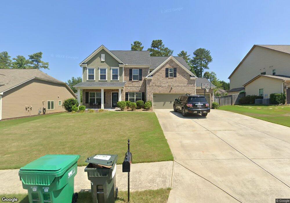
221 Parc Dr Canton, GA 30114
Sutallee NeighborhoodEstimated Value: $587,762 - $640,000
5
Beds
4
Baths
2,929
Sq Ft
$210/Sq Ft
Est. Value
About This Home
This home is located at 221 Parc Dr, Canton, GA 30114 and is currently estimated at $613,881, approximately $209 per square foot. 221 Parc Dr is a home located in Cherokee County with nearby schools including Sixes Elementary School, Freedom Middle School, and Woodstock High School.
Ownership History
Date
Name
Owned For
Owner Type
Purchase Details
Closed on
Jul 9, 2020
Sold by
Robledo Jorge
Bought by
Robledo Jorge and Restrepo Paula M
Current Estimated Value
Home Financials for this Owner
Home Financials are based on the most recent Mortgage that was taken out on this home.
Original Mortgage
$238,700
Outstanding Balance
$211,121
Interest Rate
3.2%
Mortgage Type
New Conventional
Estimated Equity
$402,760
Purchase Details
Closed on
Nov 25, 2013
Sold by
The Ryland Grp Inc
Bought by
Robledo Jorge
Home Financials for this Owner
Home Financials are based on the most recent Mortgage that was taken out on this home.
Original Mortgage
$258,746
Interest Rate
4.4%
Mortgage Type
FHA
Create a Home Valuation Report for This Property
The Home Valuation Report is an in-depth analysis detailing your home's value as well as a comparison with similar homes in the area
Home Values in the Area
Average Home Value in this Area
Purchase History
| Date | Buyer | Sale Price | Title Company |
|---|---|---|---|
| Robledo Jorge | -- | -- | |
| Robledo Jorge | $263,520 | -- |
Source: Public Records
Mortgage History
| Date | Status | Borrower | Loan Amount |
|---|---|---|---|
| Open | Robledo Jorge | $238,700 | |
| Previous Owner | Robledo Jorge | $258,746 |
Source: Public Records
Tax History Compared to Growth
Tax History
| Year | Tax Paid | Tax Assessment Tax Assessment Total Assessment is a certain percentage of the fair market value that is determined by local assessors to be the total taxable value of land and additions on the property. | Land | Improvement |
|---|---|---|---|---|
| 2025 | $5,256 | $222,680 | $50,000 | $172,680 |
| 2024 | $5,050 | $213,560 | $50,000 | $163,560 |
| 2023 | $4,540 | $210,000 | $48,000 | $162,000 |
| 2022 | $3,703 | $147,480 | $32,000 | $115,480 |
| 2021 | $3,754 | $136,720 | $29,520 | $107,200 |
| 2020 | $3,533 | $124,320 | $26,600 | $97,720 |
| 2019 | $3,317 | $116,720 | $23,200 | $93,520 |
| 2018 | $3,217 | $112,520 | $23,200 | $89,320 |
| 2017 | $3,203 | $277,900 | $23,200 | $87,960 |
| 2016 | $3,078 | $264,300 | $17,480 | $88,240 |
| 2015 | $2,906 | $247,100 | $17,480 | $81,360 |
| 2014 | $2,718 | $230,700 | $17,480 | $74,800 |
Source: Public Records
Map
Nearby Homes
- 211 Parc Dr
- 238 Parc Dr
- 331 Laurel Glen Crossing
- 109 Hale View Cir
- 552 Steels Bridge Rd
- 3021 Heatherbrook Trace
- 3008 Heatherbrook Trace Unit 2B
- 265 Parc Dr
- 204 Wildwood Way
- 3018 Heatherbrook Trace
- Jasper II Plan at Cambridge at Steels Bridge
- Newton II Plan at Cambridge at Steels Bridge
- Fulton II Plan at Cambridge at Steels Bridge
- Brookwood Plan at Cambridge at Steels Bridge
- Tifton II Plan at Cambridge at Steels Bridge
- 160 Henley St Unit 15
- 160 Henley St
- 164 Henley St
- 130 Windsong Trail
- 8014 Bells Ferry Rd
- 219 Parc Dr
- 217 Parc Dr
- 225 Parc Dr
- 156 Hale View Cir
- 632 Steels Bridge Rd
- 630 Steels Bridge Rd
- 632 Steel Bridge Rd Unit 2D
- 630 Steel Bridge Rd
- 220 Parc Dr
- 215 Parc Dr
- 227 Parc Dr
- 634 Steels Bridge Rd Unit 2435
- 634 Steels Bridge Rd
- 634 Steel Bridge Rd
- 628 Steel Bridge Rd Unit 2D
- 161 Hale View Cir
- 635 Steel Bridge Rd Unit 2D
- 224 Parc Dr
- 152 Hale View Cir
- 626 Steels Bridge Rd