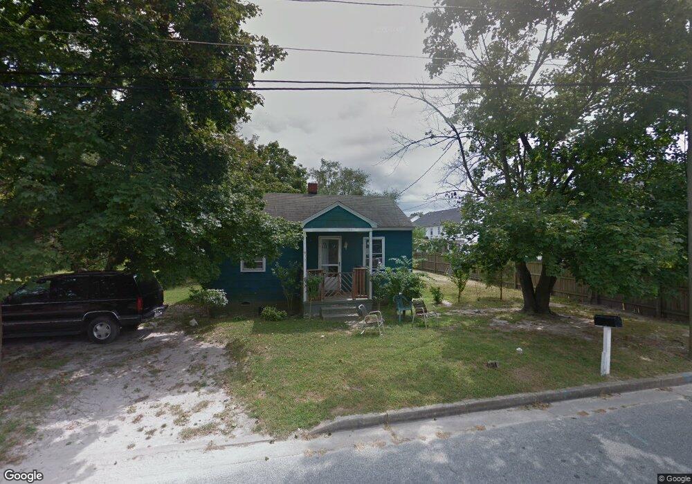
221 Poplar St Fruitland, MD 21826
Estimated Value: $68,000 - $133,000
--
Bed
--
Bath
--
Sq Ft
5,053
Sq Ft Lot
About This Home
This home is located at 221 Poplar St, Fruitland, MD 21826 and is currently estimated at $100,500. 221 Poplar St is a home located in Wicomico County with nearby schools including Fruitland Primary School, Fruitland Intermediate School, and Bennett Middle School.
Ownership History
Date
Name
Owned For
Owner Type
Purchase Details
Closed on
Feb 24, 2011
Sold by
Warren Andrew W and Warren Jessie Mae
Bought by
Warren Elinoria and Lewis Deon Lamont
Current Estimated Value
Purchase Details
Closed on
Jun 25, 1986
Sold by
Hannon Patrick J
Bought by
Warren Andrew W and Jessie Mae
Home Financials for this Owner
Home Financials are based on the most recent Mortgage that was taken out on this home.
Original Mortgage
$1,500
Interest Rate
10.61%
Create a Home Valuation Report for This Property
The Home Valuation Report is an in-depth analysis detailing your home's value as well as a comparison with similar homes in the area
Home Values in the Area
Average Home Value in this Area
Purchase History
| Date | Buyer | Sale Price | Title Company |
|---|---|---|---|
| Warren Elinoria | -- | -- | |
| Warren Andrew W | $2,500 | -- |
Source: Public Records
Mortgage History
| Date | Status | Borrower | Loan Amount |
|---|---|---|---|
| Previous Owner | Warren Andrew W | $1,500 |
Source: Public Records
Tax History Compared to Growth
Tax History
| Year | Tax Paid | Tax Assessment Tax Assessment Total Assessment is a certain percentage of the fair market value that is determined by local assessors to be the total taxable value of land and additions on the property. | Land | Improvement |
|---|---|---|---|---|
| 2025 | $2 | $200 | $200 | $0 |
| 2024 | $2 | $200 | $200 | $0 |
| 2023 | $2 | $200 | $200 | $0 |
| 2022 | $2 | $200 | $200 | $0 |
| 2021 | $2 | $200 | $200 | $0 |
| 2020 | $2 | $200 | $200 | $0 |
| 2019 | $2 | $200 | $200 | $0 |
| 2018 | $2 | $200 | $200 | $0 |
| 2017 | $2 | $200 | $0 | $0 |
| 2016 | -- | $200 | $0 | $0 |
| 2015 | $2 | $200 | $0 | $0 |
| 2014 | $2 | $200 | $0 | $0 |
Source: Public Records
Map
Nearby Homes
- 207 & 209 N Dulany Ave
- 222 N Dulany Ave
- 214 N Dulany Ave
- 227 N Brown St
- 212 Green St
- 103 W Main St
- 105 Russell Ave
- 210 Hunter's Way
- 415 Creekside Trail
- 209 W Main St
- 3960 Saint Lukes Rd
- 110 Moore Ave
- 229 Sand Castle Blvd
- 404 Sheldon Ave
- 104 Toms Crossing
- 134 Liberty Way
- 115 Walden Dr
- 224 Canal Park Dr Unit 101
- 210 Ringgold Rd
- 208 Ringgold Rd
- 219 Poplar St
- 223 Poplar St
- 302 Louise Ave
- 214 Poplar St
- 216 Poplar St Unit 211
- 217 Poplar St
- 301 Louise Ave
- 212 Poplar St
- 304 Louise Ave
- 213 Poplar St
- 303 Louise Ave
- 303 Poplar St
- 305 Louise Ave
- 211 Poplar St
- 210 Poplar St
- 306 Louise Ave
- 210 Seabrook Ave
- 300 Poplar St
- 302 Elizabeth St
- 211 Leslie St