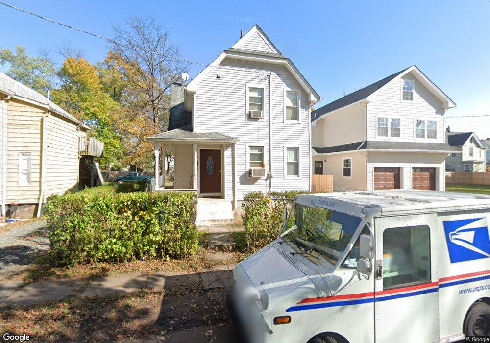
221 Prescott Place Unit 23 Plainfield, NJ 07063
Estimated Value: $298,756 - $463,000
--
Bed
--
Bath
819
Sq Ft
$478/Sq Ft
Est. Value
About This Home
This home is located at 221 Prescott Place Unit 23, Plainfield, NJ 07063 and is currently estimated at $391,689, approximately $478 per square foot. 221 Prescott Place Unit 23 is a home located in Union County with nearby schools including Washington Community School, Hubbard Middle School, and Plainfield High School.
Ownership History
Date
Name
Owned For
Owner Type
Purchase Details
Closed on
Feb 21, 2007
Sold by
Estate Of Wayne Lewis Alexande
Bought by
Alexander Gwendolyn Gail
Current Estimated Value
Home Financials for this Owner
Home Financials are based on the most recent Mortgage that was taken out on this home.
Original Mortgage
$117,000
Outstanding Balance
$71,008
Interest Rate
6.4%
Estimated Equity
$320,681
Create a Home Valuation Report for This Property
The Home Valuation Report is an in-depth analysis detailing your home's value as well as a comparison with similar homes in the area
Home Values in the Area
Average Home Value in this Area
Purchase History
| Date | Buyer | Sale Price | Title Company |
|---|---|---|---|
| Alexander Gwendolyn Gail | -- | -- |
Source: Public Records
Mortgage History
| Date | Status | Borrower | Loan Amount |
|---|---|---|---|
| Open | Alexander Gwendolyn Gail | $117,000 |
Source: Public Records
Tax History Compared to Growth
Tax History
| Year | Tax Paid | Tax Assessment Tax Assessment Total Assessment is a certain percentage of the fair market value that is determined by local assessors to be the total taxable value of land and additions on the property. | Land | Improvement |
|---|---|---|---|---|
| 2025 | $6,339 | $72,600 | $26,600 | $46,000 |
| 2024 | $6,277 | $72,600 | $26,600 | $46,000 |
| 2023 | $6,277 | $72,600 | $26,600 | $46,000 |
| 2022 | $6,141 | $72,600 | $26,600 | $46,000 |
| 2021 | $6,088 | $72,600 | $26,600 | $46,000 |
| 2020 | $6,070 | $72,600 | $26,600 | $46,000 |
| 2019 | $6,070 | $72,600 | $26,600 | $46,000 |
| 2018 | $5,943 | $72,600 | $26,600 | $46,000 |
| 2017 | $5,798 | $72,600 | $26,600 | $46,000 |
| 2016 | $5,680 | $72,600 | $26,600 | $46,000 |
| 2015 | $5,512 | $72,600 | $26,600 | $46,000 |
| 2014 | -- | $72,600 | $26,600 | $46,000 |
Source: Public Records
Map
Nearby Homes
- 667 S 2nd St
- 954 W 4th St
- 312 Monroe Ave Unit 14
- 829 S 2nd St
- 951 W Front St
- 325 Manson Place Unit 27
- 318-20 Manson Place
- 338 Manson Place Unit 40
- 211 Grant Ave
- 301 Grant Ave Unit 3
- 950 W 6th St Unit 52
- 962-64 W 6th St
- 745 W 4th St Unit 47
- 957 Myrtle Ave Unit 59
- 20-22 Albert St
- 318 Halsey St Unit 20
- 1637 S 2nd St
- 720 W Front St
- 355 Bergen St
- 610 Darrow Ave Unit 16
- 225-27 Prescott Place
- 225 Prescott Place
- 217 Prescott Place Unit 19
- 220 Prescott Place Unit 22
- 224-26 Prescott Place
- 224 Prescott Place Unit 26
- 216 Prescott Place Unit 18
- 216 Prescott Place Unit 2
- 932 W 3rd St
- 212 Prescott Place Unit 14
- 220 Stebbins Place Unit 22
- 930 W 3rd St
- 224 Stebbins Place Unit 26
- 216 Stebbins Place Unit 18
- 224-26 Stebbins Place
- 926 W 3rd St Unit 28
- 926 W 3rd St Unit 2
- 208 Prescott Place Unit 10
- 210 Stebbins Place Unit 14
- 936-38 W 3rd St