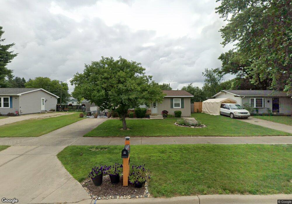
221 S Dekraft Ave Big Rapids, MI 49307
Estimated Value: $138,591 - $158,000
--
Bed
--
Bath
952
Sq Ft
$156/Sq Ft
Est. Value
About This Home
This home is located at 221 S Dekraft Ave, Big Rapids, MI 49307 and is currently estimated at $148,864, approximately $156 per square foot. 221 S Dekraft Ave is a home located in Mecosta County with nearby schools including Big Rapids High School, Crossroads Charter Academy Elementary School, and Crossroads Charter Academy Middle/High School.
Ownership History
Date
Name
Owned For
Owner Type
Purchase Details
Closed on
Jun 28, 2024
Sold by
Kaufman David L and Kaufman Tammy L
Bought by
Kaufman David L and Kaufman Tammy L
Current Estimated Value
Purchase Details
Closed on
Nov 23, 2011
Sold by
Kaufman David L and Kaufman Tammy L
Bought by
Kaufman David L and Kaufman Tammy L
Purchase Details
Closed on
Jul 28, 2010
Sold by
Federal Home Loan Mortgage Corporation
Bought by
Fifth Third Mortgage Mi Llc
Purchase Details
Closed on
Sep 23, 2009
Sold by
Smalley Julie
Bought by
Federal Home Loan Mortgage Corp
Purchase Details
Closed on
Mar 17, 2005
Sold by
Smalley Scott
Bought by
Smalley Julie
Home Financials for this Owner
Home Financials are based on the most recent Mortgage that was taken out on this home.
Original Mortgage
$73,000
Interest Rate
5.67%
Mortgage Type
Purchase Money Mortgage
Create a Home Valuation Report for This Property
The Home Valuation Report is an in-depth analysis detailing your home's value as well as a comparison with similar homes in the area
Home Values in the Area
Average Home Value in this Area
Purchase History
| Date | Buyer | Sale Price | Title Company |
|---|---|---|---|
| Kaufman David L | -- | Peak Title | |
| Kaufman David L | -- | None Available | |
| Fifth Third Mortgage Mi Llc | -- | None Available | |
| Federal Home Loan Mortgage Corp | $55,000 | None Available | |
| Smalley Julie | -- | Mecosta County Abstract & Ti |
Source: Public Records
Mortgage History
| Date | Status | Borrower | Loan Amount |
|---|---|---|---|
| Previous Owner | Smalley Julie | $73,000 |
Source: Public Records
Tax History Compared to Growth
Tax History
| Year | Tax Paid | Tax Assessment Tax Assessment Total Assessment is a certain percentage of the fair market value that is determined by local assessors to be the total taxable value of land and additions on the property. | Land | Improvement |
|---|---|---|---|---|
| 2025 | $1,636 | $47,800 | $0 | $0 |
| 2024 | -- | $45,400 | $0 | $0 |
| 2023 | -- | $40,300 | $0 | $0 |
| 2022 | $1,569 | $33,900 | $0 | $0 |
| 2021 | $1,569 | $30,700 | $0 | $0 |
| 2020 | -- | -- | $0 | $0 |
| 2019 | -- | -- | $0 | $0 |
| 2018 | -- | -- | $0 | $0 |
| 2017 | -- | -- | $0 | $0 |
| 2016 | -- | -- | $0 | $0 |
| 2014 | -- | -- | $0 | $0 |
| 2013 | -- | -- | $0 | $0 |
Source: Public Records
Map
Nearby Homes
- 211 Gilbertson Ave
- 202 S Bronson Ave
- 203 S 3rd Ave
- V/L 16 Mile Rd
- 203 N 3rd Ave
- 314 S 3rd Ave
- 707 Maple St
- 226 2nd Ave
- 316 2nd Ave
- 18725 16 Mile Rd
- 18751 16 Mile Rd
- 417 Maple St
- 615 Linden St
- 414 Maple St
- 326 Ives Ave
- 420 Linden St
- 114 N Warren Ave
- 117 S Warren Ave
- 216 S Warren Ave
- 709 Tioga Park Dr
- 223 S Dekraft Ave
- 219 S Dekraft Ave
- 217 S Dekraft Ave
- 217 S Dekraft Ave
- 219 S Dekraft Ave
- 204 S Dekraft Ave
- 205 S Dekraft Ave
- 202 S Dekraft Ave
- 222 Gilbertson Ave
- 222 Gilbertson Ave Unit 10, 1
- 204 S Dekrafft Ave
- 216 Gilbertson Ave
- 206 Gilbertson Ave
- V/L E Elm St
- 1101 E Elm St
- 305 S Dekraft Ave
- 218 S Dekraft Ave
- 220 S Dekraft Ave
- 223 Gilbertson Ave
- 219 Gilbertson Ave