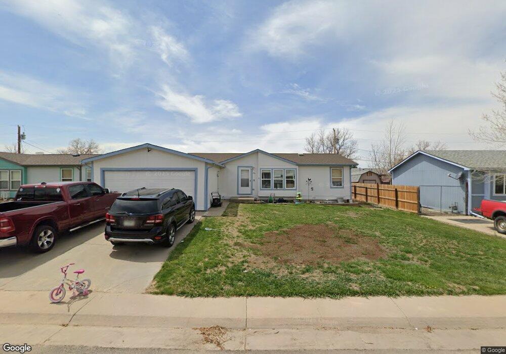
221 S Elm St Bennett, CO 80102
Estimated Value: $430,000 - $453,000
3
Beds
3
Baths
1,260
Sq Ft
$347/Sq Ft
Est. Value
About This Home
This home is located at 221 S Elm St, Bennett, CO 80102 and is currently estimated at $437,148, approximately $346 per square foot. 221 S Elm St is a home located in Adams County with nearby schools including Bennett Elementary School, Bennett Middle School, and Bennett High School.
Ownership History
Date
Name
Owned For
Owner Type
Purchase Details
Closed on
Dec 3, 2021
Sold by
Binford Daniel Robert and Binford Rachael Elizabeth
Bought by
Binford Daniel Robert
Current Estimated Value
Home Financials for this Owner
Home Financials are based on the most recent Mortgage that was taken out on this home.
Original Mortgage
$392,755
Outstanding Balance
$358,156
Interest Rate
2.8%
Mortgage Type
FHA
Estimated Equity
$78,992
Purchase Details
Closed on
Oct 23, 2021
Sold by
Holloway Cheryl
Bought by
Binford Daniel Robert and Binford Rachael Elizabeth
Home Financials for this Owner
Home Financials are based on the most recent Mortgage that was taken out on this home.
Original Mortgage
$392,755
Outstanding Balance
$358,156
Interest Rate
2.8%
Mortgage Type
FHA
Estimated Equity
$78,992
Purchase Details
Closed on
Oct 14, 2014
Sold by
Abd Limited
Bought by
Holloway Cheryl
Home Financials for this Owner
Home Financials are based on the most recent Mortgage that was taken out on this home.
Original Mortgage
$191,468
Interest Rate
3.87%
Mortgage Type
FHA
Purchase Details
Closed on
Jan 8, 2008
Sold by
Dryer Allen M and Dryer Bridgett R
Bought by
Abd Ltd
Purchase Details
Closed on
Aug 15, 2002
Sold by
Brock William E and Brock Barbara
Bought by
Dryer Allen M and Dryer Bridgett R
Home Financials for this Owner
Home Financials are based on the most recent Mortgage that was taken out on this home.
Original Mortgage
$185,381
Interest Rate
6.21%
Mortgage Type
FHA
Purchase Details
Closed on
Dec 15, 1997
Sold by
Okeefe David J and Okeefe Joann E
Bought by
Brock William E and Brock Barbara
Home Financials for this Owner
Home Financials are based on the most recent Mortgage that was taken out on this home.
Original Mortgage
$122,000
Interest Rate
7.22%
Purchase Details
Closed on
Jan 16, 1996
Sold by
Wells Charles R
Bought by
Okeefe David J and Okeefe Joann E
Home Financials for this Owner
Home Financials are based on the most recent Mortgage that was taken out on this home.
Original Mortgage
$101,650
Interest Rate
7.14%
Purchase Details
Closed on
Aug 30, 1995
Sold by
Dodson Milton and Dodson Phyllis
Bought by
Wells Charles R
Create a Home Valuation Report for This Property
The Home Valuation Report is an in-depth analysis detailing your home's value as well as a comparison with similar homes in the area
Home Values in the Area
Average Home Value in this Area
Purchase History
| Date | Buyer | Sale Price | Title Company |
|---|---|---|---|
| Binford Daniel Robert | -- | Land Title Guarantee Co | |
| Binford Daniel Robert | $400,000 | Land Title Guarantee | |
| Holloway Cheryl | $195,000 | Land Title Guarantee Company | |
| Abd Ltd | -- | None Available | |
| Dryer Allen M | $188,000 | Title America | |
| Brock William E | $122,000 | North American Title | |
| Okeefe David J | $107,000 | Land Title | |
| Wells Charles R | $15,000 | Land Title |
Source: Public Records
Mortgage History
| Date | Status | Borrower | Loan Amount |
|---|---|---|---|
| Open | Binford Daniel Robert | $392,755 | |
| Previous Owner | Holloway Cheryl | $191,468 | |
| Previous Owner | Dryer Allen M | $185,381 | |
| Previous Owner | Brock William E | $122,000 | |
| Previous Owner | Okeefe David J | $101,650 |
Source: Public Records
Tax History Compared to Growth
Tax History
| Year | Tax Paid | Tax Assessment Tax Assessment Total Assessment is a certain percentage of the fair market value that is determined by local assessors to be the total taxable value of land and additions on the property. | Land | Improvement |
|---|---|---|---|---|
| 2024 | $2,410 | $27,000 | $3,750 | $23,250 |
| 2023 | $2,426 | $32,060 | $4,460 | $27,600 |
| 2022 | $2,156 | $24,520 | $4,590 | $19,930 |
| 2021 | $2,156 | $24,520 | $4,590 | $19,930 |
| 2020 | $2,005 | $23,800 | $4,720 | $19,080 |
| 2019 | $2,059 | $23,800 | $4,720 | $19,080 |
| 2018 | $1,991 | $20,930 | $2,300 | $18,630 |
| 2017 | $2,009 | $20,930 | $2,300 | $18,630 |
| 2016 | $1,303 | $14,060 | $2,550 | $11,510 |
| 2015 | $1,297 | $14,060 | $2,550 | $11,510 |
| 2014 | $1,070 | $11,450 | $2,390 | $9,060 |
Source: Public Records
Map
Nearby Homes
- 45952 Gentry Ave
- 45915 Wood Thrush Ave
- 45921 Wood Thrush Ave
- 45933 Wood Thrush Ave
- 45946 Gentry Ave
- 45928 Gentry Ave
- 240 Lark Sparrow Way
- 228 Ash St
- 625 Aspen Ave
- 635 Cottonwood Ave
- 47385 Lily Ave
- 311 Maple St
- 47349 Lily Ave
- 333 Spruce St
- 47322 Iris Ave
- 47363 Lilac Ave
- 47375 Lilac Ave
- 485 4th St
- 535 N 5th St
- 530 2nd St