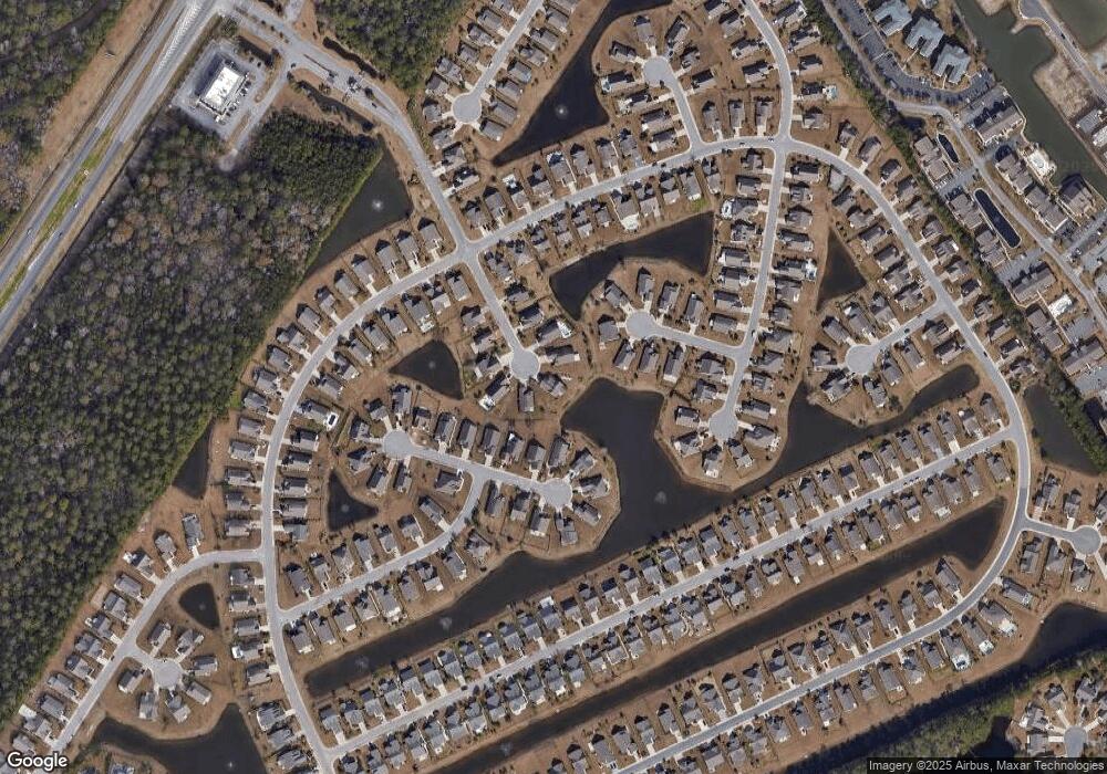
221 Sutter Dr Unit Surfside Beach Club Myrtle Beach, SC 29575
Estimated Value: $474,000 - $534,000
3
Beds
2
Baths
2,179
Sq Ft
$232/Sq Ft
Est. Value
About This Home
This home is located at 221 Sutter Dr Unit Surfside Beach Club, Myrtle Beach, SC 29575 and is currently estimated at $504,521, approximately $231 per square foot. 221 Sutter Dr Unit Surfside Beach Club is a home located in Horry County with nearby schools including Seaside Elementary, St. James Intermediate, and St. James Middle School.
Ownership History
Date
Name
Owned For
Owner Type
Purchase Details
Closed on
Oct 16, 2013
Sold by
Crumbling Barbara A
Bought by
Belisle Phillip E and Belisle Susan B
Current Estimated Value
Home Financials for this Owner
Home Financials are based on the most recent Mortgage that was taken out on this home.
Original Mortgage
$200,000
Interest Rate
4.52%
Mortgage Type
Future Advance Clause Open End Mortgage
Purchase Details
Closed on
Dec 21, 2009
Sold by
Bill Clark Homes Of Myrtle Beach Llc
Bought by
Tomblin Earl Ray
Create a Home Valuation Report for This Property
The Home Valuation Report is an in-depth analysis detailing your home's value as well as a comparison with similar homes in the area
Home Values in the Area
Average Home Value in this Area
Purchase History
| Date | Buyer | Sale Price | Title Company |
|---|---|---|---|
| Belisle Phillip E | $222,000 | -- | |
| Tomblin Earl Ray | $265,866 | -- |
Source: Public Records
Mortgage History
| Date | Status | Borrower | Loan Amount |
|---|---|---|---|
| Previous Owner | Belisle Phillip E | $200,000 |
Source: Public Records
Tax History Compared to Growth
Tax History
| Year | Tax Paid | Tax Assessment Tax Assessment Total Assessment is a certain percentage of the fair market value that is determined by local assessors to be the total taxable value of land and additions on the property. | Land | Improvement |
|---|---|---|---|---|
| 2024 | $3,752 | $29,779 | $12,491 | $17,288 |
| 2023 | $3,752 | $15,844 | $3,919 | $11,925 |
| 2021 | $3,459 | $32,028 | $6,859 | $25,169 |
| 2020 | $3,293 | $32,028 | $6,859 | $25,169 |
| 2019 | $3,293 | $32,028 | $6,859 | $25,169 |
| 2018 | $2,975 | $24,111 | $6,859 | $17,252 |
| 2017 | $2,960 | $13,777 | $3,919 | $9,858 |
| 2016 | -- | $13,777 | $3,919 | $9,858 |
| 2015 | $2,960 | $13,778 | $3,920 | $9,858 |
| 2014 | $2,861 | $13,778 | $3,920 | $9,858 |
Source: Public Records
Map
Nearby Homes
- 1509 Mordecai Ct
- 1225 Wayvland Dr
- 1949 Bent Grass Dr Unit G
- 1943 Bent Grass Dr Unit H
- 1931 Bent Grass Dr Unit A
- 1950 Bent Grass Dr Unit C
- 1950 Bent Grass Dr Unit K
- 1980 Bent Grass Dr Unit F
- 2020 Cross Gate Blvd Unit 102
- 2020 Cross Gate Blvd Unit 203
- 2000 Cross Gate Blvd Unit 102
- 2000 Cross Gate Blvd Unit 202
- 930 Anson Ct
- 2030 Cross Gate Blvd Unit 302
- 2040 Cross Gate Blvd Unit 204
- 2060 Cross Gate Blvd Unit 305 Maddington Plac
- 2050 Cross Gate Blvd Unit 201
- 2050 Cross Gate Blvd Unit 303
- 178 Kessinger Dr
- 2080 Cross Gate Blvd Unit 201
- 221 Sutter Dr
- 217 Sutter Dr
- 217 Sutter Dr Unit Lot 84
- 220 Sutter Dr
- 220 Sutter Dr Unit Lot 82
- 1717 Sauer Ct
- 1717 Sauer Ct Unit Lot 112
- 1713 Sauer Ct
- 1713 Sauer Ct Unit Lot 113
- 213 Sutter Dr
- 213 Sutter Dr Unit Lot 85
- 216 Sutter Dr
- 1716 Sauer Ct
- 1716 Sauer Ct Unit Lot 111
- 209 Sutter Dr
- 1709 Sauer Ct
- 1709 Sauer Ct Unit Lot 114
- 212 Sutter Dr
- 208 Sutter Dr
- 208 Sutter Dr Unit Lot 79
