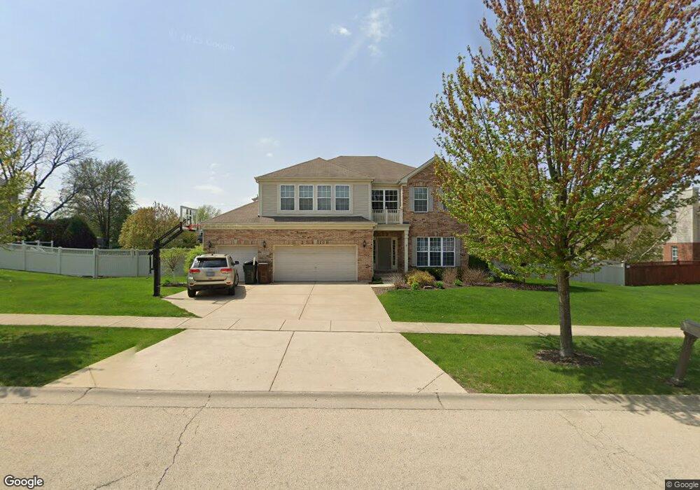
221 Tonell Ave New Lenox, IL 60451
Estimated Value: $551,299 - $624,000
--
Bed
--
Bath
--
Sq Ft
0.35
Acres
About This Home
This home is located at 221 Tonell Ave, New Lenox, IL 60451 and is currently estimated at $589,075. 221 Tonell Ave is a home located in Will County with nearby schools including Bentley Elementary School, Arnold J Tyler School, and Alex M Martino Jr High School.
Ownership History
Date
Name
Owned For
Owner Type
Purchase Details
Closed on
Apr 3, 2006
Sold by
Laurel Meadow Llc
Bought by
Rimkunas Vincent A and Rimkunas Jennifer A
Current Estimated Value
Home Financials for this Owner
Home Financials are based on the most recent Mortgage that was taken out on this home.
Original Mortgage
$344,200
Outstanding Balance
$183,356
Interest Rate
5.12%
Mortgage Type
Purchase Money Mortgage
Estimated Equity
$405,719
Create a Home Valuation Report for This Property
The Home Valuation Report is an in-depth analysis detailing your home's value as well as a comparison with similar homes in the area
Home Values in the Area
Average Home Value in this Area
Purchase History
| Date | Buyer | Sale Price | Title Company |
|---|---|---|---|
| Rimkunas Vincent A | $430,500 | First American Title Ins Co |
Source: Public Records
Mortgage History
| Date | Status | Borrower | Loan Amount |
|---|---|---|---|
| Open | Rimkunas Vincent A | $344,200 |
Source: Public Records
Tax History Compared to Growth
Tax History
| Year | Tax Paid | Tax Assessment Tax Assessment Total Assessment is a certain percentage of the fair market value that is determined by local assessors to be the total taxable value of land and additions on the property. | Land | Improvement |
|---|---|---|---|---|
| 2024 | $13,777 | $177,762 | $38,942 | $138,820 |
| 2023 | $13,777 | $162,044 | $35,499 | $126,545 |
| 2022 | $13,251 | $149,281 | $32,703 | $116,578 |
| 2021 | $11,778 | $140,394 | $30,756 | $109,638 |
| 2020 | $11,449 | $135,385 | $29,659 | $105,726 |
| 2019 | $10,963 | $131,187 | $28,739 | $102,448 |
| 2018 | $10,715 | $126,664 | $27,748 | $98,916 |
| 2017 | $10,185 | $123,022 | $26,950 | $96,072 |
| 2016 | $9,891 | $119,730 | $26,229 | $93,501 |
| 2015 | $9,533 | $115,961 | $25,403 | $90,558 |
| 2014 | $9,533 | $114,529 | $25,089 | $89,440 |
| 2013 | $9,533 | $116,073 | $25,427 | $90,646 |
Source: Public Records
Map
Nearby Homes
- 203 Tonell Ave
- 235 Roberts Rd
- 117 Walona Ave
- 328 E Lincoln Hwy
- 513 Somerset Ln
- 1017 E Lincoln Hwy
- 805 Regent St
- 920 Barnside Rd
- 718 S Prairie Rd
- 00 NE Corner Cherry Hill Road and Moss Lane Rd
- 125 N Anderson Rd
- 315 S Pine St
- 202 Hickory St
- 1125 Georgias Way
- 1139 Georgias Way
- 214 Somerset Ct
- 1193 Georgias Way
- 1212 Georgias Way
- 203 Fir St
- 305 Poplar Ln