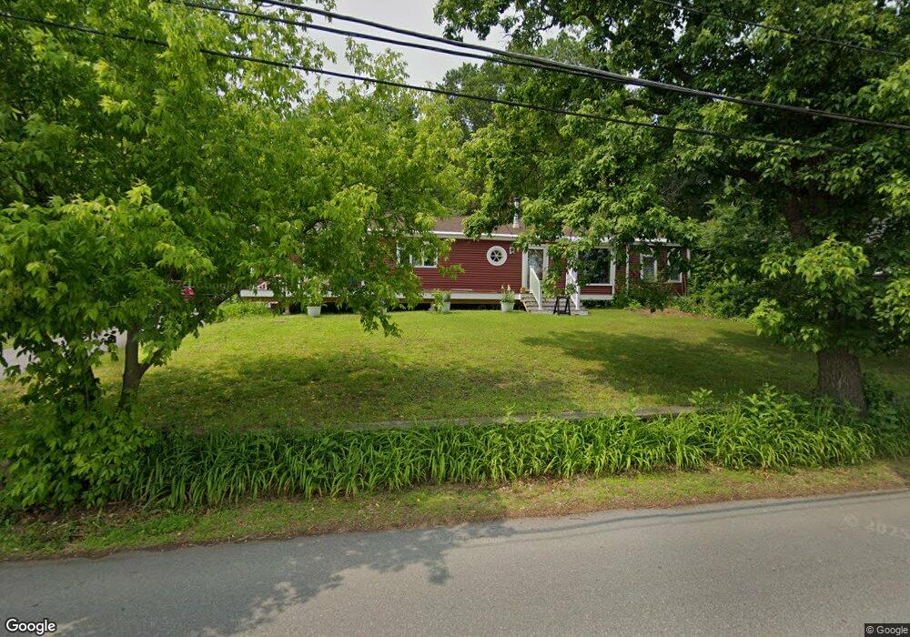
221 Varnum Rd Dracut, MA 01826
Estimated Value: $573,282 - $626,000
3
Beds
2
Baths
1,955
Sq Ft
$306/Sq Ft
Est. Value
About This Home
This home is located at 221 Varnum Rd, Dracut, MA 01826 and is currently estimated at $598,071, approximately $305 per square foot. 221 Varnum Rd is a home located in Middlesex County with nearby schools including Brookside Elementary School, Richardson Middle School, and Dracut Senior High School.
Ownership History
Date
Name
Owned For
Owner Type
Purchase Details
Closed on
Aug 13, 2015
Sold by
Thompson Annrose D
Bought by
Annrose D Thompson Lt
Current Estimated Value
Purchase Details
Closed on
Dec 14, 1983
Bought by
Thompson Annrose D
Create a Home Valuation Report for This Property
The Home Valuation Report is an in-depth analysis detailing your home's value as well as a comparison with similar homes in the area
Home Values in the Area
Average Home Value in this Area
Purchase History
| Date | Buyer | Sale Price | Title Company |
|---|---|---|---|
| Annrose D Thompson Lt | -- | -- | |
| Thompson Annrose D | -- | -- |
Source: Public Records
Mortgage History
| Date | Status | Borrower | Loan Amount |
|---|---|---|---|
| Previous Owner | Thompson Annrose D | $130,000 | |
| Previous Owner | Thompson Annrose D | $30,000 | |
| Previous Owner | Thompson Annrose D | $10,000 | |
| Previous Owner | Thompson Annrose D | $55,000 |
Source: Public Records
Tax History Compared to Growth
Tax History
| Year | Tax Paid | Tax Assessment Tax Assessment Total Assessment is a certain percentage of the fair market value that is determined by local assessors to be the total taxable value of land and additions on the property. | Land | Improvement |
|---|---|---|---|---|
| 2025 | $5,095 | $503,500 | $209,300 | $294,200 |
| 2024 | $5,056 | $483,800 | $199,300 | $284,500 |
| 2023 | $5,081 | $438,800 | $173,300 | $265,500 |
| 2022 | $5,036 | $409,800 | $157,500 | $252,300 |
| 2021 | $4,601 | $374,200 | $143,100 | $231,100 |
| 2020 | $4,673 | $350,000 | $138,800 | $211,200 |
| 2019 | $4,565 | $332,000 | $132,100 | $199,900 |
| 2018 | $6,275 | $300,800 | $132,100 | $168,700 |
| 2017 | $0 | $300,800 | $132,100 | $168,700 |
| 2016 | $3,946 | $265,900 | $127,000 | $138,900 |
| 2015 | $3,822 | $256,000 | $127,000 | $129,000 |
| 2014 | $3,551 | $245,100 | $126,100 | $119,000 |
Source: Public Records
Map
Nearby Homes
- 671 Nashua Rd
- 29 Mill St Unit B
- 17 Spare St
- 135 Stewart St Unit 1
- 25 Settlers Way
- 14 D St
- 10 Edwards St
- 124 Tennis Plaza Rd Unit 22
- 1905 Lakeview Ave
- 97 Passaconaway Dr
- 32 Walnut St
- 79 B St
- 29 Wimbledon Crossing
- 94 Tennis Plaza Rd Unit 10
- 53 Vinal St
- 11 Arbor Dr
- 84 Tennis Plaza Rd Unit 64
- 74 Tennis Plaza Rd Unit 34
- 53 4th St
- 14 Trotting Park Rd
- 235 Varnum Rd
- 215 Varnum Rd
- 228 Varnum Rd
- 236 Varnum Rd
- 241 Varnum Rd
- 220 Varnum Rd
- 205 Varnum Rd
- 214 Varnum Rd
- 253 Varnum Rd
- 201 Varnum Rd
- 465 Nashua Rd Unit 6
- 465 Nashua Rd Unit 1
- 465 Nashua Rd Unit 7
- 465 Nashua Rd Unit 8
- 465 Nashua Rd Unit Suite 8
- 465 Nashua Rd Unit Suite
- 465 Nashua Rd Unit 2
- 465 Nashua Rd
- 469 Nashua Rd Unit 3
- 469 Nashua Rd Unit 4