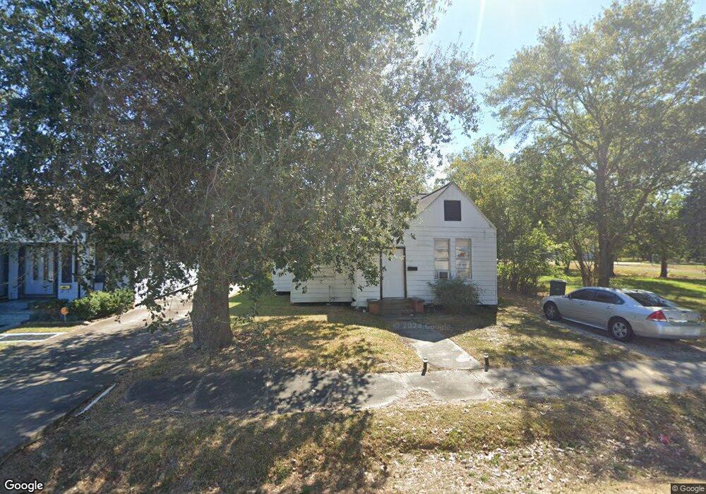
2210 18th St Port Arthur, TX 77640
Estimated Value: $42,000 - $108,000
--
Bed
--
Bath
997
Sq Ft
$70/Sq Ft
Est. Value
About This Home
This home is located at 2210 18th St, Port Arthur, TX 77640 and is currently estimated at $69,333, approximately $69 per square foot. 2210 18th St is a home located in Jefferson County with nearby schools including DeQueen Elementary School, Abraham Lincoln Middle School, and Memorial High School.
Ownership History
Date
Name
Owned For
Owner Type
Purchase Details
Closed on
Mar 10, 2025
Sold by
Korpal Real Estate Holdings Llc
Bought by
Xore Capital Llc
Current Estimated Value
Home Financials for this Owner
Home Financials are based on the most recent Mortgage that was taken out on this home.
Original Mortgage
$705,124
Outstanding Balance
$701,571
Interest Rate
6.95%
Mortgage Type
New Conventional
Estimated Equity
-$632,238
Purchase Details
Closed on
Dec 27, 2023
Sold by
Abbey Rentals Llc
Bought by
Korpal R/E Holdings Llc
Home Financials for this Owner
Home Financials are based on the most recent Mortgage that was taken out on this home.
Original Mortgage
$40,800
Interest Rate
6.76%
Mortgage Type
New Conventional
Purchase Details
Closed on
Aug 14, 2015
Sold by
Jones Rena and Walton Rudy P
Bought by
Chase Rentals Llc
Create a Home Valuation Report for This Property
The Home Valuation Report is an in-depth analysis detailing your home's value as well as a comparison with similar homes in the area
Home Values in the Area
Average Home Value in this Area
Purchase History
| Date | Buyer | Sale Price | Title Company |
|---|---|---|---|
| Xore Capital Llc | -- | Corporation Service | |
| Korpal R/E Holdings Llc | -- | Capital Title | |
| Chase Rentals Llc | -- | Attorney |
Source: Public Records
Mortgage History
| Date | Status | Borrower | Loan Amount |
|---|---|---|---|
| Open | Xore Capital Llc | $705,124 | |
| Previous Owner | Korpal R/E Holdings Llc | $40,800 |
Source: Public Records
Tax History Compared to Growth
Tax History
| Year | Tax Paid | Tax Assessment Tax Assessment Total Assessment is a certain percentage of the fair market value that is determined by local assessors to be the total taxable value of land and additions on the property. | Land | Improvement |
|---|---|---|---|---|
| 2025 | $1,596 | $58,122 | $7,000 | $51,122 |
| 2024 | $1,596 | $55,703 | $2,450 | $53,253 |
| 2023 | $1,596 | $49,972 | $980 | $48,992 |
| 2022 | $1,452 | $45,712 | $980 | $44,732 |
| 2021 | $1,444 | $43,582 | $980 | $42,602 |
| 2020 | $603 | $22,648 | $980 | $21,668 |
| 2019 | $592 | $18,590 | $980 | $17,610 |
| 2018 | $549 | $17,230 | $980 | $16,250 |
| 2017 | $534 | $17,230 | $980 | $16,250 |
| 2016 | $505 | $17,230 | $980 | $16,250 |
| 2015 | $514 | $17,230 | $980 | $16,250 |
| 2014 | $514 | $17,230 | $980 | $16,250 |
Source: Public Records
Map
Nearby Homes
- 2048 15th St
- 1848 19th St
- 1849 19th St
- 2610 15th St
- 1948 13th St
- 1235 Dequeen Blvd
- 2036 12th St
- 2401 Thomas Blvd
- 2736 Thomas Blvd
- 2726 13th St
- 1457 Saint Augustine Ave
- 1626 14th St
- 1348 Dequeen Blvd
- 527 Dequeen Blvd
- 1900 Thomas Blvd
- 515 Lake Charles Ave
- 11351 Gulfway Dr
- 1833 11th St
- 1730 Thomas Blvd
- 1431 13th St