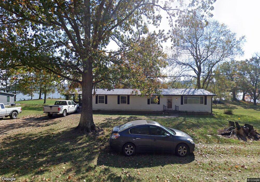
2210 Us Highway 52 Georgetown, OH 45121
Estimated Value: $176,000 - $269,000
--
Bed
1
Bath
1,426
Sq Ft
$142/Sq Ft
Est. Value
About This Home
This home is located at 2210 Us Highway 52, Georgetown, OH 45121 and is currently estimated at $202,319, approximately $141 per square foot. 2210 Us Highway 52 is a home located in Brown County with nearby schools including Ripley Union Lewis Huntington Elementary School, Ripley Union Lewis Huntington Middle School, and Ripley-Union-Lewis-Huntington High School.
Ownership History
Date
Name
Owned For
Owner Type
Purchase Details
Closed on
Apr 16, 2013
Sold by
Barker Michael and Barker Dorothy
Bought by
Day Jeffrey M and Day Deborah K
Current Estimated Value
Home Financials for this Owner
Home Financials are based on the most recent Mortgage that was taken out on this home.
Original Mortgage
$114,000
Outstanding Balance
$52,775
Interest Rate
3.5%
Mortgage Type
New Conventional
Estimated Equity
$149,544
Purchase Details
Closed on
Jun 25, 1997
Sold by
Lionell C Davis Trst
Bought by
Lung Roger W and Lung Edna L
Home Financials for this Owner
Home Financials are based on the most recent Mortgage that was taken out on this home.
Original Mortgage
$51,000
Interest Rate
8%
Mortgage Type
New Conventional
Create a Home Valuation Report for This Property
The Home Valuation Report is an in-depth analysis detailing your home's value as well as a comparison with similar homes in the area
Home Values in the Area
Average Home Value in this Area
Purchase History
| Date | Buyer | Sale Price | Title Company |
|---|---|---|---|
| Day Jeffrey M | $10,687 | None Available | |
| Lung Roger W | $59,000 | -- |
Source: Public Records
Mortgage History
| Date | Status | Borrower | Loan Amount |
|---|---|---|---|
| Open | Day Jeffrey M | $114,000 | |
| Closed | Lung Roger W | $51,000 |
Source: Public Records
Tax History Compared to Growth
Tax History
| Year | Tax Paid | Tax Assessment Tax Assessment Total Assessment is a certain percentage of the fair market value that is determined by local assessors to be the total taxable value of land and additions on the property. | Land | Improvement |
|---|---|---|---|---|
| 2024 | $1,547 | $50,760 | $22,840 | $27,920 |
| 2023 | $1,547 | $33,370 | $15,380 | $17,990 |
| 2022 | $1,149 | $33,370 | $15,380 | $17,990 |
| 2021 | $1,071 | $33,370 | $15,380 | $17,990 |
| 2020 | $988 | $29,020 | $13,370 | $15,650 |
| 2019 | $981 | $29,020 | $13,370 | $15,650 |
| 2018 | $999 | $29,420 | $13,370 | $16,050 |
| 2017 | $993 | $28,650 | $14,710 | $13,940 |
| 2016 | $974 | $28,650 | $14,710 | $13,940 |
| 2015 | $988 | $28,650 | $14,710 | $13,940 |
| 2014 | $988 | $27,310 | $13,370 | $13,940 |
| 2013 | $916 | $27,310 | $13,370 | $13,940 |
Source: Public Records
Map
Nearby Homes
- 312 White Oak St
- 307 Hamilton Ave
- 4900 Mary Ingles Hwy E
- 508 E 3rd St
- 2845 Mary Ingles Hwy E
- 414 E 2nd St
- 404 E 2nd St
- 4465 W Augusta Chatham Rd
- 401 E 4th St
- 310 E 3rd St
- 1920 Shinkles Ridge
- 305 Bracken St
- 207 E 3rd St
- Lot 49 Boudes Ferry Rd
- 301 Elizabeth St
- 114 E 4th St
- 105 E 4th St
- 6049 Big Run Rd
- ac Shinkle Ridge Rd
- 6336 Big Run Rd
- 2228 U S 52
- 2228 Us Highway 52
- 2228 Us 52
- 5 Columbia St
- 5631 State Route 505
- 9 Columbia St
- 11 Columbia St
- 105 Columbia St
- 104 Columbia St
- 106 Columbia St
- 131 Washington St
- 117 Columbia St
- 101 Olive St
- 207 Olive St
- 200 Washington St
- 0 Columbia St Unit 1717578
- 0 Columbia St
- 205 Columbia St
- 200 Washington
- 200 Columbia St