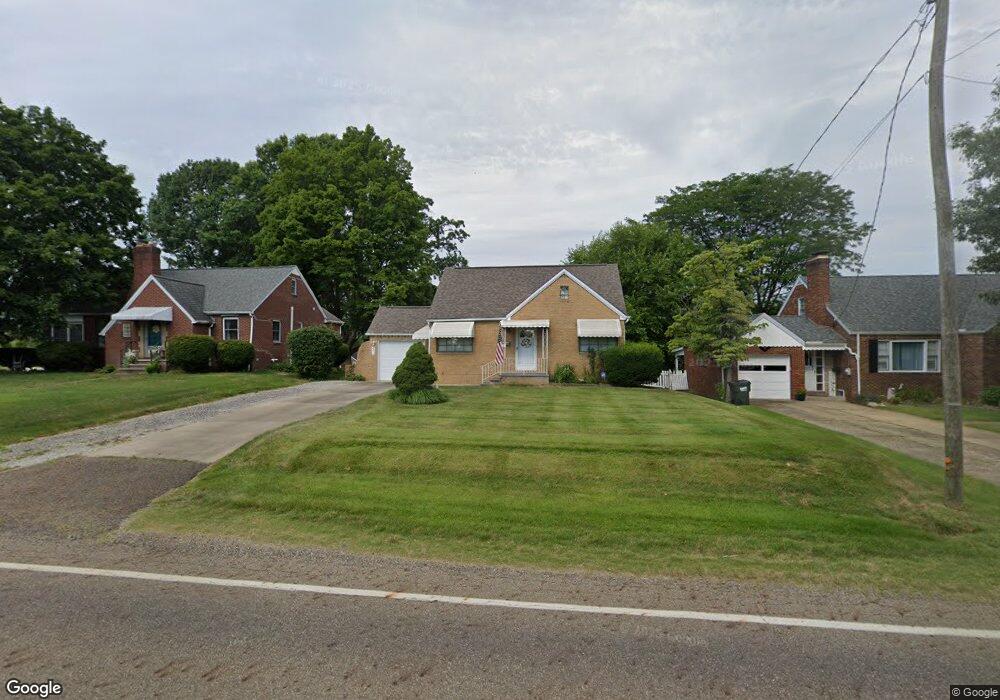
2211 Broad Ave NW Canton, OH 44708
Meyers Lake NeighborhoodEstimated Value: $146,000 - $159,000
2
Beds
2
Baths
1,080
Sq Ft
$141/Sq Ft
Est. Value
About This Home
This home is located at 2211 Broad Ave NW, Canton, OH 44708 and is currently estimated at $152,166, approximately $140 per square foot. 2211 Broad Ave NW is a home located in Stark County with nearby schools including Avondale Elementary School, Oakwood Middle School, and GlenOak High School.
Ownership History
Date
Name
Owned For
Owner Type
Purchase Details
Closed on
Dec 6, 2002
Sold by
Filliez William J and Filliez Janice M
Bought by
Fryfogle Betty R
Current Estimated Value
Home Financials for this Owner
Home Financials are based on the most recent Mortgage that was taken out on this home.
Original Mortgage
$57,050
Outstanding Balance
$24,752
Interest Rate
6.38%
Mortgage Type
Purchase Money Mortgage
Estimated Equity
$127,414
Purchase Details
Closed on
Mar 19, 1996
Sold by
Woodyard Douglas A
Bought by
Filliez William J and Filliez Janice
Home Financials for this Owner
Home Financials are based on the most recent Mortgage that was taken out on this home.
Original Mortgage
$73,150
Interest Rate
7.06%
Mortgage Type
New Conventional
Purchase Details
Closed on
Jul 22, 1993
Create a Home Valuation Report for This Property
The Home Valuation Report is an in-depth analysis detailing your home's value as well as a comparison with similar homes in the area
Home Values in the Area
Average Home Value in this Area
Purchase History
| Date | Buyer | Sale Price | Title Company |
|---|---|---|---|
| Fryfogle Betty R | $81,500 | Quest Title Agency Inc | |
| Filliez William J | $77,000 | -- | |
| -- | $61,000 | -- |
Source: Public Records
Mortgage History
| Date | Status | Borrower | Loan Amount |
|---|---|---|---|
| Open | Fryfogle Betty R | $57,050 | |
| Previous Owner | Filliez William J | $73,150 |
Source: Public Records
Tax History Compared to Growth
Tax History
| Year | Tax Paid | Tax Assessment Tax Assessment Total Assessment is a certain percentage of the fair market value that is determined by local assessors to be the total taxable value of land and additions on the property. | Land | Improvement |
|---|---|---|---|---|
| 2025 | -- | $46,450 | $13,550 | $32,900 |
| 2024 | -- | $46,450 | $13,550 | $32,900 |
| 2023 | $1,236 | $35,670 | $9,660 | $26,010 |
| 2022 | $1,263 | $35,670 | $9,660 | $26,010 |
| 2021 | $1,269 | $35,670 | $9,660 | $26,010 |
| 2020 | $1,072 | $29,440 | $8,330 | $21,110 |
| 2019 | $1,063 | $29,160 | $8,330 | $20,830 |
| 2018 | $1,036 | $29,160 | $8,330 | $20,830 |
| 2017 | $974 | $26,360 | $7,180 | $19,180 |
| 2016 | $977 | $26,360 | $7,180 | $19,180 |
| 2015 | $944 | $26,360 | $7,180 | $19,180 |
| 2014 | $902 | $25,200 | $6,860 | $18,340 |
| 2013 | $442 | $25,200 | $6,860 | $18,340 |
Source: Public Records
Map
Nearby Homes
- 2923 21st St NW
- 1931 Homedale Ave NW
- 3038 20th St NW
- 3112 21st St NW
- 3222 25th St NW
- 425 Fulton Dr NW
- 3118 Fulton Dr NW
- 3012 16th St NW
- 3016 Croydon Dr NW
- 3431 Enfield Ave NW
- 2524 Ridgedale Ave NW
- 3045 Parkway St NW
- 1610 20th St NW
- 1833 29th St NW
- 1421 24th St NW
- 1614 17th St NW
- 3034 12th St NW
- 0 Harrison Ave NW
- 2818 Marlin Ave NW
- 1325 18th St NW
- 2201 Broad Ave NW
- 2217 Broad Ave NW
- 2210 Demington Ave NW
- 2223 Broad Ave NW
- 2133 Broad Ave NW
- 2214 Broad Ave NW
- 2214 Broad Ave NW
- 2229 Broad Ave NW
- 2200 Broad Ave NW
- 2132 Demington Ave NW
- 2220 Broad Ave NW
- 2125 Broad Ave NW
- 2230 Demington Ave NW
- 2301 Broad Ave NW
- 2903 22nd St NW
- 2121 Broad Ave NW
- 2307 Broad Ave NW
- 2306 Demington Ave NW
- 2215 Demington Ave NW
- 2130 Broad Ave NW