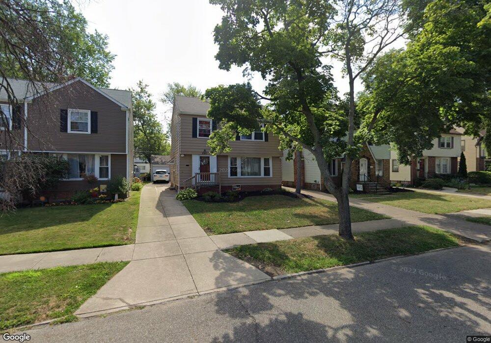
2211 Brockway Rd University Heights, OH 44118
Estimated Value: $202,264 - $272,000
3
Beds
2
Baths
1,458
Sq Ft
$156/Sq Ft
Est. Value
About This Home
This home is located at 2211 Brockway Rd, University Heights, OH 44118 and is currently estimated at $228,066, approximately $156 per square foot. 2211 Brockway Rd is a home located in Cuyahoga County with nearby schools including Canterbury Elementary School, Roxboro Middle School, and Cleveland Heights High School.
Ownership History
Date
Name
Owned For
Owner Type
Purchase Details
Closed on
Oct 25, 1999
Sold by
Chapman Kelly
Bought by
Hardaway Stephen L
Current Estimated Value
Home Financials for this Owner
Home Financials are based on the most recent Mortgage that was taken out on this home.
Original Mortgage
$100,000
Outstanding Balance
$29,487
Interest Rate
7.75%
Estimated Equity
$198,579
Purchase Details
Closed on
Nov 27, 1991
Sold by
Gordon Edward M and Gordon Janet
Bought by
Chapman Kelly
Purchase Details
Closed on
Jun 10, 1987
Sold by
Almasy Joseph S
Bought by
Gordon Edward M and Gordon Janet
Purchase Details
Closed on
Apr 23, 1979
Sold by
Metcalf Clarence E and Metcalf Carolyn
Bought by
Almasy Joseph S
Purchase Details
Closed on
Jan 1, 1975
Bought by
Metcalf Clarence E and Metcalf Carolyn
Create a Home Valuation Report for This Property
The Home Valuation Report is an in-depth analysis detailing your home's value as well as a comparison with similar homes in the area
Home Values in the Area
Average Home Value in this Area
Purchase History
| Date | Buyer | Sale Price | Title Company |
|---|---|---|---|
| Hardaway Stephen L | $98,000 | Title Xperts Agency Inc | |
| Chapman Kelly | $78,000 | -- | |
| Gordon Edward M | $63,000 | -- | |
| Almasy Joseph S | $41,000 | -- | |
| Metcalf Clarence E | -- | -- |
Source: Public Records
Mortgage History
| Date | Status | Borrower | Loan Amount |
|---|---|---|---|
| Open | Hardaway Stephen L | $100,000 |
Source: Public Records
Tax History Compared to Growth
Tax History
| Year | Tax Paid | Tax Assessment Tax Assessment Total Assessment is a certain percentage of the fair market value that is determined by local assessors to be the total taxable value of land and additions on the property. | Land | Improvement |
|---|---|---|---|---|
| 2024 | $5,436 | $63,000 | $12,320 | $50,680 |
| 2023 | $4,825 | $43,620 | $8,300 | $35,320 |
| 2022 | $4,801 | $43,610 | $8,300 | $35,320 |
| 2021 | $4,705 | $43,610 | $8,300 | $35,320 |
| 2020 | $4,647 | $38,960 | $7,420 | $31,540 |
| 2019 | $4,394 | $111,300 | $21,200 | $90,100 |
| 2018 | $4,333 | $38,960 | $7,420 | $31,540 |
| 2017 | $4,559 | $37,630 | $5,880 | $31,750 |
| 2016 | $5,212 | $37,630 | $5,880 | $31,750 |
| 2015 | $4,186 | $37,630 | $5,880 | $31,750 |
| 2014 | $4,186 | $36,900 | $5,780 | $31,120 |
Source: Public Records
Map
Nearby Homes
- 2208 Cranston Rd
- 3621 Cedarbrook Rd
- 2216 Barrington Rd
- 13605 Cedar Rd
- 3554 Raymont Blvd
- 3544 Silsby Rd
- 13526 Cedar Rd
- 2244 Edgerton Rd
- 3526 Raymont Blvd
- 2320 Allison Rd
- 3525 Raymont Blvd
- 3790 Bushnell Rd
- 3494 Raymont Blvd
- 3474 Raymont Blvd
- 13785 Cedar Rd Unit 302
- 3797 Northwood Rd
- 3631 Cummings Rd
- 2083 Wynn Rd Unit 3
- 2085 Wynn Rd Unit 2
- 2087 Wynn Rd Unit 1
- 2215 Brockway Rd
- 2219 Brockway Rd
- 2199 Brockway Rd
- 2223 Brockway Rd
- 2212 Cranston Rd
- 2216 Cranston Rd
- 2195 Brockway Rd
- 2227 Brockway Rd
- 2204 Brockway Rd
- 3634 Tullamore Rd
- 3634 Tullamore Rd Unit 2
- 3633 Tullamore Rd
- 2204 Cranston Rd
- 2220 Cranston Rd
- 2200 Cranston Rd
- 2224 Cranston Rd
- 2231 Brockway Rd
- 3630 Tullamore Rd
- 3629 Tullamore Rd
- 2196 Cranston Rd