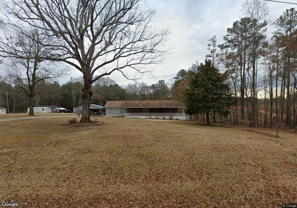
2211 Brownlee Rd Jackson, GA 30233
Estimated Value: $313,000 - $420,753
4
Beds
3
Baths
2,044
Sq Ft
$178/Sq Ft
Est. Value
About This Home
This home is located at 2211 Brownlee Rd, Jackson, GA 30233 and is currently estimated at $362,938, approximately $177 per square foot. 2211 Brownlee Rd is a home located in Butts County with nearby schools including Jackson High School.
Ownership History
Date
Name
Owned For
Owner Type
Purchase Details
Closed on
Sep 14, 2012
Sold by
Nolan Emmaline W
Bought by
Nolan Terry E
Current Estimated Value
Home Financials for this Owner
Home Financials are based on the most recent Mortgage that was taken out on this home.
Original Mortgage
$67,500
Outstanding Balance
$9,921
Interest Rate
3.68%
Mortgage Type
New Conventional
Estimated Equity
$353,017
Create a Home Valuation Report for This Property
The Home Valuation Report is an in-depth analysis detailing your home's value as well as a comparison with similar homes in the area
Home Values in the Area
Average Home Value in this Area
Purchase History
| Date | Buyer | Sale Price | Title Company |
|---|---|---|---|
| Nolan Terry E | $90,000 | -- | |
| Nolan Terry E | -- | -- |
Source: Public Records
Mortgage History
| Date | Status | Borrower | Loan Amount |
|---|---|---|---|
| Open | Nolan Terry E | $67,500 | |
| Closed | Nolan Terry E | $67,500 |
Source: Public Records
Tax History
| Year | Tax Paid | Tax Assessment Tax Assessment Total Assessment is a certain percentage of the fair market value that is determined by local assessors to be the total taxable value of land and additions on the property. | Land | Improvement |
|---|---|---|---|---|
| 2025 | $2,775 | $144,810 | $47,691 | $97,119 |
| 2024 | $2,775 | $130,438 | $47,691 | $82,747 |
| 2023 | $2,912 | $84,220 | $9,720 | $74,500 |
| 2022 | $1,491 | $64,693 | $9,720 | $54,973 |
| 2021 | $1,642 | $66,251 | $9,720 | $56,531 |
| 2020 | $1,368 | $55,167 | $9,720 | $45,447 |
| 2019 | $1,317 | $55,160 | $9,720 | $45,440 |
| 2018 | $1,016 | $43,608 | $9,720 | $33,888 |
| 2017 | $867 | $38,306 | $9,720 | $28,586 |
| 2016 | $891 | $38,306 | $9,720 | $28,586 |
| 2015 | $1,211 | $38,306 | $9,720 | $28,586 |
| 2014 | $1,216 | $36,442 | $9,720 | $26,722 |
Source: Public Records
Map
Nearby Homes
- 718 Mount Vernon Church Rd
- 131 Post Oak Dr Unit 209
- 135 Post Oak Dr Unit 207
- 139 Post Oak Dr Unit 202
- 135 Post Oak Dr
- 139 Post Oak Dr
- 130 Post Oak Dr
- 738 Teagle Rd
- 343 Fawn Rd
- 142 Post Oak Dr
- 142 Post Oak Dr Unit 136
- 144 Post Oak Dr
- 144 Post Oak Dr Unit 137
- 146 Post Oak Dr Unit 138
- 146 Post Oak Dr
- 148 Post Oak Dr Unit 139
- 148 Post Oak Dr
- 245 Brooks Rd
- 214 Woodlands Dr
- 351 Homestead Circle Lot 23a Cir Unit LOT 23A
- 2203 Brownlee Rd
- 2210 Brownlee Rd
- 2228 Brownlee Rd
- 2187 Brownlee Rd
- 2187 Brownlee Rd
- 2188 Brownlee Rd
- 2173 Brownlee Rd
- 2230 Brownlee Rd
- 2172 Brownlee Rd
- 2165 Brownlee Rd
- 2156 Brownlee Rd
- 2161 Brownlee Rd Unit D
- 2161 Brownlee Rd
- 2161 Brownlee Rd Unit A
- 2161 Brownlee Rd Unit C
- 2150 Brownlee Rd
- 2151 Brownlee Rd
- 2144 Brownlee Rd
- 300 Hammond Rd Unit 3
- 143 Hammond Rd
Your Personal Tour Guide
Ask me questions while you tour the home.