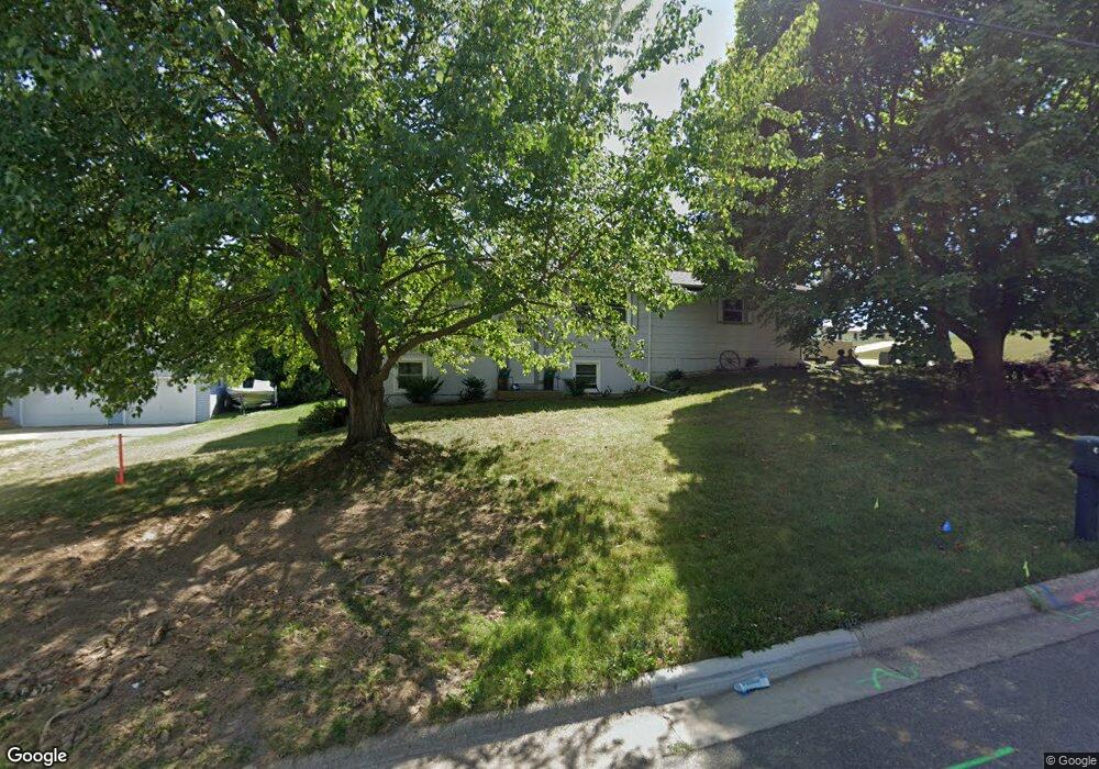
2211 Rockport Rd Janesville, WI 53548
Estimated Value: $176,000
3
Beds
2
Baths
1,566
Sq Ft
$112/Sq Ft
Est. Value
About This Home
This home is located at 2211 Rockport Rd, Janesville, WI 53548 and is currently priced at $176,000, approximately $112 per square foot. 2211 Rockport Rd is a home located in Rock County with nearby schools including Wilson Elementary School, Franklin Middle School, and Parker High School.
Ownership History
Date
Name
Owned For
Owner Type
Purchase Details
Closed on
Aug 4, 2012
Sold by
Seeman Jason
Bought by
Smith Jennifer
Current Estimated Value
Purchase Details
Closed on
Jun 17, 2008
Sold by
Bank Of New York
Bought by
Sceman Jason and Sceman Jennifer
Home Financials for this Owner
Home Financials are based on the most recent Mortgage that was taken out on this home.
Original Mortgage
$95,750
Interest Rate
5.96%
Mortgage Type
New Conventional
Purchase Details
Closed on
Feb 26, 2008
Sold by
Parra Eduardo L
Bought by
Bank Of New York
Create a Home Valuation Report for This Property
The Home Valuation Report is an in-depth analysis detailing your home's value as well as a comparison with similar homes in the area
Home Values in the Area
Average Home Value in this Area
Purchase History
| Date | Buyer | Sale Price | Title Company |
|---|---|---|---|
| Smith Jennifer | -- | None Available | |
| Sceman Jason | $98,800 | None Available | |
| Bank Of New York | $95,850 | None Available |
Source: Public Records
Mortgage History
| Date | Status | Borrower | Loan Amount |
|---|---|---|---|
| Previous Owner | Sceman Jason | $95,750 |
Source: Public Records
Tax History Compared to Growth
Tax History
| Year | Tax Paid | Tax Assessment Tax Assessment Total Assessment is a certain percentage of the fair market value that is determined by local assessors to be the total taxable value of land and additions on the property. | Land | Improvement |
|---|---|---|---|---|
| 2021 | $3,923 | $131,900 | $16,700 | $115,200 |
| 2020 | $2,845 | $131,900 | $16,700 | $115,200 |
| 2019 | $3,761 | $131,900 | $16,700 | $115,200 |
| 2018 | $2,949 | $91,200 | $16,700 | $74,500 |
| 2017 | $2,854 | $91,200 | $16,700 | $74,500 |
| 2016 | $2,333 | $91,200 | $16,700 | $74,500 |
| 2015 | $2,078 | $91,200 | $16,700 | $74,500 |
| 2014 | $2,708 | $97,100 | $16,700 | $80,400 |
| 2013 | $2,708 | $97,100 | $16,700 | $80,400 |
Source: Public Records
Map
Nearby Homes
- 702 S Willard Ave
- 1803 Rockport Rd
- 612 S Chatham St
- 1220 S Grant Ave
- 2821 W Court St
- 2005 W State St
- 1300 Grand Ave
- 1326 S Orchard St
- 702 S Washington St
- 1402 S Osborne Ave
- 2823 Mackintosh Dr
- 1122 Grand Ave
- 18 S Pearl St
- 1826 Bond Place
- 1221 Drake St
- 323 Center Ave
- 214 N Chatham St
- 217 N Pearl St
- 1521 Ravine St
- 333 Linn St
- 2127 Rockport Rd
- 719 S Willard Ave
- L2 Rockport Rd
- Lot 2 Rockport Rd
- 2206 Rockport Rd
- 2117 Rockport Rd
- 720 S Willard Ave
- 2220 Rockport Rd
- 725 S Willard Ave
- 2317 Rockport Rd
- 2115 Rockport Rd
- 2300 Rockport Rd
- 2306 Palomino Dr
- 2118 Rockport Rd
- 614 S Grant Ave
- 2105 Rockport Rd
- 809 S Willard Ave
- 2312 Rockport Rd
- 2407 Rockport Rd
- 2108 Rockport Rd