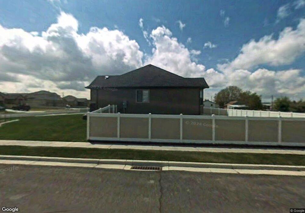
2211 W 1370 N Clinton, UT 84015
Estimated Value: $506,000 - $552,000
--
Bed
3
Baths
1,325
Sq Ft
$399/Sq Ft
Est. Value
About This Home
This home is located at 2211 W 1370 N, Clinton, UT 84015 and is currently estimated at $528,772, approximately $399 per square foot. 2211 W 1370 N is a home located in Davis County with nearby schools including Parkside Elementary School, West Point Junior High School, and Clearfield High School.
Ownership History
Date
Name
Owned For
Owner Type
Purchase Details
Closed on
Jan 28, 2025
Sold by
Platt Michael Donovan and Platt Olga M
Bought by
Platt Family Trust and Platt
Current Estimated Value
Purchase Details
Closed on
Oct 19, 2021
Sold by
Platt Michael Donovan and Platt Olga
Bought by
Platt Michael Donovan and Platt Olga
Home Financials for this Owner
Home Financials are based on the most recent Mortgage that was taken out on this home.
Original Mortgage
$241,990
Interest Rate
2.8%
Mortgage Type
New Conventional
Purchase Details
Closed on
Apr 12, 2016
Sold by
Hall Devon B and Hall Heather
Bought by
Platt Michael Donovan and Platt Olga
Home Financials for this Owner
Home Financials are based on the most recent Mortgage that was taken out on this home.
Original Mortgage
$253,800
Interest Rate
3.73%
Mortgage Type
New Conventional
Purchase Details
Closed on
Nov 21, 2005
Sold by
Gmw Development Inc
Bought by
Hall Devon B and Hall Heather
Home Financials for this Owner
Home Financials are based on the most recent Mortgage that was taken out on this home.
Original Mortgage
$206,433
Interest Rate
5.97%
Mortgage Type
Fannie Mae Freddie Mac
Create a Home Valuation Report for This Property
The Home Valuation Report is an in-depth analysis detailing your home's value as well as a comparison with similar homes in the area
Home Values in the Area
Average Home Value in this Area
Purchase History
| Date | Buyer | Sale Price | Title Company |
|---|---|---|---|
| Platt Family Trust | -- | None Listed On Document | |
| Platt Family Trust | -- | None Listed On Document | |
| Platt Michael Donovan | -- | Accommodation | |
| Platt Michael Donovan | -- | Cottonwood Title | |
| Hall Devon B | -- | Cottonwood Title Ins Agency |
Source: Public Records
Mortgage History
| Date | Status | Borrower | Loan Amount |
|---|---|---|---|
| Previous Owner | Platt Michael Donovan | $241,990 | |
| Previous Owner | Platt Michael Donovan | $253,800 | |
| Previous Owner | Hall Devon B | $206,433 |
Source: Public Records
Tax History Compared to Growth
Tax History
| Year | Tax Paid | Tax Assessment Tax Assessment Total Assessment is a certain percentage of the fair market value that is determined by local assessors to be the total taxable value of land and additions on the property. | Land | Improvement |
|---|---|---|---|---|
| 2025 | $2,694 | $259,050 | $85,976 | $173,074 |
| 2024 | $2,720 | $262,900 | $94,491 | $168,409 |
| 2023 | $2,572 | $460,000 | $107,532 | $352,468 |
| 2022 | $2,735 | $270,600 | $65,749 | $204,851 |
| 2021 | $2,589 | $380,000 | $82,358 | $297,642 |
| 2020 | $2,258 | $328,000 | $70,005 | $257,995 |
| 2019 | $2,192 | $311,000 | $81,761 | $229,239 |
| 2018 | $2,052 | $286,000 | $61,520 | $224,480 |
| 2016 | $1,678 | $120,780 | $29,128 | $91,652 |
| 2015 | $1,699 | $116,270 | $29,128 | $87,142 |
| 2014 | $1,479 | $102,859 | $29,128 | $73,731 |
| 2013 | -- | $108,875 | $31,020 | $77,855 |
Source: Public Records
Map
Nearby Homes
- 1361 N 2195 W
- 1343 N 2195 W
- 2237 W 1370 N Unit 3
- 2216 W 1300 N
- 1331 N 2195 W
- 2208 W 1370 N
- 1362 N 2195 W
- 2241 W 1370 N Unit 2
- 1348 N 2195 W
- 2192 W 1370 N
- 2238 W 1370 N Unit 1
- 1334 N 2195 W
- 1317 N 2195 W
- 2232 W 1300 N Unit LOT 4
- 1420 N 2225 W
- 1353 N 2140 W
- 2256 W 1370 N
- 1401 N 2225 W
- 1356 N 2275 W
- 1356 N 2275 W Unit 13