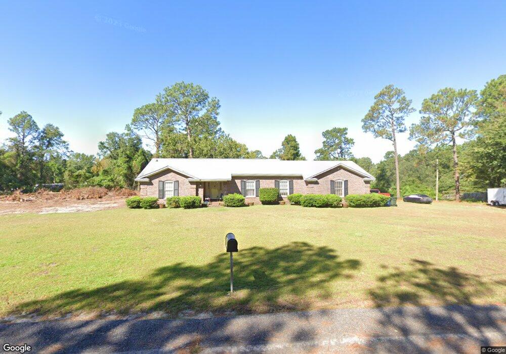
2212 Carroll Dr West Columbia, SC 29169
Estimated Value: $261,000 - $327,322
3
Beds
3
Baths
2,388
Sq Ft
$127/Sq Ft
Est. Value
About This Home
This home is located at 2212 Carroll Dr, West Columbia, SC 29169 and is currently estimated at $304,331, approximately $127 per square foot. 2212 Carroll Dr is a home located in Lexington County with nearby schools including Cayce Elementary, Cyril B. Busbee Creative Arts Academy, and Brookland-Cayce High School.
Ownership History
Date
Name
Owned For
Owner Type
Purchase Details
Closed on
Jan 25, 2024
Sold by
Phase One Sc Project Llc
Bought by
Afify Jaclyn
Current Estimated Value
Purchase Details
Closed on
Sep 9, 2022
Sold by
Fox Sloan S
Bought by
Phase One Sc Project Llc
Home Financials for this Owner
Home Financials are based on the most recent Mortgage that was taken out on this home.
Original Mortgage
$187,500
Interest Rate
5.3%
Mortgage Type
Construction
Create a Home Valuation Report for This Property
The Home Valuation Report is an in-depth analysis detailing your home's value as well as a comparison with similar homes in the area
Home Values in the Area
Average Home Value in this Area
Purchase History
| Date | Buyer | Sale Price | Title Company |
|---|---|---|---|
| Afify Jaclyn | -- | None Listed On Document | |
| Phase One Sc Project Llc | $250,000 | -- |
Source: Public Records
Mortgage History
| Date | Status | Borrower | Loan Amount |
|---|---|---|---|
| Previous Owner | Phase One Sc Project Llc | $187,500 |
Source: Public Records
Tax History Compared to Growth
Tax History
| Year | Tax Paid | Tax Assessment Tax Assessment Total Assessment is a certain percentage of the fair market value that is determined by local assessors to be the total taxable value of land and additions on the property. | Land | Improvement |
|---|---|---|---|---|
| 2024 | $1,878 | $15,000 | $5,100 | $9,900 |
| 2023 | $5,922 | $10,635 | $3,198 | $7,437 |
| 2022 | $3,978 | $10,635 | $3,198 | $7,437 |
| 2020 | $3,772 | $10,635 | $3,198 | $7,437 |
| 2019 | $3,842 | $10,726 | $3,198 | $7,528 |
| 2018 | $3,811 | $10,726 | $3,198 | $7,528 |
| 2017 | $3,740 | $10,726 | $3,198 | $7,528 |
| 2016 | $3,784 | $10,726 | $3,198 | $7,528 |
| 2014 | $690 | $7,502 | $2,132 | $5,370 |
| 2013 | -- | $7,500 | $2,130 | $5,370 |
Source: Public Records
Map
Nearby Homes
- 1210 Decatur St
- 826 Jefferson St
- TBD Woodfield Jupiter & Daisey Track
- 2312 Rainbow Dr
- 706 Westside Dr
- 2405 Rainbow Dr
- 725 Brooks Ave
- 2024 Platt Springs Rd
- 153 Cavendish Dr
- 151 Cavendish Dr
- 157 Cavendish Dr
- 1832 Wadsworth Dr
- 0 Highway 302 Hwy Unit 589442
- Oak Plan at Faith Hills
- 309 Hammond Ave
- 1911 Toole St
- 1800 Dunbar Rd
- 1409 Hazel St
- 1414 Hazel St
- 1112 Pine Croft Dr
- 1023 Westhaven Dr
- 1025 Westhaven Dr
- 1021 Westhaven Dr
- 2209 Carroll Dr
- 1019 Westhaven Dr
- 2216 Carroll Dr
- 2207 Carroll Dr
- 1122 Decatur St
- 1017 Westhaven Dr
- 2205 Carroll Dr
- 2204 Carroll Dr
- 1124 Decatur St
- 1027 Westhaven Dr
- 1015 Westhaven Dr
- 2213 Carroll Dr
- 2213 Carroll Dr
- 2203 Carroll Dr
- 0 Westhaven Dr Unit 263089
- 0 Westhaven Dr Unit 282237
- 0 Westhaven Dr Unit 310221