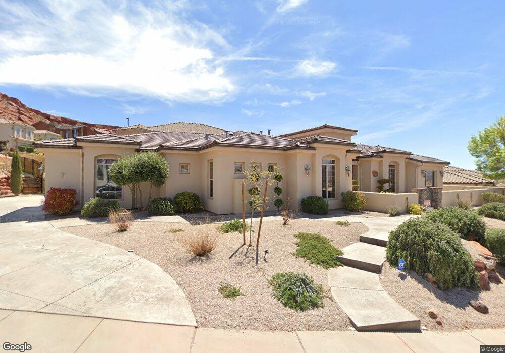
2212 Lone Rock Dr Saint George, UT 84770
Estimated Value: $822,000 - $1,109,000
3
Beds
3
Baths
3,026
Sq Ft
$302/Sq Ft
Est. Value
About This Home
This home is located at 2212 Lone Rock Dr, Saint George, UT 84770 and is currently estimated at $914,987, approximately $302 per square foot. 2212 Lone Rock Dr is a home located in Washington County with nearby schools including Snow Canyon Middle School, Diamond Valley School, and Lava Ridge Intermediate School.
Ownership History
Date
Name
Owned For
Owner Type
Purchase Details
Closed on
Dec 3, 2020
Sold by
Ford Tracy and Ford Julie
Bought by
Mcoy David James and Mcoy Shauna
Current Estimated Value
Home Financials for this Owner
Home Financials are based on the most recent Mortgage that was taken out on this home.
Original Mortgage
$487,600
Outstanding Balance
$434,884
Interest Rate
2.8%
Mortgage Type
New Conventional
Estimated Equity
$480,103
Purchase Details
Closed on
May 23, 2017
Sold by
Cieslewicz Rachel
Bought by
Ford Tracy and Ford Julie
Home Financials for this Owner
Home Financials are based on the most recent Mortgage that was taken out on this home.
Original Mortgage
$384,000
Interest Rate
4.08%
Mortgage Type
New Conventional
Purchase Details
Closed on
May 9, 2016
Sold by
Martin Eric M
Bought by
Cieslewicz Rachel
Purchase Details
Closed on
Sep 7, 2012
Sold by
Bevers Jon R
Bought by
Martin Eric M
Purchase Details
Closed on
Nov 30, 2011
Sold by
Bevers Patricia L
Bought by
Bevers Jon R
Create a Home Valuation Report for This Property
The Home Valuation Report is an in-depth analysis detailing your home's value as well as a comparison with similar homes in the area
Home Values in the Area
Average Home Value in this Area
Purchase History
| Date | Buyer | Sale Price | Title Company |
|---|---|---|---|
| Mcoy David James | -- | Southern Utah Title Co | |
| Ford Tracy | -- | Vanguard Title Ins Agency | |
| Cieslewicz Rachel | -- | None Available | |
| Martin Eric M | -- | First American Title Company | |
| Bevers Jon R | -- | None Available |
Source: Public Records
Mortgage History
| Date | Status | Borrower | Loan Amount |
|---|---|---|---|
| Open | Mcoy David James | $487,600 | |
| Previous Owner | Ford Tracy | $384,000 |
Source: Public Records
Tax History Compared to Growth
Tax History
| Year | Tax Paid | Tax Assessment Tax Assessment Total Assessment is a certain percentage of the fair market value that is determined by local assessors to be the total taxable value of land and additions on the property. | Land | Improvement |
|---|---|---|---|---|
| 2025 | $2,875 | $436,755 | $98,175 | $338,580 |
| 2023 | $2,686 | $401,335 | $92,400 | $308,935 |
| 2022 | $2,943 | $413,490 | $86,625 | $326,865 |
| 2021 | $2,725 | $570,900 | $131,300 | $439,600 |
| 2020 | $2,622 | $517,400 | $105,000 | $412,400 |
| 2019 | $2,709 | $522,200 | $105,000 | $417,200 |
| 2018 | $2,489 | $247,775 | $0 | $0 |
| 2017 | $2,400 | $231,935 | $0 | $0 |
| 2016 | $2,645 | $236,390 | $0 | $0 |
| 2015 | $2,555 | $219,065 | $0 | $0 |
| 2014 | $2,564 | $221,265 | $0 | $0 |
Source: Public Records
Map
Nearby Homes
- 2294 N Gunsight Dr
- 1996 W 1940 N
- 2090 N Tuweap Dr Unit 13
- 2090 N Tuweap Dr Unit 9
- 2090 N Tuweap Dr Unit 15
- 2090 N Tuweap Dr Unit 56
- 2139 W Cougar Rock Cir
- 2139 W Cougar Rock Cir Unit 131
- 2139 W Cougar Rock Cir Unit 179
- 2139 W Cougar Rock Cir Unit 135
- 2139 W Cougar Rock Cir Unit 192
- 2139 W Cougar Rock Cir Unit 195
- 2139 W Cougar Rock Cir Unit 182
- 20 Grayhawk Cir
- 1959 W Cougar Rock Cir
- 2047 W Cougar Rock Cir
- 2255 N Tuweap Dr Unit 14
- 2255 N Tuweap Dr Unit 58
- 2255 N Tuweap Dr Unit 54
- 2212 N Lone Rock Dr
- 2201 N Tower Butte Dr
- 2186 Lone Rock Dr
- 2217 N Cascade Canyon Dr
- 2183 N Tower Butte Dr
- 2215 N Lone Rock Dr
- 2219 N Lone Rock Dr
- 2203 Lone Rock Dr
- 2232 N Cascade Canyon Dr
- 2205 N Cascade Canyon Dr
- 2174 N Lone Rock Dr
- 2174 Lone Rock Dr
- 2177 Lone Rock Dr
- 2177 N Lone Rock Dr
- 2245 N Cascade Canyon Dr
- 2220 N Cascade Canyon Dr
- 2167 N Tower Butte Dr
- 2167 N Tower Butte Dr Unit 50
- 2214 N Cascade Canyon Dr
- 1838 W Ticaboo