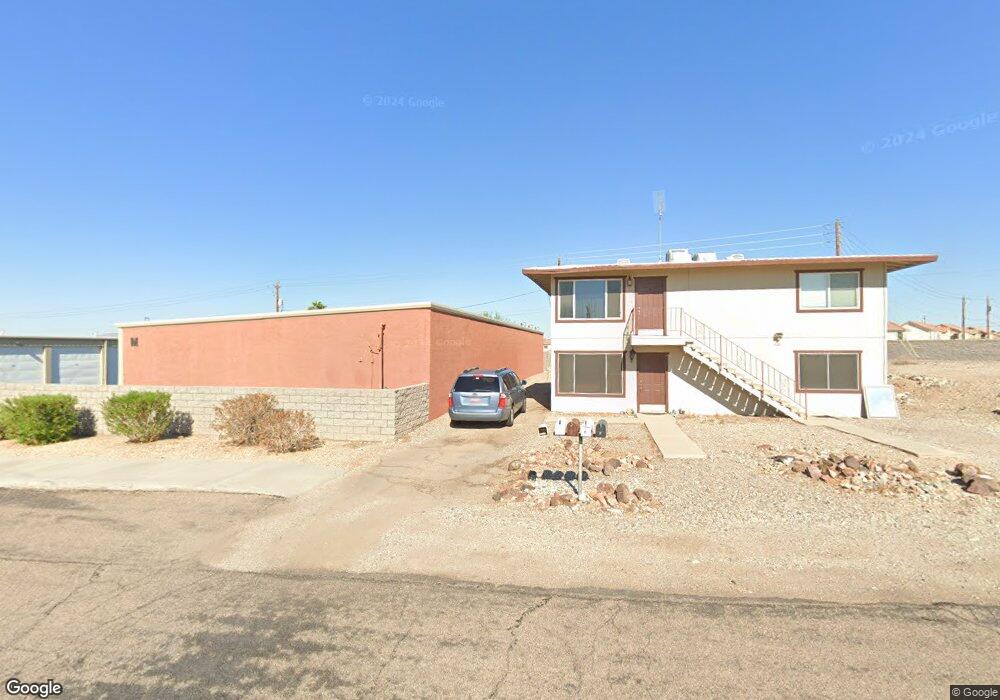
2212 N Kiowa #26 Blvd Lake Havasu City, AZ 86403
Estimated Value: $94,000 - $184,000
--
Bed
--
Bath
520
Sq Ft
$253/Sq Ft
Est. Value
About This Home
This home is located at 2212 N Kiowa #26 Blvd, Lake Havasu City, AZ 86403 and is currently estimated at $131,418, approximately $252 per square foot. 2212 N Kiowa #26 Blvd is a home located in Mohave County with nearby schools including Nautilus Elementary School, Thunderbolt Middle School, and Lake Havasu High School.
Ownership History
Date
Name
Owned For
Owner Type
Purchase Details
Closed on
Mar 6, 2025
Sold by
Vanewyk Juliet A and Vanewyk Fred C
Bought by
Nevarez Joseph Anthony and Nevarez Tammy Louise
Current Estimated Value
Home Financials for this Owner
Home Financials are based on the most recent Mortgage that was taken out on this home.
Original Mortgage
$190,750
Outstanding Balance
$189,753
Interest Rate
6.76%
Mortgage Type
New Conventional
Estimated Equity
-$58,335
Purchase Details
Closed on
Dec 18, 2014
Sold by
Cammas George F and Cammas Lisa C
Bought by
Vanvanewyk Fred Van and Ewyk Juliet Van
Purchase Details
Closed on
May 16, 2008
Sold by
First Savings Bank
Bought by
Cammas George F and Cammas Lisa C
Create a Home Valuation Report for This Property
The Home Valuation Report is an in-depth analysis detailing your home's value as well as a comparison with similar homes in the area
Home Values in the Area
Average Home Value in this Area
Purchase History
| Date | Buyer | Sale Price | Title Company |
|---|---|---|---|
| Nevarez Joseph Anthony | $272,500 | Pioneer Title Agency | |
| Vanvanewyk Fred Van | $32,000 | Pioneer Title Agency Inc | |
| Cammas George F | $40,000 | State Title Agency Inc |
Source: Public Records
Mortgage History
| Date | Status | Borrower | Loan Amount |
|---|---|---|---|
| Open | Nevarez Joseph Anthony | $190,750 |
Source: Public Records
Tax History Compared to Growth
Tax History
| Year | Tax Paid | Tax Assessment Tax Assessment Total Assessment is a certain percentage of the fair market value that is determined by local assessors to be the total taxable value of land and additions on the property. | Land | Improvement |
|---|---|---|---|---|
| 2026 | -- | -- | -- | -- |
| 2025 | $207 | $3,570 | $0 | $0 |
| 2024 | $207 | $4,532 | $0 | $0 |
| 2023 | $207 | $3,570 | $0 | $0 |
| 2022 | $198 | $2,801 | $0 | $0 |
| 2021 | $337 | $2,676 | $0 | $0 |
| 2019 | $326 | $2,393 | $0 | $0 |
| 2018 | $319 | $2,206 | $0 | $0 |
| 2017 | $317 | $2,012 | $0 | $0 |
| 2016 | $298 | $1,952 | $0 | $0 |
| 2015 | $291 | $1,745 | $0 | $0 |
Source: Public Records
Map
Nearby Homes
- 2212 Kiowa Blvd N Unit 123
- 2212 Kiowa Blvd N Unit 117
- 2212 Kiowa Blvd N Unit 227
- 2211 Sandwood Dr
- 2205 Sandwood Dr
- 2312 Palisades Dr
- 2148 Sandwood Dr
- 2183 Runabout Dr
- 2395 San Juan Dr
- 2285 Pennant Ln
- 2162 Runabout Dr
- 2529 Palisades Dr
- 2535 Palisades Dr
- 2050 Kiowa Blvd N
- 985 Hurricane Dr
- 2257 Barranca Dr
- 2335 Palo Verde Blvd N
- 2091 Holly Ave
- 2543 Hillview Dr
- 2264 Barranca Dr
- 2281 Sandwood Dr Unit C28
- 2281 Sandwood Dr
- 2311 Shorewood Dr
- 2311 Shorewood Dr
- 2256 Sandwood Dr
- 2256 Sandwood Dr
- 2264 Sandwood Dr
- 2248 Sandwood Dr
- 2272 Sandwood Dr
- 2282 Sandwood Dr
- 2212 Kiowa Blvd N B17 Rv
- 2020 Richey Cir
- 2031 Richey Cir
- 2041 Richey Cir
- 2240 Sandwood Dr
- 2241 Sandwood Dr Unit 2
- 2241 Sandwood Dr Unit 1
- 2241 Sandwood Dr
- 2249 Sandwood Dr
- 2061 Richey Cir