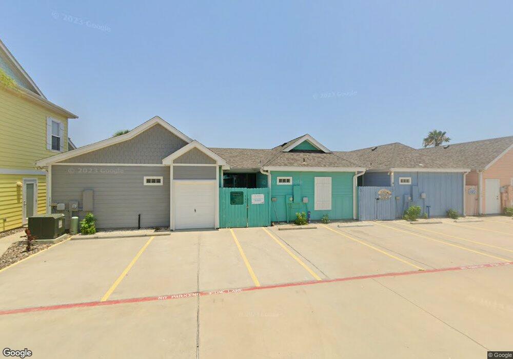
2212 State Highway 361 Unit 110 Port Aransas, TX 78373
Padre Island NeighborhoodEstimated Value: $449,922 - $543,000
2
Beds
2
Baths
1,060
Sq Ft
$460/Sq Ft
Est. Value
About This Home
This home is located at 2212 State Highway 361 Unit 110, Port Aransas, TX 78373 and is currently estimated at $487,981, approximately $460 per square foot. 2212 State Highway 361 Unit 110 is a home located in Nueces County with nearby schools including Olsen Elementary School, Brundrett Middle School, and Port Aransas High School.
Ownership History
Date
Name
Owned For
Owner Type
Purchase Details
Closed on
Feb 16, 2012
Sold by
Pirates Bay Llc
Bought by
Moore Mark J and Moore Veronica G
Current Estimated Value
Home Financials for this Owner
Home Financials are based on the most recent Mortgage that was taken out on this home.
Original Mortgage
$170,400
Outstanding Balance
$117,077
Interest Rate
3.95%
Mortgage Type
New Conventional
Estimated Equity
$370,904
Create a Home Valuation Report for This Property
The Home Valuation Report is an in-depth analysis detailing your home's value as well as a comparison with similar homes in the area
Home Values in the Area
Average Home Value in this Area
Purchase History
| Date | Buyer | Sale Price | Title Company |
|---|---|---|---|
| Moore Mark J | -- | Bay Area Title Services Llc |
Source: Public Records
Mortgage History
| Date | Status | Borrower | Loan Amount |
|---|---|---|---|
| Open | Moore Mark J | $170,400 |
Source: Public Records
Tax History Compared to Growth
Tax History
| Year | Tax Paid | Tax Assessment Tax Assessment Total Assessment is a certain percentage of the fair market value that is determined by local assessors to be the total taxable value of land and additions on the property. | Land | Improvement |
|---|---|---|---|---|
| 2025 | $7,084 | $399,008 | $163,480 | $235,528 |
| 2024 | $7,084 | $551,012 | $163,480 | $387,532 |
| 2023 | $6,507 | $514,942 | $163,480 | $351,462 |
| 2022 | $5,822 | $376,670 | $28,609 | $348,061 |
| 2021 | $5,208 | $307,171 | $28,609 | $278,562 |
| 2020 | $4,526 | $256,884 | $28,609 | $228,275 |
| 2019 | $3,811 | $204,939 | $28,609 | $176,330 |
| 2018 | $4,015 | $219,630 | $28,609 | $191,021 |
| 2017 | $5,219 | $285,982 | $28,609 | $257,373 |
| 2016 | $4,426 | $242,515 | $28,609 | $213,906 |
| 2015 | $4,444 | $248,094 | $40,870 | $207,224 |
| 2014 | $4,444 | $234,215 | $40,870 | $193,345 |
Source: Public Records
Map
Nearby Homes
- 2212 State Highway 361 Unit 102
- 2212 State Highway 361 Unit 108
- 2212 State Highway 361 Unit 211
- 2212 State Highway 361 Unit 205
- 2212 State Highway 361 Unit 213
- 2212 State Highway 361 Unit 204
- 172 Paradise Pointe Dr
- 000 State Highway 361
- 268 Flounder Dr
- 100 Red Fish Ln
- 1100 Port St Unit 12
- 214 Sunset Ave Unit 2
- 214 Sunset Ave Unit 7
- 214 Sunset Ave Unit 5
- 1100 Port St
- 1100 Port St Unit 1*
- 1100 Port St Unit 6*
- 1100 Port St Unit 28
- 1100 Port St Unit 27
- 1100 Port St Unit 18
- 2212 State Highway 361 Unit 116
- 2212 State Highway 361 Unit 104
- 2212 State Highway 361 Unit 102
- 2212 State Highway 361 Unit 118
- 2212 State Highway 361 Unit 123
- 2212 State Highway 361 Unit 114
- 2212 State Highway 361 Unit 121
- 2212 State Highway 361 Unit 203
- 2212 State Highway 361 Unit 221
- 2212 State Highway 361 Unit 224
- 2212 State Highway 361 Unit 308
- 2212 State Highway 361 Unit 113
- 2212 State Highway 361 Unit 109
- 2212 State Highway 361 Unit 219