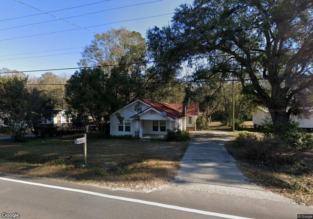
2212 Sylvester Dr Moultrie, GA 31768
Estimated Value: $73,458 - $143,000
--
Bed
1
Bath
1,415
Sq Ft
$75/Sq Ft
Est. Value
About This Home
This home is located at 2212 Sylvester Dr, Moultrie, GA 31768 and is currently estimated at $106,615, approximately $75 per square foot. 2212 Sylvester Dr is a home located in Colquitt County with nearby schools including Doerun Elementary School, C.A. Gray Junior High School, and Willie J. Williams Middle School.
Ownership History
Date
Name
Owned For
Owner Type
Purchase Details
Closed on
Apr 19, 2004
Sold by
Raya Efrain
Bought by
Perales Antonio
Current Estimated Value
Purchase Details
Closed on
Aug 29, 2000
Bought by
Raya Efrain
Purchase Details
Closed on
Jun 21, 1999
Bought by
Imc Mortgage Company
Purchase Details
Closed on
May 1, 1998
Bought by
Wiley Caroline
Purchase Details
Closed on
Jun 18, 1993
Bought by
Young Ernest
Purchase Details
Closed on
May 16, 1993
Bought by
Schweinitz Kimberly P
Purchase Details
Closed on
Apr 2, 1991
Bought by
Young Ernest Life Est
Create a Home Valuation Report for This Property
The Home Valuation Report is an in-depth analysis detailing your home's value as well as a comparison with similar homes in the area
Home Values in the Area
Average Home Value in this Area
Purchase History
| Date | Buyer | Sale Price | Title Company |
|---|---|---|---|
| Perales Antonio | $26,000 | -- | |
| Raya Efrain | -- | -- | |
| Raya Efrain | $10,500 | -- | |
| Imc Mortgage Company | -- | -- | |
| Wiley Caroline | $19,200 | -- | |
| Young Ernest | -- | -- | |
| Schweinitz Kimberly P | $12,500 | -- | |
| Young Ernest Life Est | -- | -- |
Source: Public Records
Tax History Compared to Growth
Tax History
| Year | Tax Paid | Tax Assessment Tax Assessment Total Assessment is a certain percentage of the fair market value that is determined by local assessors to be the total taxable value of land and additions on the property. | Land | Improvement |
|---|---|---|---|---|
| 2024 | $478 | $24,476 | $832 | $23,644 |
| 2023 | $516 | $17,318 | $832 | $16,486 |
| 2022 | $326 | $13,710 | $832 | $12,878 |
| 2021 | $259 | $10,646 | $832 | $9,814 |
| 2020 | $263 | $10,646 | $832 | $9,814 |
| 2019 | $233 | $10,460 | $832 | $9,628 |
| 2018 | $268 | $10,460 | $832 | $9,628 |
| 2017 | $230 | $10,460 | $832 | $9,628 |
| 2016 | $233 | $10,460 | $832 | $9,628 |
| 2015 | $235 | $10,460 | $832 | $9,628 |
| 2014 | $231 | $10,460 | $832 | $9,628 |
| 2013 | -- | $10,460 | $832 | $9,628 |
Source: Public Records
Map
Nearby Homes
- 0 S U Highway 319 N
- 15,23,27 29th Ave NW
- 107 30th Ave NW
- 1208 Maple St
- 3233 Sylvester Dr
- 615 1st St NW
- 722 Martin Luther King jr Dr
- 316 5th Ave NW
- 503 2nd St NW
- 521 5th Ave NW
- 417 9th St NW
- 408 9th St NW
- 614 2nd Ave NW
- 410 W Bypass Pass NW
- 610 1st Ave NW
- 410 West Bypass NW
- 1321 Hallmark Dr
- 310 1st Ave SW
- 00 1st Ave SW
- 118 5th St SW
- 2206 Sylvester Dr
- 2220 Sylvester Dr
- 2202 Sylvester Dr
- 2232 Sylvester Dr
- 2120 Sylvester Dr
- 2211 Sylvester Dr
- 2205 Sylvester Dr
- 2217 Sylvester Dr
- 2201 Sylvester Dr
- 2219 Sylvester Dr
- 2304 Sylvester Dr
- 2225 Sylvester Dr
- 146 Vinson St
- 2121 Sylvester Dr
- 2112 Sylvester Dr
- 2231 Sylvester Dr
- 2308 Sylvester Dr
- 2235 Sylvester Dr
- 2111 Sylvester Dr
- 124 Vinson St