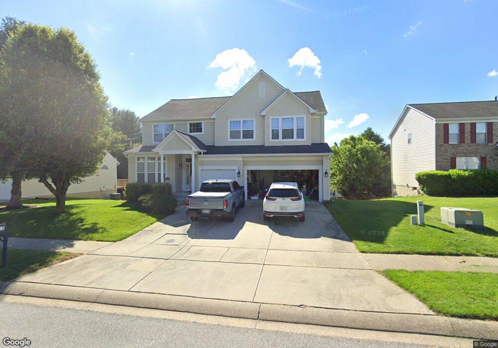
2213 Deadora Dr Bel Air, MD 21015
Estimated Value: $707,000 - $767,000
--
Bed
4
Baths
3,335
Sq Ft
$218/Sq Ft
Est. Value
About This Home
This home is located at 2213 Deadora Dr, Bel Air, MD 21015 and is currently estimated at $726,961, approximately $217 per square foot. 2213 Deadora Dr is a home located in Harford County with nearby schools including Emmorton Elementary School, Bel Air Middle School, and Bel Air High School.
Ownership History
Date
Name
Owned For
Owner Type
Purchase Details
Closed on
Jan 28, 2000
Sold by
Citraro Mickey J
Bought by
Cho Dae Sik and Cho Hwa Ja
Current Estimated Value
Purchase Details
Closed on
May 11, 1995
Sold by
Grp Ryland
Bought by
Citraro Mickey J
Home Financials for this Owner
Home Financials are based on the most recent Mortgage that was taken out on this home.
Original Mortgage
$189,350
Interest Rate
8.31%
Create a Home Valuation Report for This Property
The Home Valuation Report is an in-depth analysis detailing your home's value as well as a comparison with similar homes in the area
Home Values in the Area
Average Home Value in this Area
Purchase History
| Date | Buyer | Sale Price | Title Company |
|---|---|---|---|
| Cho Dae Sik | $265,000 | -- | |
| Citraro Mickey J | $237,075 | -- |
Source: Public Records
Mortgage History
| Date | Status | Borrower | Loan Amount |
|---|---|---|---|
| Previous Owner | Citraro Mickey J | $189,350 | |
| Closed | Cho Dae Sik | -- |
Source: Public Records
Tax History Compared to Growth
Tax History
| Year | Tax Paid | Tax Assessment Tax Assessment Total Assessment is a certain percentage of the fair market value that is determined by local assessors to be the total taxable value of land and additions on the property. | Land | Improvement |
|---|---|---|---|---|
| 2025 | $5,731 | $592,733 | $0 | $0 |
| 2024 | $5,731 | $545,667 | $0 | $0 |
| 2023 | $5,434 | $498,600 | $116,400 | $382,200 |
| 2022 | $5,285 | $484,933 | $0 | $0 |
| 2021 | $10,657 | $471,267 | $0 | $0 |
| 2020 | $5,281 | $457,600 | $116,400 | $341,200 |
| 2019 | $5,230 | $453,233 | $0 | $0 |
| 2018 | $5,133 | $448,867 | $0 | $0 |
| 2017 | $5,083 | $444,500 | $0 | $0 |
| 2016 | $140 | $434,967 | $0 | $0 |
| 2015 | $5,418 | $425,433 | $0 | $0 |
| 2014 | $5,418 | $415,900 | $0 | $0 |
Source: Public Records
Map
Nearby Homes
- 402 Tall Sycamore Ct
- 407 Country Ridge Cir
- 2332 Darby Ct
- 403 Summershade Ct
- 201 Burkwood Ct Unit 3B
- 202 Burkwood Ct
- 2302 Bell's Tower Ct
- 2310 Bell's Tower Ct Unit 5
- Parkland Plan at Bell's Tower - Bell's Tower
- 2300 Arthurs Woods Dr
- 2007 Royal Fern Ct
- 0 W Wheel Rd Unit MDHR2045912
- 613 Berwick Ct
- 300 Lothian Way Unit 202
- 400 Cahill Rd
- 2815 Lanarkshire Way
- 2913 Islay Ct
- 632 Camelot Dr
- 209 Hunters Run Terrace
- 25 Oak Crest Ct
- 2215 Deadora Dr
- 2211 Deadora Dr
- 404 Tall Sycamore Ct
- 2217 Deadora Dr
- 400 Country Ridge Cir
- 2208 Deadora Dr
- 2206 Deadora Dr
- 402 Country Ridge Cir
- 2210 Deadora Dr
- 405 Tall Sycamore Ct
- 2219 Deadora Dr
- 404 Country Ridge Cir
- 552 Country Ridge Cir
- 2212 Deadora Dr
- 400 Tall Sycamore Ct
- 408 Golden Oak Ct
- 550 Country Ridge Cir
- 403 Tall Sycamore Ct
- 2214 Deadora Dr
- 548 Country Ridge Cir