Estimated Value: $244,000 - $337,000
--
Bed
--
Bath
1,760
Sq Ft
$164/Sq Ft
Est. Value
About This Home
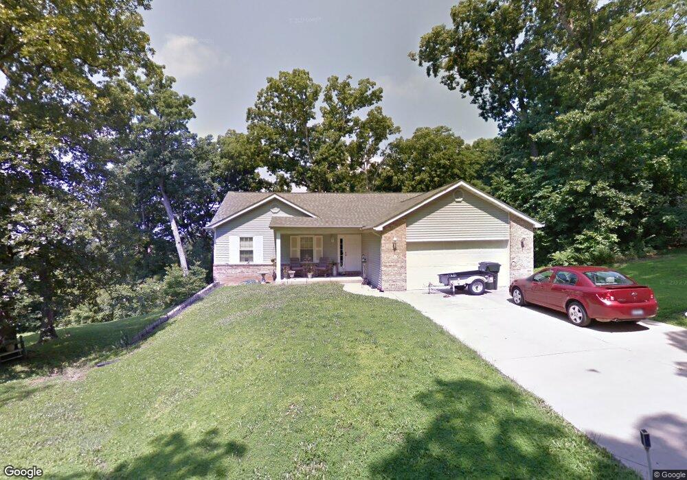
This home is located at 2213 Levin Crest Ln, Dupo, IL 62239 and is currently estimated at $288,144, approximately $163 per square foot. 2213 Levin Crest Ln is a home located in St. Clair County with nearby schools including Bluffview Elementary School and Dupo High School.
Ownership History
Date
Name
Owned For
Owner Type
Purchase Details
Closed on
Jan 24, 2006
Sold by
Levin William L and Levin Judith Ann
Bought by
Baum Kenneth and Baum Judy
Current Estimated Value
Home Financials for this Owner
Home Financials are based on the most recent Mortgage that was taken out on this home.
Original Mortgage
$154,400
Interest Rate
6.46%
Mortgage Type
Fannie Mae Freddie Mac
Create a Home Valuation Report for This Property
The Home Valuation Report is an in-depth analysis detailing your home's value as well as a comparison with similar homes in the area
Home Values in the Area
Average Home Value in this Area
Purchase History
| Date | Buyer | Sale Price | Title Company |
|---|---|---|---|
| Baum Kenneth | $193,000 | Atc |
Source: Public Records
Mortgage History
| Date | Status | Borrower | Loan Amount |
|---|---|---|---|
| Closed | Baum Kenneth | $154,400 |
Source: Public Records
Tax History Compared to Growth
Tax History
| Year | Tax Paid | Tax Assessment Tax Assessment Total Assessment is a certain percentage of the fair market value that is determined by local assessors to be the total taxable value of land and additions on the property. | Land | Improvement |
|---|---|---|---|---|
| 2024 | $5,506 | $76,120 | $19,304 | $56,816 |
| 2023 | $5,728 | $70,730 | $17,937 | $52,793 |
| 2022 | $5,060 | $66,345 | $16,825 | $49,520 |
| 2021 | $4,874 | $62,437 | $15,834 | $46,603 |
| 2020 | $5,286 | $63,103 | $14,495 | $48,608 |
| 2019 | $4,949 | $63,103 | $14,495 | $48,608 |
| 2018 | $4,717 | $60,207 | $13,830 | $46,377 |
| 2017 | $2,228 | $55,949 | $12,852 | $43,097 |
| 2016 | $4,490 | $54,084 | $12,424 | $41,660 |
| 2014 | $4,086 | $54,084 | $12,424 | $41,660 |
| 2013 | $4,789 | $55,341 | $12,713 | $42,628 |
Source: Public Records
Map
Nearby Homes
- 2148 Stone Gate Dr
- 2219 Stone Gate Dr
- 2011 Shady Station Trail
- 5 Ogle Estates
- 7 Ogle Estates
- 4 Ogle Estates
- 646 Marian Dr
- 1252 Columbia Rd
- 420 Micahs Way
- 602 Illinois Ave
- 305 Fox Run Dr
- 1539 Frost Landing
- 526 State St
- 501 State St
- 2846 Robert Dr
- 419 State St
- 2838 Robert Dr
- 403 State St
- 329 S Main St
- 526 Columbia Rd
- 2209 Levin Crest Ln
- 0 Levin Crest Ln
- 2217 Levin Crest Ln
- 2175 Stonecrest
- 2179 Stonecrest
- 2171 Stonecrest
- 2167 Stonecrest
- 0TBB Levin Crest Ln
- 2163 Stonecrest
- 2221 Levin Crest Ln
- 2204 Stone Gate Dr
- 2172 Stonecrest
- 2206 Stone Gate Dr
- 2176 Stonecrest
- 2180 Stonecrest
- 2208 Stone Gate Dr
- 2168 Stonecrest
- 2160 Stonecrest
- 2164 Stonecrest
- 2209 Stone Gate Dr