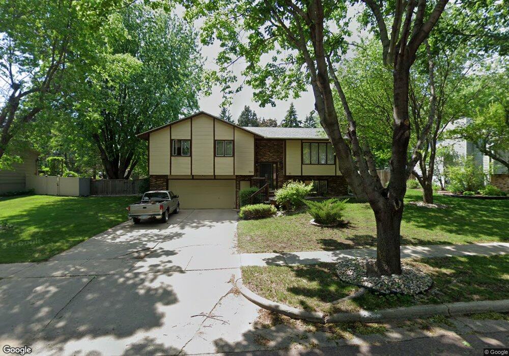
2213 S Sheffield Ave Sioux Falls, SD 57106
Kingswood NeighborhoodEstimated Value: $308,000 - $362,000
3
Beds
3
Baths
1,976
Sq Ft
$170/Sq Ft
Est. Value
About This Home
This home is located at 2213 S Sheffield Ave, Sioux Falls, SD 57106 and is currently estimated at $336,096, approximately $170 per square foot. 2213 S Sheffield Ave is a home located in Minnehaha County with nearby schools including Oscar Howe Elementary School, Memorial Middle School, and Roosevelt High School.
Ownership History
Date
Name
Owned For
Owner Type
Purchase Details
Closed on
Jul 31, 2019
Sold by
Woodworth Roger S and Woodworth Barbara
Bought by
Kronaizl Ryan
Current Estimated Value
Purchase Details
Closed on
Mar 28, 2014
Sold by
Marc D Marc D and Whipkey Berdene
Bought by
Woodworth Roger S and Woodworth Barbara
Home Financials for this Owner
Home Financials are based on the most recent Mortgage that was taken out on this home.
Original Mortgage
$162,000
Interest Rate
4.29%
Mortgage Type
Stand Alone First
Create a Home Valuation Report for This Property
The Home Valuation Report is an in-depth analysis detailing your home's value as well as a comparison with similar homes in the area
Home Values in the Area
Average Home Value in this Area
Purchase History
| Date | Buyer | Sale Price | Title Company |
|---|---|---|---|
| Kronaizl Ryan | $218,000 | Getty Abstract & Title Co | |
| Woodworth Roger S | $173,000 | -- |
Source: Public Records
Mortgage History
| Date | Status | Borrower | Loan Amount |
|---|---|---|---|
| Previous Owner | Woodworth Roger S | $162,000 |
Source: Public Records
Tax History
| Year | Tax Paid | Tax Assessment Tax Assessment Total Assessment is a certain percentage of the fair market value that is determined by local assessors to be the total taxable value of land and additions on the property. | Land | Improvement |
|---|---|---|---|---|
| 2024 | $3,800 | $275,400 | $35,300 | $240,100 |
| 2023 | $4,019 | $281,600 | $35,300 | $246,300 |
| 2022 | $3,866 | $255,300 | $35,300 | $220,000 |
| 2021 | $3,294 | $216,700 | $0 | $0 |
| 2020 | $3,294 | $207,700 | $0 | $0 |
| 2019 | $3,194 | $197,714 | $0 | $0 |
| 2018 | $2,901 | $192,209 | $0 | $0 |
| 2017 | $2,764 | $179,960 | $33,934 | $146,026 |
| 2016 | $2,764 | $171,321 | $31,814 | $139,507 |
| 2015 | $2,722 | $162,193 | $31,813 | $130,380 |
| 2014 | -- | $164,761 | $31,813 | $132,948 |
Source: Public Records
Map
Nearby Homes
- 6201 W 32nd St
- 2408 S Valley View Rd
- 2309 S Dover Dr
- 6520 W Westminster Dr
- 5808 W 32nd St
- 2209 S Dover Dr
- 5913 W 27th St
- 5909 W Chadwick Place
- 2305 S Royal Ct
- 6418 W Hillary Dr
- 2305 S Roosevelt Ave
- 5704 W Walden Dr
- 1605 S Silver Creek Cir
- 6915 W Westminster Dr
- 6812 W Hathaway Ln
- 3009 S Greenwood Ave
- 2401 S Beech Ave
- 5417 W Oak St
- 0 Tbd Ave Ave Unit 22601806
- 0 Tbd Ave Ave Unit 22601805
- 2209 S Sheffield Ave
- 2301 S Sheffield Ave
- 2212 S Queens Ave
- 2300 S Queens Ave
- 2212 S Sheffield Ave
- 2300 S Sheffield Ave
- 2208 S Queens Ave
- 2208 S Sheffield Ave
- 2305 S Sheffield Ave
- 2205 S Sheffield Ave
- 2304 S Queens Ave
- 2304 S Sheffield Ave
- 2304 S Sheffield Ave
- 2204 S Queens Ave
- 2204 S Sheffield Ave
- 2308 S Queens Ave
- 6200 W 32nd St
- 2201 S Sheffield Ave
- 2308 S Sheffield Ave
- 2213 S Queens Ave
Your Personal Tour Guide
Ask me questions while you tour the home.