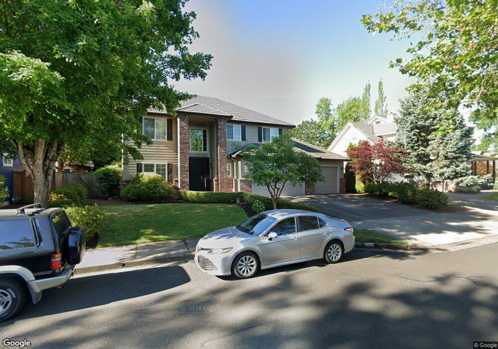
2214 Avengale Dr Eugene, OR 97408
Estimated Value: $902,000 - $1,106,000
4
Beds
4
Baths
3,052
Sq Ft
$321/Sq Ft
Est. Value
About This Home
This home is located at 2214 Avengale Dr, Eugene, OR 97408 and is currently estimated at $980,450, approximately $321 per square foot. 2214 Avengale Dr is a home located in Lane County with nearby schools including Gilham Elementary School, Cal Young Middle School, and Sheldon High School.
Ownership History
Date
Name
Owned For
Owner Type
Purchase Details
Closed on
Jan 23, 2002
Sold by
Character Homes Inc
Bought by
Kitzel Richard A and Kitzel Kami A
Current Estimated Value
Home Financials for this Owner
Home Financials are based on the most recent Mortgage that was taken out on this home.
Original Mortgage
$258,950
Outstanding Balance
$105,234
Interest Rate
7.11%
Estimated Equity
$875,216
Purchase Details
Closed on
Aug 3, 2001
Sold by
Hidden Creek Development Llc
Bought by
Character Homes
Create a Home Valuation Report for This Property
The Home Valuation Report is an in-depth analysis detailing your home's value as well as a comparison with similar homes in the area
Home Values in the Area
Average Home Value in this Area
Purchase History
| Date | Buyer | Sale Price | Title Company |
|---|---|---|---|
| Kitzel Richard A | $323,700 | Western Pioneer Title Co | |
| Character Homes | $58,900 | Western Pioneer Title Co |
Source: Public Records
Mortgage History
| Date | Status | Borrower | Loan Amount |
|---|---|---|---|
| Open | Kitzel Richard A | $258,950 |
Source: Public Records
Tax History Compared to Growth
Tax History
| Year | Tax Paid | Tax Assessment Tax Assessment Total Assessment is a certain percentage of the fair market value that is determined by local assessors to be the total taxable value of land and additions on the property. | Land | Improvement |
|---|---|---|---|---|
| 2025 | $11,350 | $582,526 | -- | -- |
| 2024 | $11,209 | $565,560 | -- | -- |
| 2023 | $11,209 | $549,088 | $0 | $0 |
| 2022 | $10,501 | $533,096 | $0 | $0 |
| 2021 | $9,672 | $517,569 | $0 | $0 |
| 2020 | $9,501 | $502,495 | $0 | $0 |
| 2019 | $9,174 | $487,860 | $0 | $0 |
| 2018 | $8,648 | $427,839 | $0 | $0 |
| 2017 | $7,594 | $427,839 | $0 | $0 |
| 2016 | $7,313 | $415,378 | $0 | $0 |
| 2015 | $7,094 | $403,280 | $0 | $0 |
| 2014 | $7,005 | $391,534 | $0 | $0 |
Source: Public Records
Map
Nearby Homes
- 2183 Ashbury Dr
- 3510 Walton Ln
- 3540 Walton Ln
- 3708 Gilham Rd
- 2138 Country Haven Dr
- 2181 Turning Oak Place
- 2063 Lake Wind Dr
- 3696 River Pointe Dr
- 2428 Marjorie Ave
- 1880 Lake Cove Ave
- 3128 Riverbend Ave
- 2053 Lakeview Dr
- 3328 Lakemont Dr
- 3428 River Pointe Dr
- 3435 Meadow View Dr
- 1909 Elkhorn Dr
- 3566 Nestucca Loop
- 3355 N Delta Hwy Unit 128
- 2868 Metolius Dr
- 2915 Chuckanut St
- 2202 Avengale Dr
- 2210 Comstock Ave
- 3585 Walton Ln
- 2220 Comstock Ave
- 2213 Avengale Dr
- 2205 Avengale Dr
- 2225 Avengale Dr
- 0 Walton Ln
- 3561 Walton Ln
- 2197 Ashbury Dr
- 3620 Walton Ln
- 2209 Comstock Ave
- 3640 Walton Ln
- 2251 Comstock Ave
- 2230 Comstock Ave
- 2237 Avengale Dr
- 3722 Marcella Dr
- 3660 Walton Ln
- 2240 Comstock Ave
- 2198 Ashbury Dr