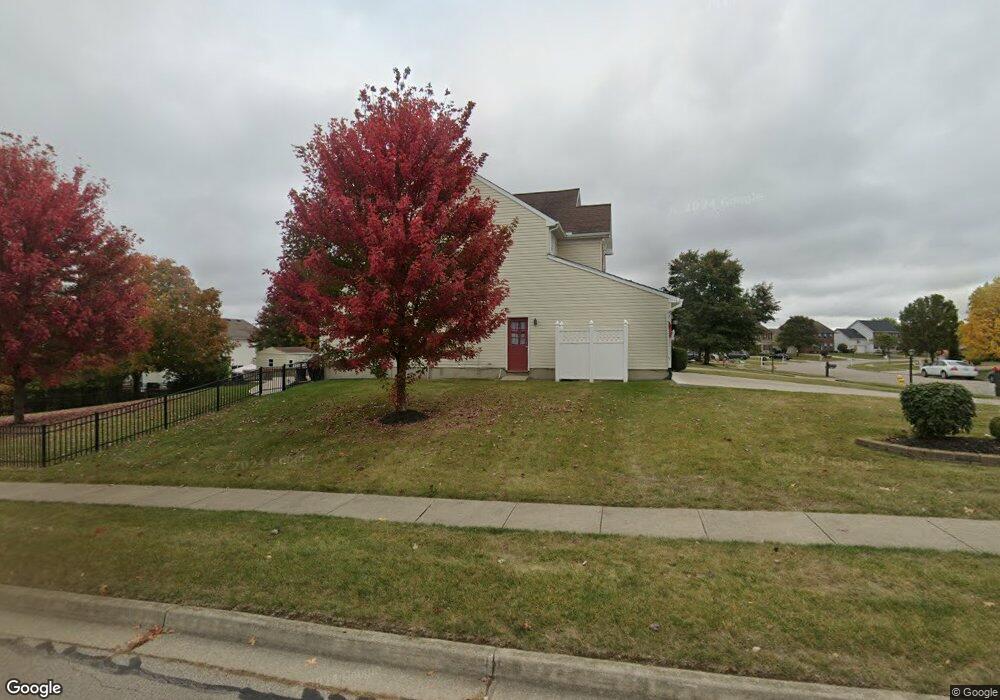
2214 Bandit Trail Dayton, OH 45434
Estimated Value: $407,000 - $468,000
4
Beds
3
Baths
2,409
Sq Ft
$182/Sq Ft
Est. Value
About This Home
This home is located at 2214 Bandit Trail, Dayton, OH 45434 and is currently estimated at $437,805, approximately $181 per square foot. 2214 Bandit Trail is a home located in Greene County with nearby schools including Trebein Elementary School, Jacob Coy Middle School, and Beavercreek High School.
Ownership History
Date
Name
Owned For
Owner Type
Purchase Details
Closed on
Sep 30, 2025
Sold by
Mcdonald Maurice D and Mcdonald Maurice B
Bought by
Mcdonald Joint Revocable Living Trust and Mcdonald
Current Estimated Value
Purchase Details
Closed on
Jul 20, 2006
Sold by
Gaha Patrick M and Mcgaha Kathleen A
Bought by
Mcdonald Maurice B and Mcdonald Sylvia J
Home Financials for this Owner
Home Financials are based on the most recent Mortgage that was taken out on this home.
Original Mortgage
$218,250
Interest Rate
6.73%
Mortgage Type
Unknown
Purchase Details
Closed on
Aug 27, 1999
Sold by
Nvr Inc
Bought by
Mcgaha Patrick M and Mcgaha Kathleen A
Home Financials for this Owner
Home Financials are based on the most recent Mortgage that was taken out on this home.
Original Mortgage
$187,500
Interest Rate
7.59%
Purchase Details
Closed on
May 14, 1999
Sold by
Arnold Rhoads Morgan Development
Bought by
Nvr Inc
Create a Home Valuation Report for This Property
The Home Valuation Report is an in-depth analysis detailing your home's value as well as a comparison with similar homes in the area
Home Values in the Area
Average Home Value in this Area
Purchase History
| Date | Buyer | Sale Price | Title Company |
|---|---|---|---|
| Mcdonald Joint Revocable Living Trust | -- | None Listed On Document | |
| Mcdonald Maurice B | $242,500 | None Available | |
| Mcgaha Patrick M | $197,500 | -- | |
| Nvr Inc | $33,000 | -- |
Source: Public Records
Mortgage History
| Date | Status | Borrower | Loan Amount |
|---|---|---|---|
| Previous Owner | Mcdonald Maurice B | $218,250 | |
| Previous Owner | Mcgaha Patrick M | $187,500 |
Source: Public Records
Tax History Compared to Growth
Tax History
| Year | Tax Paid | Tax Assessment Tax Assessment Total Assessment is a certain percentage of the fair market value that is determined by local assessors to be the total taxable value of land and additions on the property. | Land | Improvement |
|---|---|---|---|---|
| 2024 | $6,602 | $114,960 | $21,180 | $93,780 |
| 2023 | $6,602 | $114,960 | $21,180 | $93,780 |
| 2022 | $5,894 | $89,980 | $16,940 | $73,040 |
| 2021 | $5,953 | $89,980 | $16,940 | $73,040 |
| 2020 | $5,981 | $89,980 | $16,940 | $73,040 |
| 2019 | $5,956 | $82,280 | $14,050 | $68,230 |
| 2018 | $5,207 | $82,280 | $14,050 | $68,230 |
| 2017 | $5,110 | $82,280 | $14,050 | $68,230 |
| 2016 | $4,874 | $75,940 | $14,050 | $61,890 |
| 2015 | $4,904 | $75,940 | $14,050 | $61,890 |
| 2014 | $4,793 | $75,940 | $14,050 | $61,890 |
Source: Public Records
Map
Nearby Homes
- 2162 Sulky Trail
- 2154 Sulky Trail
- 2331 Eastwind Dr
- 1535 Stretch Dr
- 2073 Lincolnshire Dr
- 2507 Obetz Dr
- 1238 Freedom Point
- 2451 Dakem Dr
- 1155 Forest Dr
- 2170 Schmidt Dr N
- 2067 Codaz Way
- Hudson Plan at Nathanials Grove Estates
- Cumberland Plan at Nathanials Grove Estates
- Lehigh Plan at Nathanials Grove Estates
- Ballenger Plan at Nathanials Grove Estates
- Aviano Plan at Nathanials Grove Estates
- Allegheny Plan at Nathanials Grove Estates
- 1678 Fairground Rd
- 1247 Homestead Dr
- 1957 John Bull W
- 2206 Bandit Trail
- 2195 Sulky Trail
- 2445 Blacksmith Ln
- 2453 Blacksmith Ln
- 2219 Bandit Trail
- 2189 Sulky Trail
- 2211 Bandit Trail
- 2217 Sulky Ct
- 2225 Bandit Trail
- 2205 Bandit Trail
- 2198 Bandit Trail
- 2183 Sulky Trail
- 2195 Bandit Trail
- 2238 Bandit Trail
- 2198 Sulky Trail
- 2229 Sulky Ct
- 2194 Bandit Trail
- 2192 Sulky Trail
- 2214 Sulky Ct
- 2175 Sulky Trail