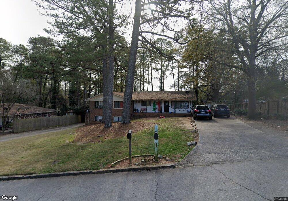
2214 Dering Cir NE Atlanta, GA 30345
Estimated Value: $476,000 - $537,000
5
Beds
3
Baths
1,794
Sq Ft
$279/Sq Ft
Est. Value
About This Home
This home is located at 2214 Dering Cir NE, Atlanta, GA 30345 and is currently estimated at $501,019, approximately $279 per square foot. 2214 Dering Cir NE is a home located in DeKalb County with nearby schools including John Robert Lewis Elementary School, Sequoyah Middle School, and Cross Keys High School.
Ownership History
Date
Name
Owned For
Owner Type
Purchase Details
Closed on
Aug 21, 2020
Sold by
Hopkins Walter
Bought by
Fort Morgan Liv Tr
Current Estimated Value
Purchase Details
Closed on
May 31, 2019
Sold by
Falcon Holding Co Llc
Bought by
Hopkins Walter and Hopkins Peregrine
Purchase Details
Closed on
Jan 9, 2008
Sold by
Cardoso Alvaro
Bought by
Falcon Holding Co Llc
Home Financials for this Owner
Home Financials are based on the most recent Mortgage that was taken out on this home.
Original Mortgage
$250,000
Interest Rate
5.94%
Mortgage Type
Trade
Create a Home Valuation Report for This Property
The Home Valuation Report is an in-depth analysis detailing your home's value as well as a comparison with similar homes in the area
Home Values in the Area
Average Home Value in this Area
Purchase History
| Date | Buyer | Sale Price | Title Company |
|---|---|---|---|
| Fort Morgan Liv Tr | -- | -- | |
| Hopkins Walter | -- | -- | |
| Falcon Holding Co Llc | $250,000 | -- |
Source: Public Records
Mortgage History
| Date | Status | Borrower | Loan Amount |
|---|---|---|---|
| Previous Owner | Falcon Holding Co Llc | $250,000 |
Source: Public Records
Tax History Compared to Growth
Tax History
| Year | Tax Paid | Tax Assessment Tax Assessment Total Assessment is a certain percentage of the fair market value that is determined by local assessors to be the total taxable value of land and additions on the property. | Land | Improvement |
|---|---|---|---|---|
| 2025 | $8,518 | $170,600 | $35,826 | $134,774 |
| 2024 | $8,295 | $172,280 | $35,720 | $136,560 |
| 2023 | $8,295 | $125,280 | $35,720 | $89,560 |
| 2022 | $6,296 | $125,280 | $35,720 | $89,560 |
| 2021 | $5,514 | $129,840 | $35,720 | $94,120 |
| 2020 | $5,787 | $114,800 | $35,720 | $79,080 |
| 2019 | $5,629 | $111,400 | $35,720 | $75,680 |
| 2018 | $3,295 | $88,160 | $21,640 | $66,520 |
| 2017 | $4,823 | $92,440 | $21,640 | $70,800 |
| 2016 | $4,934 | $96,360 | $21,640 | $74,720 |
| 2014 | $2,691 | $41,520 | $21,560 | $19,960 |
Source: Public Records
Map
Nearby Homes
- 2002 Variations Dr NE
- 2007 Variations Dr NE
- 1899 Raven Hill Dr NE
- 1932 Variations Dr NE
- 1956 Skyfall Cir NE
- 1924 Variations Dr NE
- 1929 Variations Dr NE
- 1906 Variations Dr NE
- 2601 Stoland Dr NE
- 1892 Skyfall Cir NE
- 1799 Falling Sky Ct NE
- 1807 Falling Sky Ct
- 2431 Skyland Way NE
- 1912 Canmont Dr NE
- 2440 Skyland Way NE
- 2531 Skyland Dr NE
- 2539 Skyland Dr NE
- 1951 Dresden Dr NE
- 2208 Dering Cir NE
- 2200 Dering Cir NE Unit 2198
- 2200 Dering Cir NE
- 1972 Dering Cir NE
- 1976 Dering Cir NE
- 1966 Dering Cir NE
- 1982 Dering Cir NE
- 2192 Dering Cir NE
- 1990 Dering Cir NE
- 1998 Dering Cir NE
- 2410 Dresden Parc Cir NE
- 2410 Dresden Parc Cir NE Unit 2410
- 2412 Dresden Parc Cir NE Unit 2
- 0 Dering Cir NE Unit 7352836
- 0 Dering Cir NE Unit 7165521
- 0 Dering Cir NE Unit 8532836
- 0 Dering Cir NE Unit 8308608
- 0 Dering Cir NE Unit 8153179
- 0 Dering Cir NE Unit 8003985
- 0 Dering Cir NE Unit 7305336