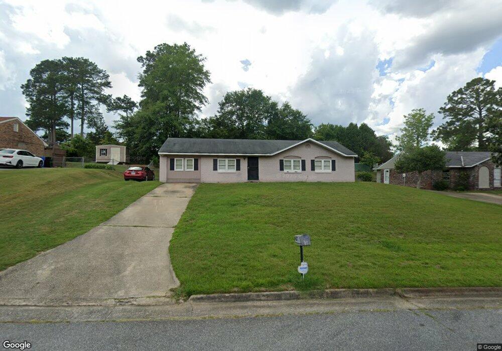
2215 Gorham Dr Columbus, GA 31907
East Columbus NeighborhoodEstimated Value: $122,000 - $136,000
4
Beds
2
Baths
1,368
Sq Ft
$96/Sq Ft
Est. Value
About This Home
This home is located at 2215 Gorham Dr, Columbus, GA 31907 and is currently estimated at $130,936, approximately $95 per square foot. 2215 Gorham Dr is a home located in Muscogee County with nearby schools including Wesley Heights Elementary School, Fort Middle School, and Kendrick High School.
Ownership History
Date
Name
Owned For
Owner Type
Purchase Details
Closed on
Feb 29, 2008
Sold by
Martin Carlos
Bought by
Smith Tineshia K and Smith John A
Current Estimated Value
Home Financials for this Owner
Home Financials are based on the most recent Mortgage that was taken out on this home.
Original Mortgage
$115,500
Interest Rate
6.04%
Mortgage Type
Purchase Money Mortgage
Purchase Details
Closed on
Oct 19, 2007
Sold by
Bridges Robert
Bought by
Martin Carlos
Purchase Details
Closed on
Jan 2, 2007
Sold by
Herrity Margaret Wagner and Herrity Margaret E
Bought by
Bridges Robert and Martin Carlos
Create a Home Valuation Report for This Property
The Home Valuation Report is an in-depth analysis detailing your home's value as well as a comparison with similar homes in the area
Home Values in the Area
Average Home Value in this Area
Purchase History
| Date | Buyer | Sale Price | Title Company |
|---|---|---|---|
| Smith Tineshia K | $115,500 | None Available | |
| Martin Carlos | $30,700 | None Available | |
| Bridges Robert | $46,500 | None Available |
Source: Public Records
Mortgage History
| Date | Status | Borrower | Loan Amount |
|---|---|---|---|
| Previous Owner | Smith Tineshia K | $115,500 |
Source: Public Records
Tax History
| Year | Tax Paid | Tax Assessment Tax Assessment Total Assessment is a certain percentage of the fair market value that is determined by local assessors to be the total taxable value of land and additions on the property. | Land | Improvement |
|---|---|---|---|---|
| 2025 | $1,290 | $40,772 | $7,308 | $33,464 |
| 2024 | $1,289 | $40,772 | $7,308 | $33,464 |
| 2023 | $603 | $40,772 | $7,308 | $33,464 |
| 2022 | $1,344 | $33,496 | $7,308 | $26,188 |
| 2021 | $1,337 | $33,484 | $7,308 | $26,176 |
| 2020 | $1,337 | $33,484 | $7,308 | $26,176 |
| 2019 | $1,343 | $33,484 | $7,308 | $26,176 |
| 2018 | $1,343 | $33,484 | $7,308 | $26,176 |
| 2017 | $1,349 | $33,484 | $7,308 | $26,176 |
| 2016 | $1,356 | $46,134 | $5,081 | $41,053 |
| 2015 | $1,358 | $46,134 | $5,081 | $41,053 |
| 2014 | $1,360 | $46,134 | $5,081 | $41,053 |
| 2013 | -- | $46,134 | $5,081 | $41,053 |
Source: Public Records
Map
Nearby Homes
- 5773 Marlette Ct
- 5725 Marlette Ct
- 6311 Morning Dew Dr
- 6303 Morning Dew Dr
- 6302 Morning Dew Dr
- 2513 Lacey Oak Ct
- 5525 Glenview Dr
- 2500 Water Oak Dr
- 2807 Doyle Ave
- 6293 Dupree Dr
- 2924 Gleason Ave
- 5429 Susan Ln
- 6362 Lemongrass Dr
- 6213 Fitzgerald Dr
- 2939 Gleason Ave
- 6370 Lemongrass Dr
- 2946 Gleason Ave
- 6374 Lemongrass Dr
- 6378 Lemongrass Dr
- 6386 Lemongrass Dr
- 2223 Gorham Dr
- 2205 Gorham Dr
- 5925 Buxton Dr
- 2214 Barnes Dr
- 2222 Barnes Dr
- 2227 Gorham Dr
- 2204 Barnes Dr
- 2214 Gorham Dr
- 2226 Barnes Dr
- 2204 Gorham Dr
- 2222 Gorham Dr
- 2233 Gorham Dr
- 2226 Gorham Dr
- 2232 Barnes Dr
- 6011 Buxton Dr
- 5932 Buxton Dr
- 5938 Buxton Dr
- 5926 Buxton Dr
- 2232 Gorham Dr
- 5910 Glenmere Dr
Your Personal Tour Guide
Ask me questions while you tour the home.