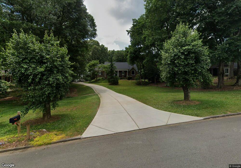
2215 Lansdowne Dr Canton, GA 30115
Union Hill NeighborhoodEstimated Value: $474,422 - $587,000
3
Beds
2
Baths
1,895
Sq Ft
$282/Sq Ft
Est. Value
About This Home
This home is located at 2215 Lansdowne Dr, Canton, GA 30115 and is currently estimated at $533,606, approximately $281 per square foot. 2215 Lansdowne Dr is a home located in Cherokee County with nearby schools including Avery Elementary School, Creekland Middle School, and Creekview High School.
Ownership History
Date
Name
Owned For
Owner Type
Purchase Details
Closed on
Sep 3, 2010
Sold by
Bulman Harrison T
Bought by
Bulman Harrison T and Bulman Jessica R
Current Estimated Value
Purchase Details
Closed on
Sep 2, 2010
Sold by
Bulman Pamela H
Bought by
Bulman Harrison T
Purchase Details
Closed on
May 13, 2010
Sold by
Johnson Thomas E and Johnson Janet E
Bought by
Bulman Harrison T and Bulman Pamela H
Home Financials for this Owner
Home Financials are based on the most recent Mortgage that was taken out on this home.
Original Mortgage
$212,143
Interest Rate
5.06%
Mortgage Type
FHA
Create a Home Valuation Report for This Property
The Home Valuation Report is an in-depth analysis detailing your home's value as well as a comparison with similar homes in the area
Home Values in the Area
Average Home Value in this Area
Purchase History
| Date | Buyer | Sale Price | Title Company |
|---|---|---|---|
| Bulman Harrison T | -- | -- | |
| Bulman Harrison T | -- | -- | |
| Bulman Harrison T | $215,000 | -- |
Source: Public Records
Mortgage History
| Date | Status | Borrower | Loan Amount |
|---|---|---|---|
| Previous Owner | Bulman Harrison T | $212,143 |
Source: Public Records
Tax History Compared to Growth
Tax History
| Year | Tax Paid | Tax Assessment Tax Assessment Total Assessment is a certain percentage of the fair market value that is determined by local assessors to be the total taxable value of land and additions on the property. | Land | Improvement |
|---|---|---|---|---|
| 2025 | $4,083 | $178,136 | $46,000 | $132,136 |
| 2024 | $3,956 | $172,656 | $40,000 | $132,656 |
| 2023 | $3,414 | $167,576 | $40,000 | $127,576 |
| 2022 | $3,569 | $152,256 | $33,600 | $118,656 |
| 2021 | $3,097 | $118,976 | $20,000 | $98,976 |
| 2020 | $2,804 | $106,236 | $20,000 | $86,236 |
| 2019 | $2,626 | $98,560 | $20,000 | $78,560 |
| 2018 | $2,499 | $92,560 | $20,000 | $72,560 |
| 2017 | $2,390 | $217,800 | $20,000 | $67,120 |
| 2016 | $2,369 | $213,100 | $20,000 | $65,240 |
| 2015 | $2,240 | $197,000 | $20,000 | $58,800 |
| 2014 | $1,907 | $167,600 | $12,200 | $54,840 |
Source: Public Records
Map
Nearby Homes
- 710 Melanie Ct
- 109 Hawks Bend
- 124 Long Shadows Dr
- 201 Windflower Ct
- 122 Long Shadows Dr
- 231 Aster Trace
- 1000 Haddie Way
- 1005 Haddie Way
- 6000 Union Hill Rd
- 9160 Union Hill Rd
- 215 Woodland Brook Dr
- 326 Seldom Seen Trail
- 9530 Union Hill Rd
- 162 Carmichael Dr
- 517 Hayes Ln
- 487 Carmichael Cir
- 101 Matthews Rd
- 1513 Old Jones Rd
- 5219 Union Hill Rd
- 116 Dallas Mark Dr
- 2235 Lansdowne Dr
- 2195 Lansdowne Dr
- 2175 Lansdowne Dr Unit 36
- 2175 Lansdowne Dr
- 120 Brannon Ct
- 2220 Lansdowne Dr
- 2255 Lansdowne Dr
- 2230 Lansdowne Dr
- 2315 Lansdowne Dr
- 2180 Lansdowne Dr
- 110 Brannon Ct
- 2295 Lansdowne Dr
- 2165 Lansdowne Dr
- 2170 Lansdowne Dr
- 2275 Lansdowne Dr
- 2240 Lansdowne Dr
- 2155 Lansdowne Dr
- 100 Brannon Ct
- 2150 Lansdowne Dr
- 2250 Lansdowne Dr