Estimated Value: $188,876 - $234,000
3
Beds
1
Bath
912
Sq Ft
$242/Sq Ft
Est. Value
About This Home
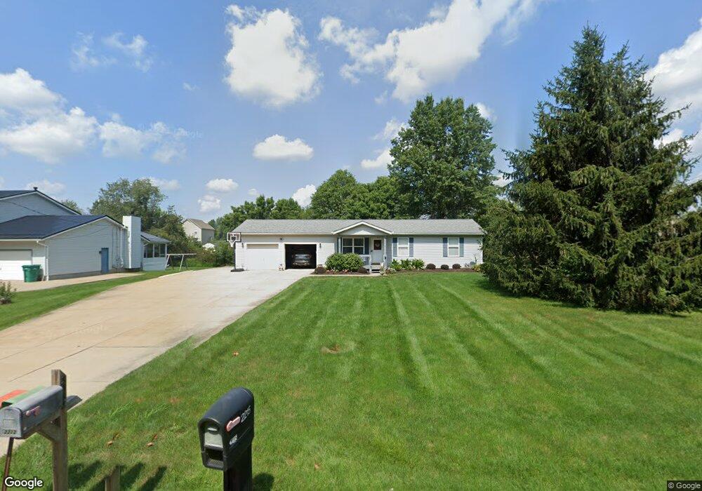
This home is located at 2215 Meloy Rd, Kent, OH 44240 and is currently estimated at $220,969, approximately $242 per square foot. 2215 Meloy Rd is a home located in Portage County with nearby schools including Brimfield Elementary School, Field Middle School, and Field High School.
Ownership History
Date
Name
Owned For
Owner Type
Purchase Details
Closed on
Jun 5, 2000
Sold by
Parker Richard A and Parker Theresa M
Bought by
Barber Sean K and Barber Jennifer L
Current Estimated Value
Home Financials for this Owner
Home Financials are based on the most recent Mortgage that was taken out on this home.
Original Mortgage
$99,450
Outstanding Balance
$33,011
Interest Rate
8.66%
Estimated Equity
$187,958
Purchase Details
Closed on
Apr 13, 1994
Bought by
Parker Richard A
Create a Home Valuation Report for This Property
The Home Valuation Report is an in-depth analysis detailing your home's value as well as a comparison with similar homes in the area
Home Values in the Area
Average Home Value in this Area
Purchase History
| Date | Buyer | Sale Price | Title Company |
|---|---|---|---|
| Barber Sean K | $117,000 | -- | |
| Parker Richard A | $19,000 | -- |
Source: Public Records
Mortgage History
| Date | Status | Borrower | Loan Amount |
|---|---|---|---|
| Open | Barber Sean K | $99,450 |
Source: Public Records
Tax History
| Year | Tax Paid | Tax Assessment Tax Assessment Total Assessment is a certain percentage of the fair market value that is determined by local assessors to be the total taxable value of land and additions on the property. | Land | Improvement |
|---|---|---|---|---|
| 2025 | $2,945 | $60,380 | $10,960 | $49,420 |
| 2024 | $2,897 | $60,380 | $10,960 | $49,420 |
| 2023 | $2,995 | $50,340 | $9,210 | $41,130 |
| 2022 | $3,003 | $50,340 | $9,210 | $41,130 |
| 2021 | $2,924 | $50,340 | $9,210 | $41,130 |
| 2020 | $2,565 | $39,910 | $9,210 | $30,700 |
| 2019 | $2,534 | $39,910 | $9,210 | $30,700 |
| 2018 | $1,999 | $37,350 | $9,210 | $28,140 |
| 2017 | $1,999 | $37,350 | $9,210 | $28,140 |
| 2016 | $1,993 | $37,350 | $9,210 | $28,140 |
| 2015 | $1,928 | $37,350 | $9,210 | $28,140 |
| 2014 | $1,861 | $37,350 | $9,210 | $28,140 |
| 2013 | $1,817 | $37,350 | $9,210 | $28,140 |
Source: Public Records
Map
Nearby Homes
- 1997 Sugar Maple Dr
- 2092 Sugar Maple Dr
- 5201 Cline Rd Unit A
- 5242 Glen Park Dr
- 4700 Gooseberry Knoll
- 4620 Briar Hill Dr
- 5100 Misty Glen
- 2671 Wintergreen Ln
- 1680 Countryview Dr
- 1676 Countryview Dr
- 2326 Orchard Cir
- 2277 Orchard Cir
- 2978 Sandy Lake Rd
- 1426 Loop Rd Unit 1426
- 4184 Hunters Ridge Dr
- 0 Meloy Rd Unit 5162435
- 5088 Spruce Knoll Run
- 5271 Aspen Meadow Dr
- 4088 Lynwood Dr
- 722 Avondale St
- 2225 Meloy Rd
- 2205 Meloy Rd
- 2212 Dorchester Dr
- 2235 Meloy Rd
- 2195 Meloy Rd
- 2202 Dorchester Dr
- 2218 Dorchester Dr
- 2226 Dorchester Dr
- 2194 Dorchester Dr
- 2234 Dorchester Dr
- 46 Briarhill Dr
- 2245 Meloy Rd
- S/L 2 Dorchester Dr
- S/L 4 Dorchester Dr
- S/L 7 Dorchester Dr
- S/L 11 Dorchester Dr
- S/L 13 Dorchester Dr
- S/L 14 Dorchester Dr
- S/L 15 Dorchester Dr
- 0 Dorchester Dr Unit 4454482
Your Personal Tour Guide
Ask me questions while you tour the home.