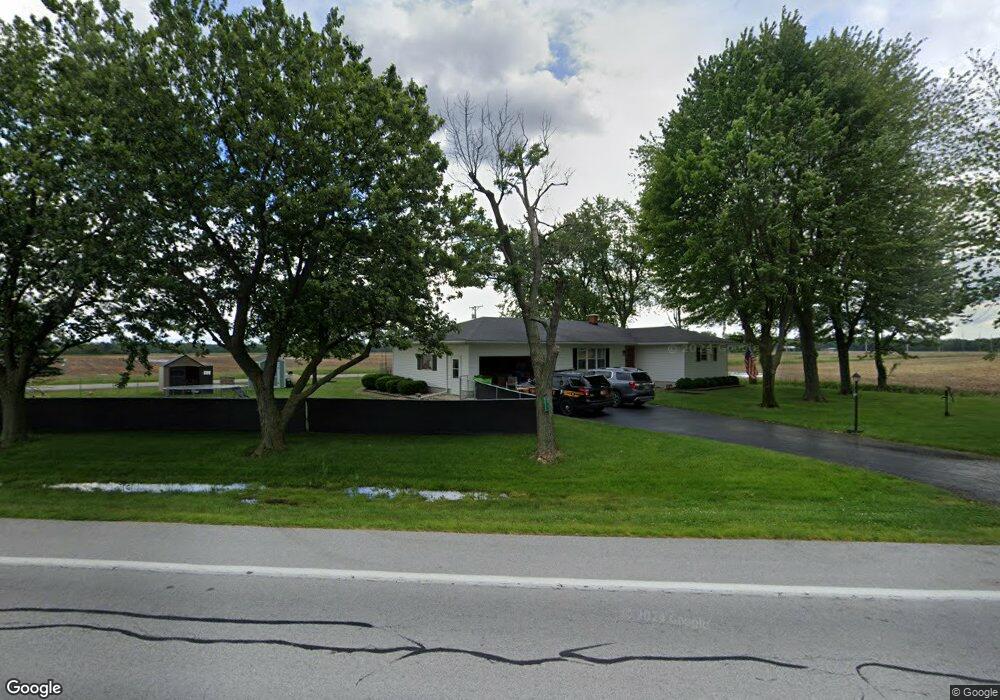
2215 State Route 12 Fremont, OH 43420
Estimated Value: $219,000 - $298,000
3
Beds
1
Bath
1,760
Sq Ft
$148/Sq Ft
Est. Value
About This Home
This home is located at 2215 State Route 12, Fremont, OH 43420 and is currently estimated at $260,517, approximately $148 per square foot. 2215 State Route 12 is a home located in Sandusky County with nearby schools including Lakota Elementary School, Lakota Middle School, and Lakota High School.
Ownership History
Date
Name
Owned For
Owner Type
Purchase Details
Closed on
Feb 11, 2021
Sold by
Brause Deborah
Bought by
Showman Lynzie and Showman Michael
Current Estimated Value
Home Financials for this Owner
Home Financials are based on the most recent Mortgage that was taken out on this home.
Original Mortgage
$151,800
Outstanding Balance
$135,533
Interest Rate
2.6%
Mortgage Type
New Conventional
Estimated Equity
$124,984
Purchase Details
Closed on
Aug 6, 2012
Sold by
Tanner Garry E and Tanner Leah A
Bought by
Tanner Garry E and Tanner Leah A
Purchase Details
Closed on
May 23, 2011
Sold by
Brubaker Janet and Brubaker Greg A
Bought by
Nieset Patricia A and Havens Norma Jean
Create a Home Valuation Report for This Property
The Home Valuation Report is an in-depth analysis detailing your home's value as well as a comparison with similar homes in the area
Home Values in the Area
Average Home Value in this Area
Purchase History
| Date | Buyer | Sale Price | Title Company |
|---|---|---|---|
| Showman Lynzie | $165,000 | First American Title | |
| Showman Lynzie | $165,000 | First American Title | |
| Tanner Garry E | -- | Attorney | |
| Nieset Patricia A | -- | None Available |
Source: Public Records
Mortgage History
| Date | Status | Borrower | Loan Amount |
|---|---|---|---|
| Open | Showman Lynzie | $151,800 | |
| Closed | Showman Lynzie | $151,800 |
Source: Public Records
Tax History Compared to Growth
Tax History
| Year | Tax Paid | Tax Assessment Tax Assessment Total Assessment is a certain percentage of the fair market value that is determined by local assessors to be the total taxable value of land and additions on the property. | Land | Improvement |
|---|---|---|---|---|
| 2024 | $2,502 | $72,420 | $10,260 | $62,160 |
| 2023 | $2,502 | $54,430 | $7,700 | $46,730 |
| 2022 | $2,180 | $54,080 | $7,700 | $46,380 |
| 2021 | $2,220 | $54,080 | $7,700 | $46,380 |
| 2020 | $1,362 | $42,280 | $7,700 | $34,580 |
| 2019 | $1,349 | $42,280 | $7,700 | $34,580 |
| 2018 | $1,351 | $42,280 | $7,700 | $34,580 |
| 2017 | $1,203 | $39,130 | $7,700 | $31,430 |
| 2016 | $1,120 | $39,130 | $7,700 | $31,430 |
| 2015 | $1,174 | $39,130 | $7,700 | $31,430 |
| 2014 | $1,165 | $38,020 | $7,740 | $30,280 |
| 2013 | $1,142 | $38,020 | $7,740 | $30,280 |
Source: Public Records
Map
Nearby Homes
- 2231 County Road 23
- 855 Rambo Ln
- 2595 County Road 13
- 0 State Route 590 Unit 6136844
- 8399 N County Road 31
- 704 County Road 126
- 203 Washington St
- 230 State St
- 17 Adams Dr
- 2484 Buckland Ave
- 43 Sun Valley Dr Unit 43
- 0 State Route 224 Unit 20240095
- 350 Conner Dr
- 1970 Morrison Rd
- 1818 Finley Dr
- 41 Brookview Dr
- 10 Meadowbrook Dr
- 10 Meadowbrook Ln
- 64 River Run Dr Unit J
- 64 River Run Dr
- 2215 Ohio 12
- 2281 State Route 12
- 2099 State Route 12
- 1785 County Road 23
- 2335 State Route 12
- 1536 County Road 15
- 2024 Ohio 12
- 2024 State Route 12
- 2343 State Route 12
- 2208 County Road 12
- 1420 County Road 15
- 2379 State Route 12
- 1493 County Road 15
- 1665 County Road 15
- 1378 County Road 15
- 1959 State Route 12
- 1226 County Road 15
- 1229 County Road 15
- 0 County Road 12 County Rd Unit 6006705
- 1997 County Road 23