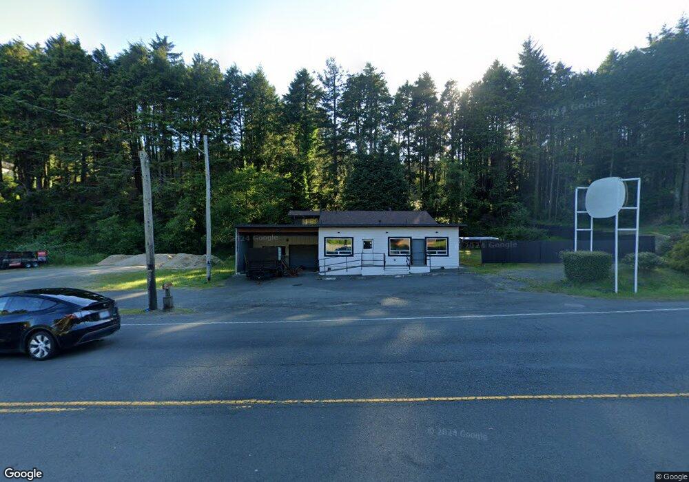
2215 SW Highway 101 Lincoln City, OR 97367
Estimated Value: $339,056
2
Beds
3
Baths
1,852
Sq Ft
$183/Sq Ft
Est. Value
About This Home
This home is located at 2215 SW Highway 101, Lincoln City, OR 97367 and is currently priced at $339,056, approximately $183 per square foot. 2215 SW Highway 101 is a home located in Lincoln County with nearby schools including Taft Elementary School, Oceanlake Elementary School, and Taft High School.
Ownership History
Date
Name
Owned For
Owner Type
Purchase Details
Closed on
Jan 3, 2024
Sold by
Tondini Robert L
Bought by
Wescott- Gregory D and Wescott- Gregory D
Current Estimated Value
Purchase Details
Closed on
Jul 18, 2008
Sold by
Tondini Robert L
Bought by
Tondini Robert L and Floyd Hale Sharon W
Home Financials for this Owner
Home Financials are based on the most recent Mortgage that was taken out on this home.
Original Mortgage
$150,000
Interest Rate
6.31%
Mortgage Type
New Conventional
Create a Home Valuation Report for This Property
The Home Valuation Report is an in-depth analysis detailing your home's value as well as a comparison with similar homes in the area
Home Values in the Area
Average Home Value in this Area
Purchase History
| Date | Buyer | Sale Price | Title Company |
|---|---|---|---|
| Wescott- Gregory D | $200,000 | Western Title | |
| Gregory D Wescott Revocable Living Trust | $200,000 | Western Title | |
| Tondini Robert L | -- | First American Title Ins Co |
Source: Public Records
Mortgage History
| Date | Status | Borrower | Loan Amount |
|---|---|---|---|
| Previous Owner | Tondini Robert L | $150,000 |
Source: Public Records
Tax History Compared to Growth
Tax History
| Year | Tax Paid | Tax Assessment Tax Assessment Total Assessment is a certain percentage of the fair market value that is determined by local assessors to be the total taxable value of land and additions on the property. | Land | Improvement |
|---|---|---|---|---|
| 2024 | $3,422 | $200,740 | -- | -- |
| 2023 | $3,328 | $194,900 | $0 | $0 |
| 2022 | $3,235 | $189,230 | $0 | $0 |
| 2021 | $3,082 | $183,720 | $0 | $0 |
| 2020 | $3,011 | $178,370 | $0 | $0 |
| 2019 | $2,909 | $173,180 | $0 | $0 |
| 2018 | $2,843 | $168,140 | $0 | $0 |
| 2017 | $2,721 | $163,250 | $0 | $0 |
| 2016 | $2,552 | $158,500 | $0 | $0 |
| 2015 | $2,495 | $153,890 | $0 | $0 |
| 2014 | $2,432 | $149,410 | $0 | $0 |
Source: Public Records
Map
Nearby Homes
- 2273 SW Hwy 101
- 1423 SE 23rd Dr
- 1966 SW Galley Ct
- 1218 SW 16th St
- 2223 SW Coast Ave
- 1502 SE Marine Ave
- 2209 SW Coast Ave
- 2513 SW Dune Ave
- 1496 SE Marine Ave
- 1933 SW Coast Ave Unit 1
- 2539 SW Coral Loop
- 2325 SW Bard Loop
- 1453 SE Marine Ave
- 1455 SE Marine Ave
- 1815 SW Coast Ave
- 1851 SE Oar Dr
- Lot 6 SE Marine Ave
- 2591 SW Barnacle Ave
- 2518 SW Anemone Ave
- 1800 BLk SE Oar Dr Unit TL 4100
- 2215 SE Highway 101
- 2273 SW Highway 101
- 2204 SE Hwy 101 Parcel B
- 2204 SE Highway 101
- 2204 SE Highway 101
- 2204 SE Highway 101
- 2204 SE Highway 101
- 2216 SW Bard Rd
- 2204 SE Hwy 101 Parcel A
- 2150 Coast Hwy 101
- 2100 Hwy 101 (Blk) SW
- 2100 Blk Hwy 101 SW
- 2100 Hwy 101 (Block) SW
- 2150 SE Highway 101
- 2314 SW Bard Rd
- 2254 SW Highway 101
- 2203 SW Bard Rd
- 2120 SW Bard Rd
- 2114 SW Highway 101
- 2311 SW Bard Rd