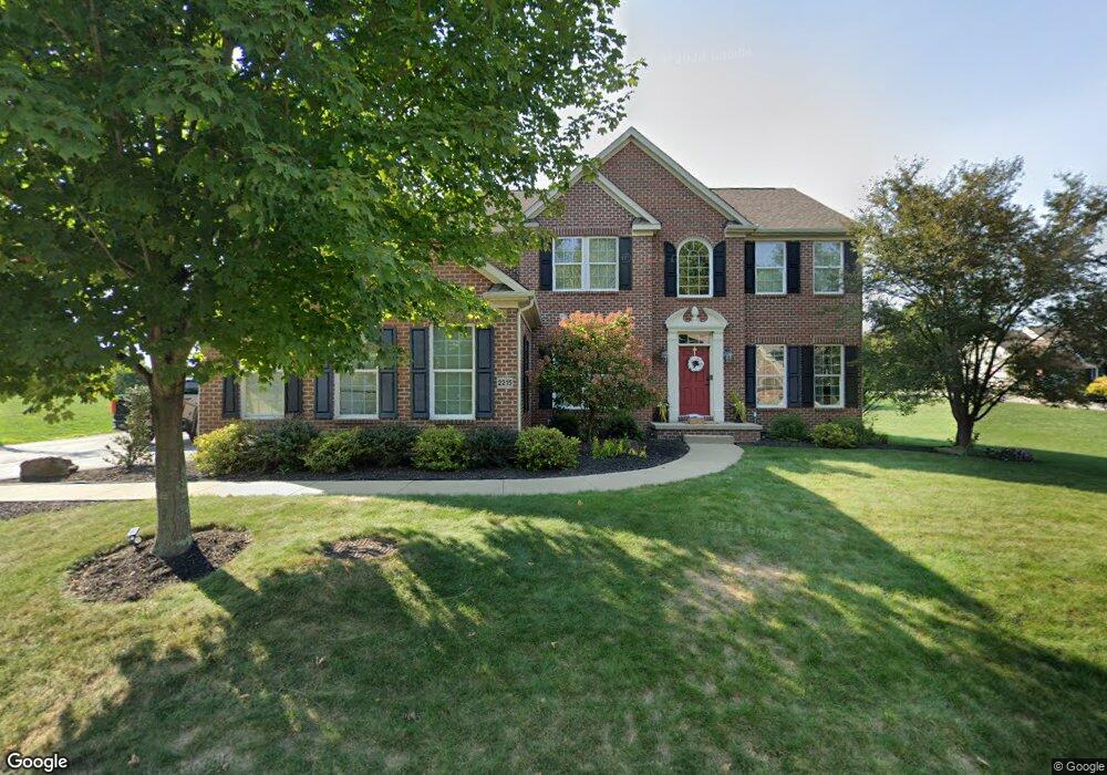
2215 Trefoil Dr Export, PA 15632
Estimated Value: $784,000 - $887,022
4
Beds
--
Bath
3,394
Sq Ft
$242/Sq Ft
Est. Value
About This Home
This home is located at 2215 Trefoil Dr, Export, PA 15632 and is currently estimated at $822,341, approximately $242 per square foot. 2215 Trefoil Dr is a home located in Westmoreland County with nearby schools including Franklin Regional Senior High School and Mother of Sorrows School.
Ownership History
Date
Name
Owned For
Owner Type
Purchase Details
Closed on
Sep 2, 2010
Sold by
Nvr Inc
Bought by
Kukura Michael F and Kukura Carolyn A
Current Estimated Value
Home Financials for this Owner
Home Financials are based on the most recent Mortgage that was taken out on this home.
Original Mortgage
$417,000
Outstanding Balance
$276,335
Interest Rate
4.51%
Mortgage Type
New Conventional
Estimated Equity
$546,006
Purchase Details
Closed on
Jun 16, 2010
Sold by
Rolling Ridge Associates Lp
Bought by
Nvr Inc
Create a Home Valuation Report for This Property
The Home Valuation Report is an in-depth analysis detailing your home's value as well as a comparison with similar homes in the area
Home Values in the Area
Average Home Value in this Area
Purchase History
| Date | Buyer | Sale Price | Title Company |
|---|---|---|---|
| Kukura Michael F | $463,500 | None Available | |
| Nvr Inc | $120,000 | None Available |
Source: Public Records
Mortgage History
| Date | Status | Borrower | Loan Amount |
|---|---|---|---|
| Open | Kukura Michael F | $417,000 |
Source: Public Records
Tax History
| Year | Tax Paid | Tax Assessment Tax Assessment Total Assessment is a certain percentage of the fair market value that is determined by local assessors to be the total taxable value of land and additions on the property. | Land | Improvement |
|---|---|---|---|---|
| 2025 | $9,695 | $63,620 | $14,700 | $48,920 |
| 2024 | $9,472 | $63,620 | $14,700 | $48,920 |
| 2023 | $8,900 | $63,620 | $14,700 | $48,920 |
| 2022 | $8,725 | $63,620 | $14,700 | $48,920 |
| 2021 | $8,534 | $63,620 | $14,700 | $48,920 |
| 2020 | $8,005 | $60,830 | $14,700 | $46,130 |
| 2019 | $7,841 | $57,920 | $11,790 | $46,130 |
| 2018 | $7,336 | $57,920 | $11,790 | $46,130 |
| 2017 | $7,184 | $57,920 | $11,790 | $46,130 |
| 2016 | $7,040 | $57,920 | $11,790 | $46,130 |
| 2015 | $7,040 | $57,920 | $11,790 | $46,130 |
| 2014 | $6,983 | $57,920 | $11,790 | $46,130 |
Source: Public Records
Map
Nearby Homes
- 0 William Penn Hwy Unit 1740233
- 1002 Black Sands Dr
- 1022 Lexington Dr
- 1001 Black Sands Dr
- 6003 Kapalua Ln
- 6001 Kapalua Ln
- 2002 Spinosa Ln
- 4561 School Rd S
- 2358 Mount Vernon Ave
- 1052 Blackthorne Dr
- 1049 Black Sands Dr
- 1053 Black Sands Dr
- 1054 Blackthorne Dr
- 1043 Blackthorne Dr
- 6004 Augusta Ln
- 1056 Blackthorne Dr
- 3005 Lampl Ln
- 1316 S Valley Dr
- 501 Sheridan Ln
- 2001 Blackthorne Dr
- 2216 Trefoil Dr
- 2214 Trefoil Dr
- 2213 Trefoil Dr
- 2301 Broomsage Ct
- 2212 Trefoil Dr
- 2211 Trefoil Dr
- 2217 Trefoil Dr
- 2218 Trefoil Dr
- 0 Trefoil Dr
- 2303 Broomsage Ct
- 2219 Trefoil Dr
- 2209 Trefoil Dr
- 2220 Trefoil Dr
- 2304 Broomsage Ct
- RL 15 Broomsage
- 0 Broomsage Ct
- 2222 Trefoil Dr
- 2221 Trefoil Dr
- 2207 Trefoil Dr
- 2223 Trefoil Dr
Your Personal Tour Guide
Ask me questions while you tour the home.