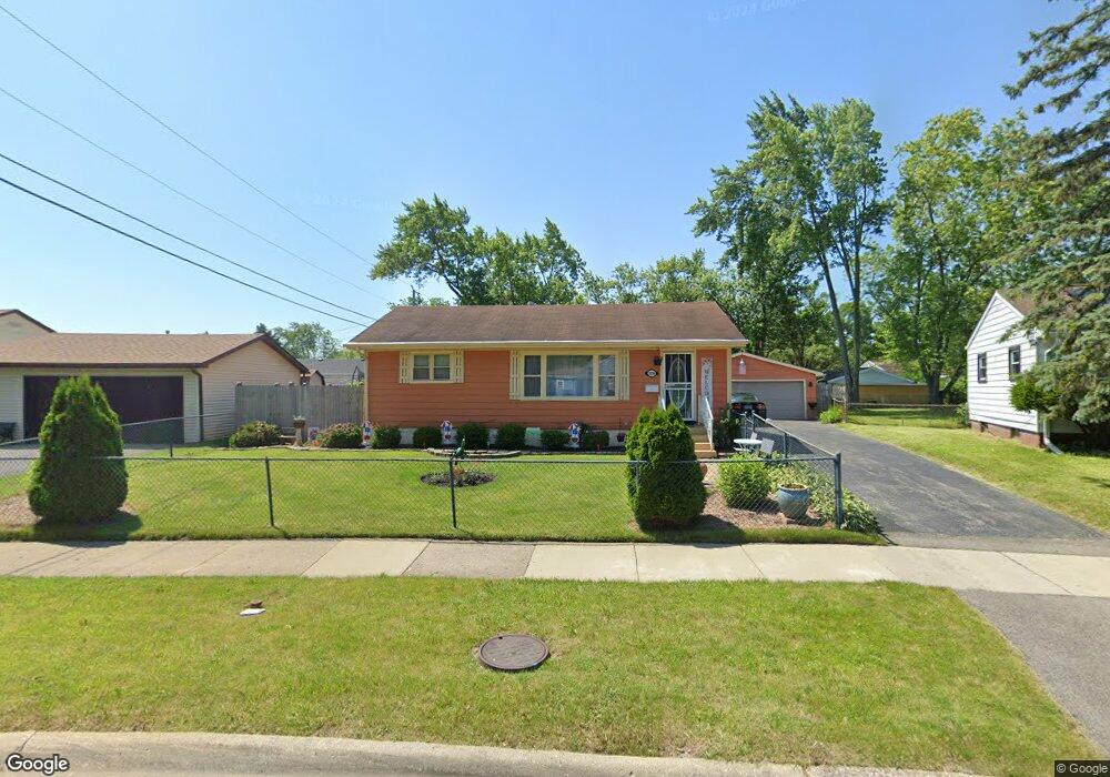
2216 Shawnee Rd Waukegan, IL 60087
Lake Cogardens NeighborhoodEstimated Value: $172,000 - $229,000
3
Beds
1
Bath
864
Sq Ft
$247/Sq Ft
Est. Value
About This Home
This home is located at 2216 Shawnee Rd, Waukegan, IL 60087 and is currently estimated at $213,129, approximately $246 per square foot. 2216 Shawnee Rd is a home located in Lake County with nearby schools including Oakdale Elementary School, Jack Benny Middle School, and Waukegan High School.
Ownership History
Date
Name
Owned For
Owner Type
Purchase Details
Closed on
May 22, 2009
Sold by
Secretary Of Housing & Urban Development
Bought by
Huerta Fernando and Garcia Evelina
Current Estimated Value
Home Financials for this Owner
Home Financials are based on the most recent Mortgage that was taken out on this home.
Original Mortgage
$87,021
Outstanding Balance
$54,982
Interest Rate
4.85%
Mortgage Type
FHA
Estimated Equity
$158,147
Purchase Details
Closed on
Nov 12, 2007
Sold by
Dripps
Bought by
Hud
Purchase Details
Closed on
Jun 12, 2003
Sold by
Hunt Joel S and Dorothy E Hunt Trust
Bought by
Dripps David M and Dripps Shelly L
Home Financials for this Owner
Home Financials are based on the most recent Mortgage that was taken out on this home.
Original Mortgage
$128,189
Interest Rate
5.51%
Mortgage Type
FHA
Purchase Details
Closed on
Aug 8, 2001
Sold by
Hunt Dorothy E
Bought by
Hunt Dorothy E and Hunt Joel S
Create a Home Valuation Report for This Property
The Home Valuation Report is an in-depth analysis detailing your home's value as well as a comparison with similar homes in the area
Home Values in the Area
Average Home Value in this Area
Purchase History
| Date | Buyer | Sale Price | Title Company |
|---|---|---|---|
| Huerta Fernando | -- | Stewart Title Company | |
| Hud | -- | Comprehensive Title | |
| Dripps David M | $130,000 | First American Title Insuran | |
| Hunt Dorothy E | -- | -- |
Source: Public Records
Mortgage History
| Date | Status | Borrower | Loan Amount |
|---|---|---|---|
| Open | Huerta Fernando | $87,021 | |
| Previous Owner | Dripps David M | $128,189 |
Source: Public Records
Tax History Compared to Growth
Tax History
| Year | Tax Paid | Tax Assessment Tax Assessment Total Assessment is a certain percentage of the fair market value that is determined by local assessors to be the total taxable value of land and additions on the property. | Land | Improvement |
|---|---|---|---|---|
| 2024 | $4,663 | $63,597 | $9,986 | $53,611 |
| 2023 | $4,067 | $57,454 | $9,022 | $48,432 |
| 2022 | $4,067 | $47,603 | $8,596 | $39,007 |
| 2021 | $3,712 | $41,600 | $7,442 | $34,158 |
| 2020 | $3,713 | $38,755 | $6,933 | $31,822 |
| 2019 | $3,684 | $35,513 | $6,353 | $29,160 |
| 2018 | $2,949 | $29,192 | $8,093 | $21,099 |
| 2017 | $2,820 | $25,827 | $7,160 | $18,667 |
| 2016 | $2,541 | $22,443 | $6,222 | $16,221 |
| 2015 | $2,380 | $20,087 | $5,569 | $14,518 |
| 2014 | $2,716 | $21,591 | $6,409 | $15,182 |
| 2012 | $2,680 | $23,393 | $6,944 | $16,449 |
Source: Public Records
Map
Nearby Homes
- 3320 Sunset Ave
- 2928 W Country Club Ave
- 3000 W Country Club Ave
- 2946 W Country Club Ave
- 2713 Varonen Ave
- 3032 W Vermont Ave
- 2705 Dana Ave
- 2708 Dana Ave
- 36955 N Garrick Ave
- 2715 W Greenwood Ave
- 12933 W Polo Ave
- 12312 W Audrey Ave
- 1913 Chippewa Rd
- 36245 N Green Bay Rd
- 2440 W Cheyenne Rd
- 2810 W Atlantic Ave
- 3436 Florida Ave
- 12535 W Blanchard Rd
- 2207 Williamsburg Dr
- 2350 N Lewis Ave
- 2220 Shawnee Rd
- 2212 Shawnee Rd
- 2900 Navaho Rd
- 2220 Ottawa Rd
- 2904 Navaho Rd
- 2832 Navaho Rd
- 2908 Navaho Rd
- 2224 Shawnee Rd
- 2225 Shawnee Rd
- 2213 Shawnee Rd
- 2912 Navaho Rd
- 2228 Shawnee Rd
- 2238 Ottawa Rd
- 2229 Shawnee Rd
- 2901 Navaho Rd
- 2225 Ottawa Rd
- 2221 Ottawa Rd
- 2920 Navaho Rd
- 2831 Navaho Rd
- 2229 Ottawa Rd