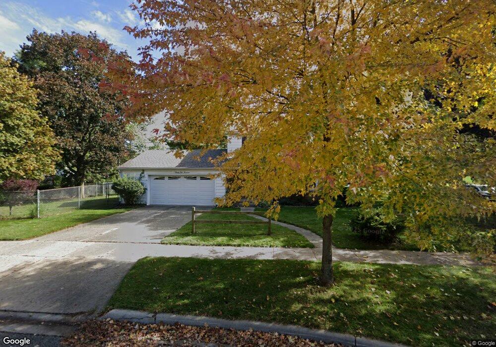
2217 Boston Blvd Lansing, MI 48910
Colonial Village NeighborhoodEstimated Value: $180,413 - $196,000
--
Bed
1
Bath
1,230
Sq Ft
$155/Sq Ft
Est. Value
About This Home
This home is located at 2217 Boston Blvd, Lansing, MI 48910 and is currently estimated at $190,103, approximately $154 per square foot. 2217 Boston Blvd is a home located in Ingham County with nearby schools including Averill Elementary School, Attwood School, and J.W. Sexton High School.
Ownership History
Date
Name
Owned For
Owner Type
Purchase Details
Closed on
Jun 20, 2003
Sold by
Burleson Roy A and Burleson Helen D
Bought by
Burton Catherine
Current Estimated Value
Home Financials for this Owner
Home Financials are based on the most recent Mortgage that was taken out on this home.
Original Mortgage
$125,400
Outstanding Balance
$53,254
Interest Rate
5.36%
Mortgage Type
Purchase Money Mortgage
Estimated Equity
$136,849
Purchase Details
Closed on
Mar 6, 1998
Sold by
Diehn Scott H
Bought by
Burleson Roy A and Burleson Helen D
Purchase Details
Closed on
Apr 1, 1992
Create a Home Valuation Report for This Property
The Home Valuation Report is an in-depth analysis detailing your home's value as well as a comparison with similar homes in the area
Home Values in the Area
Average Home Value in this Area
Purchase History
| Date | Buyer | Sale Price | Title Company |
|---|---|---|---|
| Burton Catherine | $132,000 | Transnation | |
| Burleson Roy A | $93,000 | -- | |
| -- | $81,500 | -- |
Source: Public Records
Mortgage History
| Date | Status | Borrower | Loan Amount |
|---|---|---|---|
| Open | Burton Catherine | $125,400 |
Source: Public Records
Tax History Compared to Growth
Tax History
| Year | Tax Paid | Tax Assessment Tax Assessment Total Assessment is a certain percentage of the fair market value that is determined by local assessors to be the total taxable value of land and additions on the property. | Land | Improvement |
|---|---|---|---|---|
| 2025 | $3,725 | $86,200 | $10,400 | $75,800 |
| 2024 | $30 | $79,500 | $10,400 | $69,100 |
| 2023 | $3,491 | $73,600 | $10,400 | $63,200 |
| 2022 | $3,145 | $70,800 | $9,900 | $60,900 |
| 2021 | $3,080 | $66,100 | $6,800 | $59,300 |
| 2020 | $3,061 | $61,200 | $6,800 | $54,400 |
| 2019 | $2,936 | $58,800 | $6,800 | $52,000 |
| 2018 | $2,750 | $53,900 | $6,800 | $47,100 |
| 2017 | $2,633 | $53,900 | $6,800 | $47,100 |
| 2016 | $2,518 | $48,300 | $6,800 | $41,500 |
| 2015 | $2,518 | $46,700 | $13,541 | $33,159 |
| 2014 | $2,518 | $45,600 | $10,156 | $35,444 |
Source: Public Records
Map
Nearby Homes
- 1618 Loraine Ave
- 1420 Poxson Ave
- 1404 Kelsey Ave
- 2118 Marion Ave
- 1740 Wellington Rd Unit 103
- 1312 W Mount Hope Ave
- 1315 Goodrich St
- 1607 Holly Way
- 2039 Holly Way
- 1120 Kelsey Ave
- 2812 Pleasant Grove Rd
- 1114 Goodrich St
- 2515 S Martin Luther King Junior Blvd
- 1032 Kelsey Ave
- 1116 George St
- 3125 Boston Blvd
- 2920 Pleasant Grove Rd Unit 1
- 2505 Hanover Dr
- 2409 Victor Ave
- 2112 Stirling Ave
- 1726 Gordon Ave
- 1720 Gordon Ave
- 2201 Boston Blvd
- 1725 Cooper Ave
- 1716 Gordon Ave
- 2218 Boston Blvd
- 1721 Cooper Ave
- 2301 Boston Blvd
- 2212 Boston Blvd
- 1717 Cooper Ave
- 2200 Boston Blvd
- 1712 Gordon Ave
- 1711 Cooper Ave
- 2309 Boston Blvd
- 1801 Gordon Ave
- 1708 Gordon Ave
- 1728 Cooper Ave
- 1707 Cooper Ave
- 1704 Gordon Ave
- 2207 Wellington Rd