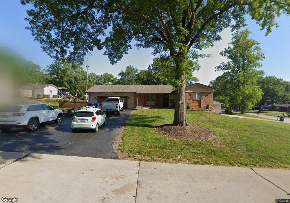
2217 Maximaus Dr Fenton, MO 63026
Estimated Value: $267,000 - $296,000
3
Beds
2
Baths
1,101
Sq Ft
$256/Sq Ft
Est. Value
About This Home
This home is located at 2217 Maximaus Dr, Fenton, MO 63026 and is currently estimated at $282,267, approximately $256 per square foot. 2217 Maximaus Dr is a home located in St. Louis County with nearby schools including Uthoff Valley Elementary School, Rockwood South Middle School, and Rockwood Summit Senior High School.
Ownership History
Date
Name
Owned For
Owner Type
Purchase Details
Closed on
Jul 24, 2015
Sold by
The Stevens Living Trust
Bought by
Hurst Kevin and Hurst Angela
Current Estimated Value
Home Financials for this Owner
Home Financials are based on the most recent Mortgage that was taken out on this home.
Original Mortgage
$143,910
Outstanding Balance
$113,068
Interest Rate
4.08%
Mortgage Type
New Conventional
Estimated Equity
$169,199
Purchase Details
Closed on
Mar 14, 2007
Sold by
Stevens Ora Lee and Stevens Gloria
Bought by
Stevens Ora L and Stevens Gloria
Create a Home Valuation Report for This Property
The Home Valuation Report is an in-depth analysis detailing your home's value as well as a comparison with similar homes in the area
Home Values in the Area
Average Home Value in this Area
Purchase History
| Date | Buyer | Sale Price | Title Company |
|---|---|---|---|
| Hurst Kevin | $159,900 | Vision Title Llc | |
| Stevens Ora L | -- | None Available |
Source: Public Records
Mortgage History
| Date | Status | Borrower | Loan Amount |
|---|---|---|---|
| Open | Hurst Kevin | $143,910 |
Source: Public Records
Tax History Compared to Growth
Tax History
| Year | Tax Paid | Tax Assessment Tax Assessment Total Assessment is a certain percentage of the fair market value that is determined by local assessors to be the total taxable value of land and additions on the property. | Land | Improvement |
|---|---|---|---|---|
| 2025 | $3,364 | $53,790 | $24,720 | $29,070 |
| 2024 | $3,364 | $45,040 | $18,910 | $26,130 |
| 2023 | $3,364 | $45,040 | $18,910 | $26,130 |
| 2022 | $3,252 | $40,610 | $16,820 | $23,790 |
| 2021 | $3,227 | $40,610 | $16,820 | $23,790 |
| 2020 | $3,055 | $36,940 | $17,710 | $19,230 |
| 2019 | $3,064 | $36,940 | $17,710 | $19,230 |
| 2018 | $3,008 | $34,800 | $13,790 | $21,010 |
| 2017 | $2,984 | $34,800 | $13,790 | $21,010 |
| 2016 | $2,523 | $29,660 | $9,990 | $19,670 |
| 2015 | $2,471 | $29,660 | $9,990 | $19,670 |
| 2014 | $2,225 | $26,010 | $6,880 | $19,130 |
Source: Public Records
Map
Nearby Homes
- 1823 Dover Trace Dr
- 2009 Gladiator Dr
- 1716 Dover Trace Dr
- 2245 Fenway Farms Trail
- 1655 Valley Park Rd
- 1704 Preston Centre Dr
- 732 Rockshire Dr
- 2 Salvation Ridge Ct
- 1320 Fenton Hills Rd
- 1604 Ivy Chase Ln
- 425 Benton St
- 625 Benton St
- 1007 Pyramid Dr
- 814 Summit Glen Ct
- 1321 Green Mist Dr
- 911 Marshall Rd
- 627 Vest Ave
- 928 Marshall Rd
- 1273 Green Falls Dr
- 457 Avalon View Ct
- 2125 Quirinal Ct
- 2215 Maximaus Dr
- 2126 Palatine Ct
- 2123 Quirinal Ct
- 2218 Maximaus Dr
- 2124 Palatine Ct
- 2128 Quirinal Ct
- 2130 Quirinal Ct
- 2126 Quirinal Ct
- 2121 Quirinal Ct
- 2132 Quirinal Ct
- 2122 Palatine Ct
- 2124 Quirinal Ct
- 2216 Maximaus Dr
- 2135 Quirinal Ct
- 2134 Quirinal Ct
- 2120 Palatine Ct
- 2119 Quirinal Ct
- 2122 Quirinal Ct
- 2127 Palatine Ct