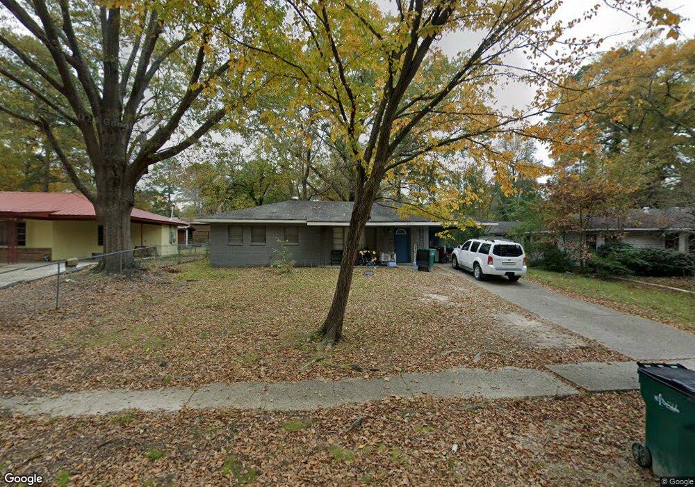
2217 Nevada St El Dorado, AR 71730
Estimated Value: $65,000 - $78,000
3
Beds
1
Bath
1,095
Sq Ft
$63/Sq Ft
Est. Value
About This Home
This home is located at 2217 Nevada St, El Dorado, AR 71730 and is currently estimated at $68,933, approximately $62 per square foot. 2217 Nevada St is a home located in Union County with nearby schools including El Dorado High School, Holy Redeemer School, and West Side Christian School.
Ownership History
Date
Name
Owned For
Owner Type
Purchase Details
Closed on
Oct 15, 2019
Sold by
Perry Billy M and Perry Jessica
Bought by
Lucas William C and Lucas Candy Z
Current Estimated Value
Home Financials for this Owner
Home Financials are based on the most recent Mortgage that was taken out on this home.
Original Mortgage
$34,849
Outstanding Balance
$30,653
Interest Rate
3.7%
Mortgage Type
Commercial
Estimated Equity
$38,280
Purchase Details
Closed on
May 5, 2010
Sold by
Henry Charles E and Henry Allie V
Bought by
Perry Billy M and Perry Jessica
Home Financials for this Owner
Home Financials are based on the most recent Mortgage that was taken out on this home.
Original Mortgage
$37,198
Interest Rate
5%
Mortgage Type
Future Advance Clause Open End Mortgage
Purchase Details
Closed on
Aug 2, 2004
Bought by
Henry Charles E
Purchase Details
Closed on
Jan 1, 1992
Bought by
West Mark R
Create a Home Valuation Report for This Property
The Home Valuation Report is an in-depth analysis detailing your home's value as well as a comparison with similar homes in the area
Home Values in the Area
Average Home Value in this Area
Purchase History
| Date | Buyer | Sale Price | Title Company |
|---|---|---|---|
| Lucas William C | $8,000 | None Available | |
| Perry Billy M | $36,000 | None Available | |
| Henry Charles E | $35,000 | -- | |
| West Mark R | -- | -- |
Source: Public Records
Mortgage History
| Date | Status | Borrower | Loan Amount |
|---|---|---|---|
| Open | Lucas William C | $34,849 | |
| Previous Owner | Perry Billy M | $37,198 |
Source: Public Records
Tax History Compared to Growth
Tax History
| Year | Tax Paid | Tax Assessment Tax Assessment Total Assessment is a certain percentage of the fair market value that is determined by local assessors to be the total taxable value of land and additions on the property. | Land | Improvement |
|---|---|---|---|---|
| 2024 | $401 | $7,800 | $900 | $6,900 |
| 2023 | $384 | $7,800 | $900 | $6,900 |
| 2022 | $316 | $6,800 | $900 | $5,900 |
| 2021 | $316 | $6,800 | $900 | $5,900 |
| 2020 | $316 | $6,800 | $900 | $5,900 |
| 2019 | $316 | $6,800 | $900 | $5,900 |
| 2018 | $0 | $6,800 | $900 | $5,900 |
| 2017 | $0 | $7,520 | $900 | $6,620 |
| 2016 | -- | $7,520 | $900 | $6,620 |
| 2014 | -- | $7,520 | $900 | $6,620 |
Source: Public Records
Map
Nearby Homes
- 2101 Marilyn
- 2010 Gaines St
- 0 Highway 63
- 14-18-15 Junction City Rd
- 606 Strong Hwy
- 126 Allison Rd
- 1306 Craig Ave
- 1005 E Cook St
- 1009 E 1st St
- 1016 S Martin Luther King Junior Blvd
- 128 Pine Crest Rd
- 0000 E Main St
- 527 E Main St
- 1020 E Faulkner St
- 0000 Ramble Rd Unit LotWP001
- 267 Nick Springs Rd
- 806 Goodwin St
- 2912 E Main St
- 266 Ponderosa Dr
- 334 Ponderosa Dr