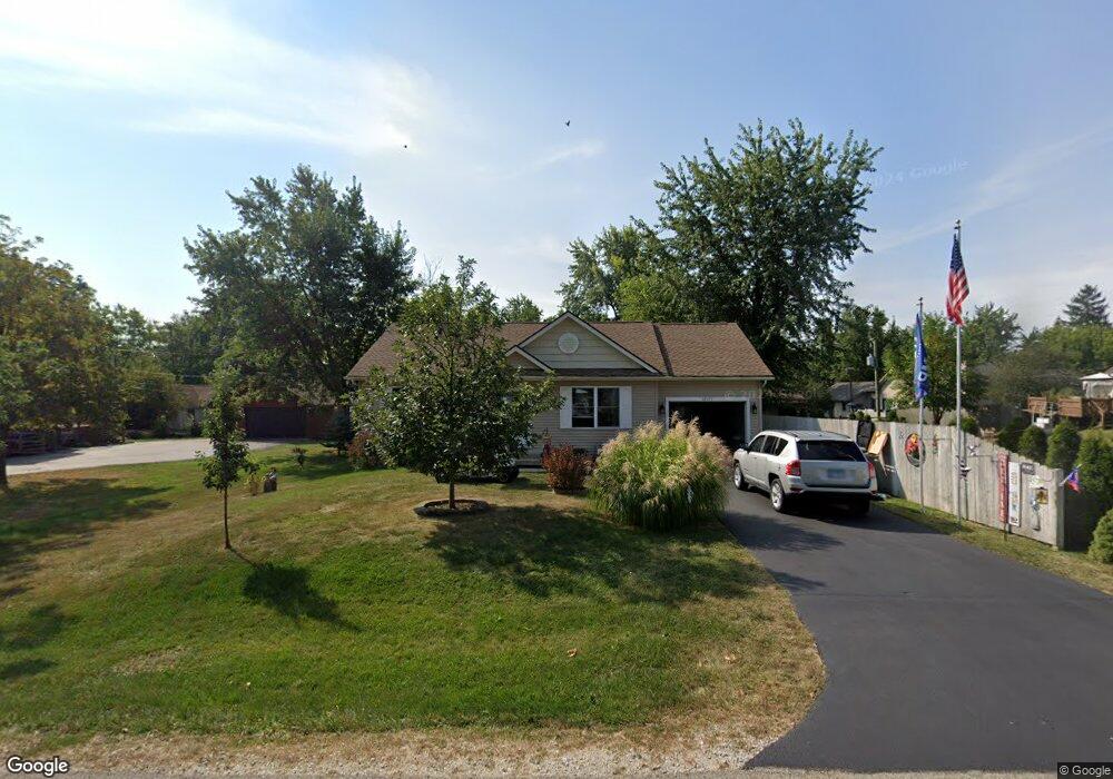
22171 W Cedar Dr Antioch, IL 60002
Estimated Value: $290,000 - $356,000
3
Beds
2
Baths
1,236
Sq Ft
$258/Sq Ft
Est. Value
About This Home
This home is located at 22171 W Cedar Dr, Antioch, IL 60002 and is currently estimated at $318,391, approximately $257 per square foot. 22171 W Cedar Dr is a home with nearby schools including Antioch Community High School.
Ownership History
Date
Name
Owned For
Owner Type
Purchase Details
Closed on
Oct 8, 2013
Sold by
Smith Joanne M
Bought by
Smith Joanne and The Joanne Smith Revocable Trust
Current Estimated Value
Purchase Details
Closed on
Oct 22, 2007
Sold by
Mpl General Contracting Inc
Bought by
Smith Joanne M
Home Financials for this Owner
Home Financials are based on the most recent Mortgage that was taken out on this home.
Original Mortgage
$30,000
Interest Rate
6.75%
Mortgage Type
Unknown
Purchase Details
Closed on
Dec 1, 2004
Sold by
Miner Kathleen
Bought by
Mpl General Contracting
Purchase Details
Closed on
Oct 7, 2002
Sold by
Miner Kathleen and Miner Harry M
Bought by
Miner Kathleen and The Kathleen Miner Living Trust
Purchase Details
Closed on
Aug 12, 2002
Sold by
Miner Kathleen
Bought by
Miner Kathleen and Miner Harry M
Purchase Details
Closed on
Jul 9, 2002
Sold by
Miner Kathleen
Bought by
Miner Benjamin Forbes and Miner Kathleen
Create a Home Valuation Report for This Property
The Home Valuation Report is an in-depth analysis detailing your home's value as well as a comparison with similar homes in the area
Home Values in the Area
Average Home Value in this Area
Purchase History
| Date | Buyer | Sale Price | Title Company |
|---|---|---|---|
| Smith Joanne | -- | None Available | |
| Smith Joanne M | $40,000 | None Available | |
| Mpl General Contracting | $34,000 | -- | |
| Miner Kathleen | -- | -- | |
| Miner Kathleen | -- | -- | |
| Miner Benjamin Forbes | -- | -- |
Source: Public Records
Mortgage History
| Date | Status | Borrower | Loan Amount |
|---|---|---|---|
| Closed | Smith Joanne M | $30,000 |
Source: Public Records
Tax History
| Year | Tax Paid | Tax Assessment Tax Assessment Total Assessment is a certain percentage of the fair market value that is determined by local assessors to be the total taxable value of land and additions on the property. | Land | Improvement |
|---|---|---|---|---|
| 2024 | $3,770 | $87,878 | $3,671 | $84,207 |
| 2023 | $4,362 | $78,687 | $3,287 | $75,400 |
| 2022 | $4,362 | $70,503 | $3,814 | $66,689 |
| 2021 | $4,351 | $65,786 | $3,559 | $62,227 |
| 2020 | $4,392 | $63,970 | $3,461 | $60,509 |
| 2019 | $4,628 | $61,175 | $3,310 | $57,865 |
| 2018 | $4,634 | $59,336 | $3,350 | $55,986 |
| 2017 | $4,804 | $56,479 | $3,189 | $53,290 |
| 2016 | $4,870 | $54,506 | $3,078 | $51,428 |
| 2015 | $4,976 | $53,120 | $3,000 | $50,120 |
| 2014 | $487 | $4,476 | $4,476 | $0 |
| 2012 | $448 | $4,476 | $4,476 | $0 |
Source: Public Records
Map
Nearby Homes
- 40472 N Donald Dr
- 22171 W Pineview Dr
- 22271 W Loon Dr
- 40963 N Champaign Dr
- 41016 N Ridge Cir
- 1629 Elderberry Ln
- 41092 N Deep Lake Rd
- 1749 Serenity Ct
- 1692 Serenity Dr
- 41270 N Bayview Dr
- 966 Forest View Way
- 4.73AC 59 Hwy
- 777 Spring Cir S
- 40523 N Il Route 83
- 22566 W Lillian Place
- 1764 S Port Dr
- 1768 S Port Dr
- 1772 S Port Dr
- 1873 White Lake Dr
- 39101 N Walnut St
- 22183 W Cedar Dr
- 22143 W Cedar Dr
- 22172 W North Dr
- 22178 W Cedar Dr
- 22184 W North Dr
- 22144 W Cedar Dr
- 22213 W Cedar Dr
- 22130 W North Dr
- 22206 W Cedar Dr
- 22130 W Cedar Dr
- 22214 W North Dr
- 22223 W Cedar Dr
- 22117 W Cedar Dr
- 22214 W Cedar Dr
- 40481 N Donald Dr
- 22183 W Pineview Dr
- 22143 W Pineview Dr
- 22177 W Pineview Dr
- 40477 N Donald Dr
- 22205 W Pineview Dr
Your Personal Tour Guide
Ask me questions while you tour the home.